Yeah, I can imagine. We lost power in Raleigh for a couple of days, trees down everywhere. The 85 corridor is in rough shape for this event. I wouldn’t want to be thereWas in Kannapolis for that at 11yrs old. No power 11 days
Sent from my iPhone using Tapatalk
-
Hello, please take a minute to check out our awesome content, contributed by the wonderful members of our community. We hope you'll add your own thoughts and opinions by making a free account!
You are using an out of date browser. It may not display this or other websites correctly.
You should upgrade or use an alternative browser.
You should upgrade or use an alternative browser.
Wintry January 23rd-27th 2026
- Thread starter SD
- Start date
Tsappfrog20
Member
Was in Kannapolis for that at 11yrs old. No power 11 days
Sent from my iPhone using Tapatalk
I was in Atlanta during the 2000 Super Bowl Ice Storm
Sent from my iPhone using Tapatalk
Heelyes
Member
Yeah it was 9 days without power here but I was without children at the time and I wasn’t young enough to be home with the parentsWas in Kannapolis for that at 11yrs old. No power 11 days
Sent from my iPhone using Tapatalk
Up here just NE of you should escape the worst of it too, I hope. But yeah there is a corridor just west of you thats gonna be brutalYep, seeing the same thing. 30 miles from 1” QPF and 30 from less then .30”. This just for the overrunning part which I feel that is the meat of this. The band that swings through after could be rain.
I just feel Raleigh will escape the worst…but you guys and that corridor down to GSP is rough.
View attachment 187746
NCHighCountryWX
Member
- Joined
- Dec 28, 2016
- Messages
- 699
- Reaction score
- 1,918
BAMWX Evening Analysis
Enjoy
Enjoy
Blue_Ridge_Escarpment
Member
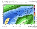
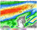
18z Google AI…right at 0.5” QPF for Raleigh for the overrunning portion. Yesterday runs had 1”.
View attachment 187759
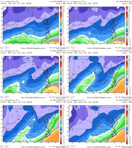
Google temps…very cold throughout.
LongRanger
Member
Also what I meant when I said not like they saying was models I don't think it turns out to be near what they showing. I wasn't talking about damageSerious question have you ever been in a .5” ice storm?
Makeitsnow
Member
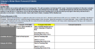
I urge everyone to read wpc's snow and ice discussion. It's one for the ages and should be saved. For our neck of the woods i'll highlight
Heavy icing is also expected farther east into the southern
Appalachians and southern Mid-Atlantic. The setup across the
southern Mid- Atlantic down as far south as northern GA and areas
just inland from the coasts of the Carolinas is an extreme case of
CAD with a 1040mb high situated over the Interior Northeast on
Saturday night. While regional soundings indicate there may be
considerable sleet in this area as well, especially across southern
VA into northern NC, these CADs are notorious for their effective
dry/isallobaric flow, enhanced by precipitation, leading to dry
wet-bulb advection offsetting the latent heat of freezing during
freezing rain. With such an impressive high in place at
precipitation onset, this will likely result in considerable
accumulations of sleet and freezing rain here, too, with WPC
probabilities indicating a moderate risk (50-70%) of at least 0.5",
highest across the Piedmont. The guidance has trended just a bit
colder this afternoon, but significant icing is also possible as
far north as Richmond, VA and towards the Chesapeake Bay.
rburrel2
Member
The difference between the ai models and every other model in eastern NC is wild.18z Google AI…right at 0.5” QPF for Raleigh for the overrunning portion. Yesterday runs had 1”.
View attachment 187759
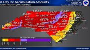
Whoever get 0.5”+ accrual will be a big big problem. I just think that will be focused up and down 85 corridor from NC down to northern GASerious question have you ever been in a .5” ice storm?
packfan98
Moderator
I can’t believe we might be in the teens here during the event. Would be one of the coldest I can remember.
Same thing was said with Helene and we saw what happened there...I had a similar thought, these biblical totals are dependent on the insane qpf the models are spitting out and assuming perfect accrual. We have seen forecasted ice storms before end up being more sleet than freezing rain. Part of it is me being hopeful we don’t see catastrophic totals (with a 3 year old and a 1 year old) but climo tells you that we aren’t going to shatter 150+ year records here in a few days. I could be wrong but we will see.
Mpirone12
Member
It’s unfortunate. Weathers so hard to predict here that no one in the triad is taking our meteorologists seriously with their warnings.
Sent from my iPhone using Tapatalk
Sent from my iPhone using Tapatalk
Heelyes
Member
A whole bunch of people are going to be very uncomfortable for a week some more than others
packfan98
Moderator
Sure they are. Folks are stocking up and getting prepared from what I’ve observed.It’s unfortunate. Weathers so hard to predict here that no one in the triad is taking our meteorologists seriously with their warnings.
Sent from my iPhone using Tapatalk
Not sure if this part is on people’s radars or not. Assuming sleet doesn’t take a chunk out of the large potential for 0.4”+ ZR in NC/SC/GA, we are set up for a pretty breezy (20-30mph gusts) Monday across the area. Eastern NC escarpment has both the highest ZR and highest wind potential as well
How would that not be heavy sleet? I can’t imagine teens and freezing rain for you guys. I don’t get it. I do think you guys could see 3” or sleet. Would be so sick.I can’t believe we might be in the teens here during the event. Would be one of the coldest I can remember.
Yeah I thought the same thing before Helene...... Never say never and there's a first time for anything. Models always underestimate CAD and the duration. Hopefully we dodge a bullet but with the latest trends it remains to be seen.Look, tbh this will anger some ….. this may be a “dangerous” potential event. But we’ve all seen this time and time again, these earth shattering amounts modeled that have never been recorded and never will, bc it’s impossible. I’d bet my left you know what no one from GA - VA ends up more than 1” FRZN. Yes that’s dangerous, but that’s never happened in 150yrs of records if I’m not mistaken and this weekend will be no different. My forecast at worst would be “UP TO 3/4”” even in the worst spot no more, ever. No matter what I saw on any model. This will not become some 1000yr event, be realistic we’ve all been here.
Sent from my iPhone using Tapatalk
NorthHillsWx
Member
Look I’m going to say my peace with this, but these are just numbers we almost refer to as benchmarks. I have seen 1 (one) ice event near 0.5” (2002). We did not have power for 5 days and we lived inside the beltline kn Raleigh. We were completely caught off guard, we had to wait in line for bottled water at the Harris teeter on Glenwood delivered from a semi truck because our pipes froze (because we had no heat for 5 days). It was so cold in the house there was frost on the inside of windows. We went to multiple pawn shops with a family friend who lived on the main road bc nothing else was open before we found one selling a chainsaw so we could cut our vehicles out of our neighborhood. We made it 3 days before we went to stay with friends who got their power back. 0.5” is a sh*t ton of ice and hasn’t happened for most on this board but maybe once or twice. I’m not trying to engage in hyperbole or say this is going to be the worst event, but if we receive widespread amounts over 0.5” (and god forbid anyone see 1”) with near zero degree temps moving in afterwards, this will be one no one, even the “general public” forgets.
Climo/lack of historic precedent just makes it hard to believe that anyone can get above 0.75” down in the upstate off the escarpment. I know it’s possible and the models are screaming, it’s just literally- hard to believe.This ain’t the lollipop I wanted. I might need a bigger generatorwe are going to give it a run at an all timer hereView attachment 187763
I’m planning on making a forecast video tomorrow morning and I have no clue what I’ll say about ZR accums here.
Makeitsnow
Member
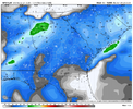
I hate to even post this but areas around atlanta northward will have the worst wind gusts..it's there on every model. Even assuming it's a touch overdone it's bad. To make matters worse...after having gusts from one direction the winds will do a 180 out of the northwest with the passage of the cold front monday...which will compound the problem.
LongRanger
Member
Yeah and how many times have we seen Models not be worth a Crap with end results too??Yeah I thought the same thing before Helene...... Never say never and there's a first time for anything. Models always underestimate CAD and the duration. Hopefully we dodge a bullet but with the latest trends it remains to be seen.
SimeonNC
Member
What were the SREF mean when it came to temps? How did those change?
Yeah, this will be a good test of them, I guess. I’m going doubt them until proven otherwise here but we’ll see!The difference between the ai models and every other model in eastern NC is wild.
Not a fan of the RGEM moving the sleet line north at 18z
Euro hasn’t done well at all for this storm with CAD or consistency. Would not bet on its QPF being right at this point. Expect more than what it is spitting out. AI has also sucked. Trusting the short ranges and the gfs at this point
How can you know that until after the storm?
Cad Wedge NC
Member
Yeah, most people see the ice predictions and have no idea what that will do....... "Oh, it's only 1 inch of ice. That's nothing. I thought this was going to be a big storm"Climo/lack of historic precedent just makes it hard to believe that anyone can get above 0.75” down in the upstate off the escarpment. I know it’s possible and the models are screaming, it’s just literally- hard to believe.
I’m planning on making a forecast video tomorrow morning and I have no clue what I’ll say about ZR accums here.
Plenty but things don't work the way they did 20 years ago the climate is changing. I'd rather be prepared than not. Someone along the escarpment is going to get a thumping and my bet is NE GA to Upstate SC to Highlands in NC.Yeah and how many times have we seen Models not be worth a Crap with end results too??
packfan98
Moderator
Quite a bit colder.What were the SREF mean when it came to temps? How did those change?
Thought about folks who only look at apple weather. “1.05 wintry mix”Yeah, most people see the ice predictions and have no idea what that will do....... "Oh, it's only 1 inch of ice. That's nothing. I thought this was going to be a big storm"
And then they’ll blame meteorologists when they lose power “unexpectedly”
Would be surprised if the 00z NAM doesn’t follow suit, then, in a bit!Quite a bit colder.
----
double ---- didnt realize this was the storm thread. Sorry
SimeonNC
Member
I honestly believe CLT proper through GSO, and essentially the W. Piedmont in general will be saved from the catastrophic ice amounts due to sleet.
Also, this has to be repeated, heavy ZR rates are inefficient for accrual in general so if/when we do switch to mainly ZR and the precip is heavy like it's predicted on some models. The accrual won't be as high as some are fearing.
I honestly think Mississippi, southern Arkansas, northern Louisiana through N. Georgia/portions of SC are hosed when it comes to ZR though, especially MS/AR/LA where models have consistently given them long range GEM levels of ice accretion.
packfan98
Moderator
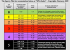
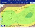
Where did you find this graphic?

