rusrius
Member
Will that allow for further colder air infiltration?System keeps trending slower. View attachment 187712
Will that allow for further colder air infiltration?System keeps trending slower. View attachment 187712
Just don’t know much warming will be with coastal transfer and what dryslot will beStill underestimating CAD imo
View attachment 187721
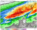
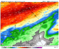
So latest ICON and GFS both have a destructive ice storm in Atlanta with >0.5 ice accretion (FRAM) (gfs is >1”).
With ECMWF also trending in that direction.
00z NAM/CAMs are fed from 18z GFS, so I’d expect them to shift similarly.
Gotta watch and see if the wedge drives deeper into AL.there’s also more around BHM, albeit minor amounts.
The one next weekend is our storm...if it verifies. Low stays in Fla, giving us sn/ip probably. Looks like we are dodging the worst of the zr, unless the cad gets cranking. These clown maps are useless. Some give me 2 inch of qpf, some .20. I go with the FFc when it gets close. Right now they have me a .25 zr, which I can handle. Some of the clownies give me a 1/2 inch, or more, which will wreck my tree tops.
The GFS is over 2" as well. Wow. I think this has a good chance of being the highest liquid equivalent winter storm I've ever experienced.18z ICON is ~2" liquid equivalent here with temperatures barely getting to the mid-20s by the end of the storm. Apocalyptic. We better be building a sleet mountain because my house is going to collapse if that is mostly ZR.
View attachment 187701

These fram images are scary.View attachment 187721
So latest ICON and GFS both have a destructive ice storm in Atlanta with >0.5 ice accretion (FRAM) (gfs is >1”).
With ECMWF also trending in that direction.
00z NAM/CAMs are fed from 18z GFS, so I’d expect them to shift similarly.
how about 4.75 in gainesville?The GFS is over 2" as well. Wow. I think this has a good chance of being the highest liquid equivalent winter storm I've ever experienced.
View attachment 187725

3-4 inches liquid in Oconee and Ne Ga...gonna be a wild ride even if you cut that in half its a disaster!The GFS is over 2" as well. Wow. I think this has a good chance of being the highest liquid equivalent winter storm I've ever experienced.
View attachment 187725
Wow, 3-5 through NGA to the Upstate. This is literally the cold high pressures and the long duration QPF we have always dreamed about; if only it could have been snow!The GFS is over 2" as well. Wow. I think this has a good chance of being the highest liquid equivalent winter storm I've ever experienced.
View attachment 187725
I've experienced 25 degrees with sleet and freezing rain in 2004 and the roads did not ice up. Our ground temps are relatively warm (45 to 50). Probably going to be ok, but there will be a ton of trees to clear off roads.One thing to think about for areas that accumulate sleet of any consequence before the transition to ZR is that roads will be a skating rink. 29-32 degrees ZR generally doesn't accumulate on non-elevated roadways. With so much QPF predicted, a few inches of sleet followed by 1/2"-1" of ZR may well occur in some areas. We haven't been in the deep freeze ahead of the storm, so I would think ground accumulations of ZR, even at night, will be limited in the Atlanta area at least.
Thoughts on what temperature is required for surface streets ZR only nighttime accumulations? I've never experienced ZR below 29 here.
Heavy precip isn't going to accrete very well, but hey if that's the biggest thing going against this storm I think it's good. We could be surprised if it's as historic as it could be. 31-32 is a very common thing in CAD here in Atlanta. Just the way it's been. That means not too bad in Atlanta proper based on clmio. This may be one the fits outside that climo box though.Do we really think 2-3 inches of liquid can fall with an 8-10 degree warm nose and not “win” and defeat the cold surface layer and get people up to freezing? I know this CAD is being continuously fed cold air, but dang. I’d expect at least a little warming from that much latent heat release at the surface.
Your 925’s are cold enough to limit some of thatDo we really think 2-3 inches of liquid can fall with an 8-10 degree warm nose and not “win” and defeat the cold surface layer and get people up to freezing? I know this CAD is being continuously fed cold air, but dang. I’d expect at least a little warming from that much latent heat release at the surface.
I’ve experienced ZR in the upper 20s and the roads in Atlanta being a black ice skating rink including the entirety of 285. It all seems like such a crapshoot with how the roads do in these things.I've experienced 25 degrees with sleet and freezing rain in 2004 and the roads did not ice up. Our ground temps are relatively warm (45 to 50). Probably going to be ok, but there will be a ton of trees to clear off roads.
How is that plot for RDU?
I’m planning on being out of school all next week. If that next system pans out too, my pacing guide for the rest of the year will be in shambles.

I think those dominos fall soon. GSP is just waiting on MRX, and you’ll probably get RAH tomorrow morning if not soonerI would think warnings for a lot of places go up after next model runs.
Sent from my iPhone using Tapatalk
Link: look on the left to configure this tool to your location
What model?There’s no way it actually turns to regular rain in upstate sc? Models under-doing the Cad?
