Brandon10
Member
I was against the low being able to push up the west spine of the Apps...but maybe it is the path of least resistance if it cant go south around the wedge, it decides to go NW periphery of it.
probably but as webb said a warm nose this strong juxtaposed with a wedge this strong is so rare that we don't really have a mental rolodex of events to look back at. you're going off theory and vibesDoes the warmnose strength matter much once snow flakes are fully melted?
Like if the warm nose is +4 or +8, does that have a material effect if the cold layer is let’s say -8c and goes up to 850mb for example?
I imagine it wouldn’t matter much, but gonna be tough to get sleet either way I think.
That would be tough. I'm thinking gainesville, athens, over toward greenwood sc . There is still a ways to go just for there and even there it will change to freezing rain sunday at best. I should clarify that when i say save i mean to say maybe if we are really lucky half will be sleet but that still means a lot of damaging ice. I really fear that atlanta is going to be mostly freezing rain and there will be no changeover...at least not until it's mostly over anyway.Even in ATL? I saw the 925 in ATL but the precip was not there yet.
And entirely too ampedNothing like the NAM being entirely too dry in the long range
I could be completely wrong, but I vaguely remember an event years ago when the rain was so heavy it pulled the warm air down and actually eroded the wedge faster. But...... I could be completely misremembering, so take with a heavy grain of saltDoes the warmnose strength matter much once snow flakes are fully melted?
Like if the warm nose is +4 or +8, does that have a material effect if the cold layer is let’s say -8c and goes up to 850mb for example?
I imagine it wouldn’t matter much, but gonna be tough to get sleet either way I think.
This. So much this. I commented about it last night with one of the models (forget which) but it was at the end of a page so it got ignored. Folks kept posting how it was further south at the same validity time, when in reality it was just delayed by an hour or two. If instead you compared the (e.g) 12z run at 2pm to the 18z run at 4pm or the 12z at 4pm to the 18z at 6pm, they matched almost exactly, and so on and so forth.When yall are doing comparisons for model runs (this run vs last), maybe it would be most helpful to find the frames on the two or 3 different runs that match in terms of precipitation and feature placement and compare those. I don't know how easy that is to do, but the 12z now vs the last runs at the same time period will be deceptive if there are timing issues, i.e. maybe the whole pattern is slowed by 3-6 hours. That's why we're getting "yay this run looks better colder snowier" "nah oh well".
Yea I mean if the cold layer gets eroded then sure. But I’m talking as a snap shot of the moment if you have a sounding like I described, does the warm layer being “warmer” effect the outcome. I’m not sure.I could be completely wrong, but I vaguely remember an event years ago when the rain was so heavy it pulled the warm air down and actually eroded the wedge faster. But...... I could be completely misremembering, so take with a heavy grain of salt
The Euro and now the NAM have both picked up on this in recent runs. Although the extent of this dry slot appears to be too extensive on the NAM, it would cut back QPF totals and possibly save many of us some grief as far as freezing rain amounts. Lets hope these models are sniffing something the air besides glue with this dry slotWell, if y'all are looking for a way out of this mess, the NAM shows you the way. Maga dry slot.
View attachment 187501
And the models would be the same wouldn’t they? Very little historical data to pull from. I don’t remember there being this wide a range of forecast at 48 hours.probably but as webb said a warm nose this strong juxtaposed with a wedge this strong is so rare that we don't really have a mental rolodex of events to look back at. you're going off theory and vibes
The only thing i see saving atlanta is just the overall heavy precip doesn't materialize/the models are over doing it. But an old rule of thumb for me is that if you have subfreezing temps and cold 950mb temps you are going to get a lot of accretion. Well here is the 84 hour nam and the icon at the end of precip. Not good at all.Looking at all of the models, I don’t currently see how ATL escapes ZR. The main question is how much. I’m hoping the 1.75-2”+ model amounts are too much or otherwise we’re looking at the heaviest ZR since 1/1973 and 12/1935. Because such heavy amounts have been extremely rare (only 2 in 100 years), it’s a reasonable hope that the 1.75” extremely devastating scenario models like GFS/Icon won’t verify closely. We’ll see. But the most likely alternative appears to be in the ~~1” category, which would easily be the worst for N ATL since way back in 2005 and would obviously be bad enough. On the south/east side to Augusta, their last bad one was 2/2014.


Me and you both. We definitely have a smorgasbord of solutions to choose from.And the models would be the same wouldn’t they? Very little historical data to pull from. I don’t remember there being this wide a range of forecast at 48 hours.
Love that Jim Gandy guy, the SC crew introduced us to. Been watching his sleet maps off the icon. That's best case scenario for us More sleet, the better.My best hope is that the cold is there and the surface low is dampened out more than depicted. Hopefully this would lessen the warm nose and there's a larger footprint of sleet that lasts as long as possible. Hoping for the slimmest of slivers with the .50+ ice contours.
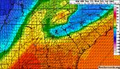
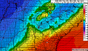
it won't be dry. You'll end up with freezing drizzle/light rain which would likely add up faster than moderate to heavy freezing rain.I do not buy the dry NAM. This is taken from a "dry" area. This is a freezing drizzle sounding:
View attachment 187507
It nailed the last minor event last Sunday at this range.Yep icon is nearly identical to it's previous runs. It's been impressive at it's consistency.
Yep icon is nearly identical to it's previous runs. It's been impressive at it's consistency.
Nice and balmy weather for the Smoky Mountains
The temp differences in this neck of the woods are going to be the most insane I have ever seen in a CAD event I think. Waynesville and Cherokee may go for the mid 40s
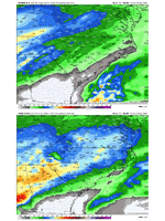
The ICON has a little less precipitation in northeast Georgia CAD areas, but still copious amounts. It has trended a bit more amplified over the last few runs with the warmer push from the south. Subtle nod to the other guidance, but once again, a devastating CAD ice storm.
View attachment 187525View attachment 187526
my tax dollars are going to these guys taking pointless joyrides to caboHurricane hunter’s flying in the gulf and Baja again today, we will see what trends. Today we should have a good grasp on this system
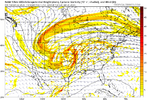
it's simpler than you'd think. low pressure can't form in the presence/middle of cold stable air, like a wedge, and will go around it. the easterlies/northeasterlies you see during a wedge? the edge of that serves as a nice boundary and a convenient area of low level vorticity to get cyclogenesis fired up. that's the idea. but i think some mets are being too rigid with what they think the low will do. let's check out 500 mb on the latest nam.Can Webber or bouncy or any other met with a good understanding of physics chime in? What is the mechanism of action for a weakening/diverting low in the face of a CAD wedge?


