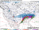
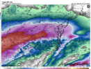
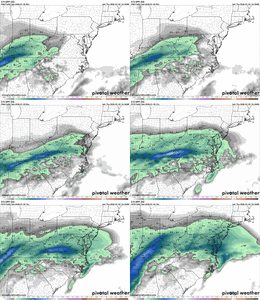
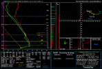
You just want that warm nose to hold off as long as possible, but I don't think there's any stopping it to be quite frankThat was a well put together analysis of what the models are currently showing and very easy to read. So from what I am getting the ideal situation would be that if the GFS is right about colder temperatures and more sleet and the Euro suite is correct about a dry slot limiting QPF amounts. One thing is certain, there is still a lot that can change with more than 48 hours before we start feeling the effects from this storm.
-
Hello, please take a minute to check out our awesome content, contributed by the wonderful members of our community. We hope you'll add your own thoughts and opinions by making a free account!
You are using an out of date browser. It may not display this or other websites correctly.
You should upgrade or use an alternative browser.
You should upgrade or use an alternative browser.
Wintry January 23rd-27th 2026
- Thread starter SD
- Start date
Brandon10
Member
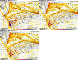
Yeah....the digging is still happening west w the NS, just seemed a tad later. UGH.
rburrel2
Member
Another thing to consider for the upstate. Assuming we don’t sleet(and it’s going to be hard to sleet bc the snowflakes will be 100% melted in the warm layer).
You’re going to have water drops that have been super cooled below freezing when they pass through that -8 to -10c 925mb to the surface layer. Every last drop is going to immediately freeze on impact in that scenario, truly worst case. Fram could be underdone?
On the flip side, the heavy precip that comes through Sunday afternoon will not be efficiently accreted… but the damage is done by then anyways.
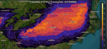
NEVER underestimate the power of CAD in the Carolinas and parts of GA. CADs are ALWAYS underestimated at the beginning and ALWAYS last much longer than forecast. Central NC/SC to the west and portions of N Ga will likely be below freezing for the entire event. Yes, there is going to be crippling freezing rain on the southern edges and maybe even half of the region. Snow/sleet will limit the power damages to the N and W but travel impacts will be horrendous.
Brandon10
Member
NAM seems to phase better, just a tad later. That pushed 850s north after showing them futher south initially.
mydoortotheworld
Member
Can Webber or bouncy or any other met with a good understanding of physics chime in? What is the mechanism of action for a weakening/diverting low in the face of a CAD wedge?View attachment 187484
Opinion of SC’s Weatherman Jim Gandy is that the models have a bad handle on the CAD. May be god news for areas like the Piedmont of NC but bad news for the Midlands of SC.
packfan98
Moderator
My best hope is that the cold is there and the surface low is dampened out more than depicted. Hopefully this would lessen the warm nose and there's a larger footprint of sleet that lasts as long as possible. Hoping for the slimmest of slivers with the .50+ ice contours.
for those not in the know; gandy has been doing this for many many many many years, he did well with hugo before we had all this computer crap like we do now, and it really set his on air career off
if he says the wedge erodes too quickly on modeling and is looking towards the icon, pay attention along and just south of i-20. hes usually very conservative. one of the only on air mets that i actually believe in, so i will be buying fuel today
hes basically saying the low should dance around the high, not plow into it
Webberweather53
Meteorologist
Governor Stein has already declared a State of Emergency and rightly so in this case. Things could get rough for folks in North Carolina and could be even worse for the states south of us north of Florida. My boss decided to fly to the Virgin Islands for a vacation next week. It looks like he will be out of harm's way.Hey gang
Any ideas if we will start seeing state of emergency declared anytime soon? Hope we are all safe and well during this event and keeping front line people in our thoughts and prayers
This run is looking a touch colder at the surface to me, which kind of makes sense. “More amped” can strengthen the CAD, correct?
EDIT: Well, let’s see about the “amping”, might call that too early.
EDIT: Well, let’s see about the “amping”, might call that too early.
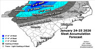
I love your input and analysis Webberweather53 but I hope that sleet map is underdone quite a bit.
NCPROGRAMMER
Member
NAM is actually less amped and looks to be flatter. Interesting.
rburrel2
Member
Also, I’m sure it’s been said… but the biggest way these solid CAD events always bust is holding on longer and colder than models show. I absolutely 100% expect the heart of cad country to stay colder/longer than what’s expected. I’m not surprised the weathernext is holding it on longer than the euro, but I bet it’s even too quick to erode.
(This may not be as true for the Raleigh area when dealing with eastern edge erosion of cad)
Edit: I see it was said 5 minutes before me already, lol. But I agree
(This may not be as true for the Raleigh area when dealing with eastern edge erosion of cad)
Edit: I see it was said 5 minutes before me already, lol. But I agree
Makeitsnow
Member
nam is south overall compared to it's previous run through 72 hours
your maps are further north than i was expecting. mentally i have raleigh slated as predominantly sleet
12z NAM is 1-3 degrees colder across the NC Piedmont at hr 66-72 as the storm unfolds.
Also, looks a little further south, not seeing significant snows in Columbus, OH like 06z (so far, at least). EDIT: More delayed than south, per se.
Also, looks a little further south, not seeing significant snows in Columbus, OH like 06z (so far, at least). EDIT: More delayed than south, per se.
Last edited:
Webberweather53
Meteorologist
your maps are further north than i was expecting. mentally i have raleigh slated as predominantly sleet
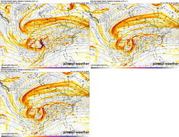
This storm has an incredibly strong warm nose aloft, I haven't ever seen one like this in real-time before.
When yall are doing comparisons for model runs (this run vs last), maybe it would be most helpful to find the frames on the two or 3 different runs that match in terms of precipitation and feature placement and compare those. I don't know how easy that is to do, but the 12z now vs the last runs at the same time period will be deceptive if there are timing issues, i.e. maybe the whole pattern is slowed by 3-6 hours. That's why we're getting "yay this run looks better colder snowier" "nah oh well".
rburrel2
Member
I unfortunately think you’re probably dead on for upstate. But I hope you’re wrong!
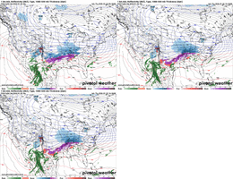
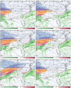
ICON is 7-9F colder than the Euro with largely the same track.
ICON must have a cold bias in these wedge scenarios
View attachment 187428View attachment 187429
They say its the warmest KyloG from over previous post in this thread.
It’s not a known bias as far as I’m aware. Somewhere in between would be appropriate if the setup remains similar. Maybe we should compare all of the major models at this time period and see where we stand?
No it typically has a warm bias like the EURO
Only one way to tell and that's wait for verification and see if the two stand their ground. I've always thought the ICON to be too warm at times but maybe it is possible the Euro isn't wrong and temps will be borderline
Maybe it'll be right but the last arctic cad event in 2021 it did this but I'm sure everyone will tell you about its unverified warm bias
I don’t know where the idea of a ICON warm bias originates. Recently in a couple of cases I was following, the ICON along with CMC have easily been the two coldest of the major globals for lows when no precip. and no snowcover. (Sometimes with great radiational cooling they verified closest.) UKMET was warmest with GFS/Euro in between. (Aside: GFS is often coldest by far for radiational cooling lows over snowcover, which is a known cold bias, but I’m not talking about that here.) Granted, those weren’t during precip. But regardless, I don’t see why the currently colder ICON is being called warm biased by some.
Makeitsnow
Member
Nam is holding on the colder 925mb temps a bit longer. If it ticked like this about 2 or 3 more times it will save a lot of folks with sleet.Also, I’m sure it’s been said… but the biggest way these solid CAD events always bust is holding on longer and colder than models show. I absolutely 100% expect the heart of cad country to stay colder/longer than what’s expected. I’m not surprised the weathernext is holding it on longer than the euro, but I bet it’s even too quick to erode.
(This may not be as true for the Raleigh area when dealing with eastern edge erosion of cad)
Edit: I see it was said 5 minutes before me already, lol. But I agree
Need some ticks south to keep it sleet.What an insane front end thump. Gonna go to cloudy conditions to getting sandblasted by sleet right out the gate. View attachment 187495
The NAM is still insistent on driving the heaviest precip north of the NC / VA border, at least until the frontal passage itself, which is beyond its range. As a result, much of NC / SC are well under 1” or QPF out to the end of the run (pre-frontal passage). More similar to the Euro I’m that regard. Helps us avoid the worst of it, if it happens.
Even in ATL? I saw the 925 in ATL but the precip was not there yet.Nam is holding on the colder 925mb temps a bit longer. If it ticked like this about 2 or 3 more times it will save a lot of folks with sleet.
iGRXY
Member
Nothing like the NAM being entirely too dry in the long range
rburrel2
Member
Does the warmnose strength matter much once snow flakes are fully melted?This storm has an incredibly strong warm nose aloft, I haven't ever seen one like this in real-time before.
Like if the warm nose is +4 or +8, does that have a material effect if the cold layer is let’s say -8c and goes up to 850mb for example?
I imagine it wouldn’t matter much, but gonna be tough to get sleet either way I think.
Basically, if the surface low pushes up into KY, a lot of us are going to get dry slotted (of course, there will still be freezing drizzle). I don’t think those solutions are so realistic against the wedge, but then again I’ve thought that before and it’s happened anyways.
mydoortotheworld
Member
ATL went from crippling ice storm to severe wx. No way this happens right????View attachment 187500
I may have to swap the generators for helmets for the storm shelter. Unbelievable how this has trended

