-
Hello, please take a minute to check out our awesome content, contributed by the wonderful members of our community. We hope you'll add your own thoughts and opinions by making a free account!
You are using an out of date browser. It may not display this or other websites correctly.
You should upgrade or use an alternative browser.
You should upgrade or use an alternative browser.
Wintry January 23rd-27th 2026
- Thread starter SD
- Start date
Blue_Ridge_Escarpment
Member
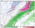
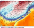
I think it’s starting to realize there is a decent HP to its north.Euro looks locked in. Hopefully it keeps trending warmer as it end Sunday evening
View attachment 187413
rburrel2
Member
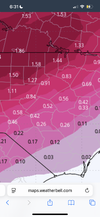
Yes. Novelty event for Raleigh on the euro…Nice to see Euro showing rain as it sweeps thru Sunday night.
For Raleigh…much to do about nothing
View attachment 187411
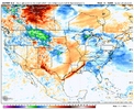
Euro with a small tip of the cap to GFS/Icon maybe it definitely had slightly better cold press to start and less interaction so initially flatter eventually though it still cuts but maybe a little south and stronger CAD signature
Do you have that for GAYes. Novelty event for Raleigh on the euro…
View attachment 187415
NCHighCountryWX
Member
- Joined
- Dec 28, 2016
- Messages
- 699
- Reaction score
- 1,918
rburrel2
Member
SimeonNC
Member
I reckon that it helps in keeping a lot of places as sleet longer.
It’s been cut in half past couple of runs…thanks for pointing that out. 3 more days to tick north into a nuisance eventYes. Novelty event for Raleigh on the euro…
View attachment 187415
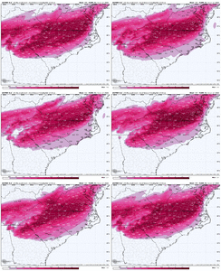
Blue_Ridge_Escarpment
Member
6Z euro drops the freezing rain line about 25 miles to the south this run
Yeah it's a small nod to GFS camp we shall see if trending grows6Z euro drops the freezing rain line about 25 miles to the south this run
SOMEONE PLEASE DROP THE TOTAL ZR FROM THE EURO FOR ALABAMA WHEN IT FISHSHES PLEASE. I DONT HAVE ACCESS TO THAT
Atlanta totals went up due to the better push of cold air. Would love to see more more separation on the EURO to keep flatten it out. I think the GFS will trend this way at 12z.It’s been cut in half past couple of runs…thanks for pointing that out. 3 more days to tick north into a nuisance event
rburrel2
Member
NCWeatherNow
Member
Looks like we are trending drier and warmer
10 posters say the Euro trended south and colder and 1 poster(edit: make that 2 posters) says the Euro trended warmer and drier and to nothing.
I'm not sure what's going on this morning.
I'm not sure what's going on this morning.
iGRXY
Member
The euro is folding to the GFS in terms of low level cold air and LP
Places further west it could be rough. For NC west just depends on how much precip. For Raleigh I am not worried.Atlanta totals went up due to the better push of cold air. Would love to see more more separation on the EURO to keep flatten it out. I think the GFS will trend this way at 12z.
Cad Wedge NC
Member
As much as you want it to be all rain, we are not getting out of this one .... especially back here in the western Carolinas. Euro starting to see the power of the wedge. Sure, the back end may warm, but by then, the damage has already been done.It’s been cut in half past couple of runs…thanks for pointing that out. 3 more days to tick north into a nuisance event
View attachment 187419
- Joined
- Jan 2, 2017
- Messages
- 1,566
- Reaction score
- 4,279
BTW we had a nice batch of flurries last night (2nd flurry action)
Agree with Rburrel that the RGEM is typically the best model for any cad event and is the one to watch(may be fall flat for this one..lol)
Agree with Rburrel that the RGEM is typically the best model for any cad event and is the one to watch(may be fall flat for this one..lol)
Understood,! I really want a NAM solution at the end of the day just a nuisance event for ATL... less qdf. Was the more flatter then the 0z?Places further west it could be rough. For NC west just depends on how much precip. For Raleigh I am not worried.
Looks like 6z euro shows more ice for the upstate and gaIt’s been cut in half past couple of runs…thanks for pointing that out. 3 more days to tick north into a nuisance event
View attachment 187419
Mpirone12
Member
Guys, I rarely post but have been on board between here and Americanwx for years. If you’re unsure of how to read the models can we please stop with the posts. There’s been numerous contradictions post after post when the new models come out.
Also I understand we aren’t getting 20 inch’s of snow but the negative comments for still a big storm are bringing down the vibes for everyone else on here.
Sent from my iPhone using Tapatalk
Also I understand we aren’t getting 20 inch’s of snow but the negative comments for still a big storm are bringing down the vibes for everyone else on here.
Sent from my iPhone using Tapatalk
They say its the warmest KyloG from over previous post in this thread.ICON is 7-9F colder than the Euro with largely the same track.
ICON must have a cold bias in these wedge scenarios
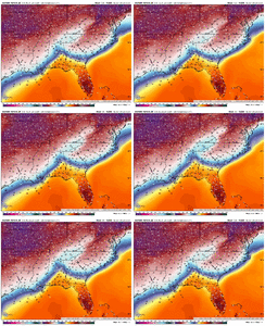
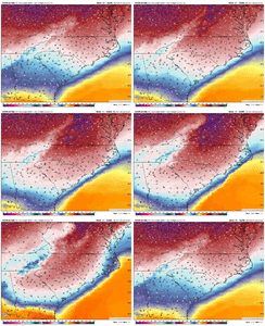
View attachment 187428View attachment 187429
packfan98
Moderator
It’s not a known bias as far as I’m aware. Somewhere in between would be appropriate if the setup remains similar. Maybe we should compare all of the major models at this time period and see where we stand?ICON is 7-9F colder than the Euro with largely the same track.
ICON must have a cold bias in these wedge scenarios
View attachment 187428View attachment 187429
I don't know what to think about the latest model runs. Seeing the Euro fold to the other models was a shock and everything seems to be trending south, colder and slower for the onset of precipitation for most of us. I don't think we still have a clear picture of what will happen yet.
No it typically has a warm bias like the EUROICON is 7-9F colder than the Euro with largely the same track.
ICON must have a cold bias in these wedge scenarios
View attachment 187428View attachment 187429
SimeonNC
Member
I agree completely! I am a degreed Met from NC State (focus more on air pollution meteorology in my career) and just recently came to this forum after several colleagues spoke highly of the analysis on here. Really thought I can learn some and also contribute at times, but the recent banter is starting to negate the positive analysis. I think there are some really smart Mets and weather enthusiasts on here and I can see how it can be great if we can clean some of that up and take some of the emotion out of it. I get it though I really do, but we can be better. Hoping everyone stays safe and enjoys whatever weather is coming your way!Guys, I rarely post but have been on board between here and Americanwx for years. If you’re unsure of how to read the models can we please stop with the posts. There’s been numerous contradictions post after post when the new models come out.
Also I understand we aren’t getting 20 inch’s of snow but the negative comments for still a big storm are bringing down the vibes for everyone else on here.
Sent from my iPhone using Tapatalk
ForsythSnow
Moderator
Only one way to tell and that's wait for verification and see if the two stand their ground. I've always thought the ICON to be too warm at times but maybe it is possible the Euro isn't wrong and temps will be borderlineICON is 7-9F colder than the Euro with largely the same track.
ICON must have a cold bias in these wedge scenarios
View attachment 187428View attachment 187429
LongRanger
Member
I agree! Some on here has no clue what they're doing They just think they do I'm one that doesn't have a clue But I'm not one trying to tell people what's gonna happen either. I wish they was a way they could straighten that out, Cause it definitely gets confusing for the ones that wants to know exactly what's really going on.Guys, I rarely post but have been on board between here and Americanwx for years. If you’re unsure of how to read the models can we please stop with the posts. There’s been numerous contradictions post after post when the new models come out.
Also I understand we aren’t getting 20 inch’s of snow but the negative comments for still a big storm are bringing down the vibes for everyone else on here.
Sent from my iPhone using Tapatalk
The snow line has moved south overnight on the models and with another fifty to one hundred mile adjustment folks in Central North Carolina might get in on the fun at least at the beginning of the storm until the warm upper level temperatures take over. QPF totals seem to have lessened too.
Maybe it'll be right but the last arctic cad event in 2021 it did this but I'm sure everyone will tell you about its unverified warm biasICON is 7-9F colder than the Euro with largely the same track.
ICON must have a cold bias in these wedge scenarios
View attachment 187428View attachment 187429
I don’t get the sentiment models are too warm…atleast for us…they are always too cold.Maybe it'll be right but this last arctic cad event in 2021 it did this but I'm sure everyone will tell you about its unverified warm bias or it was too warm one time
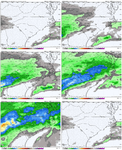
Every ounce of me hopes this is close to reality. I hope this is like one of those summer events where we are hoping for drought relief but just end up not getting as much precipitation as advertised. It can happen.This is how central NC gets out of this mess as just a nuisance mess. Overrunning largely miss to north and miller B dryslot.
Much to do about nothing for Raleigh.
View attachment 187408View attachment 187409

