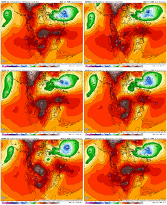
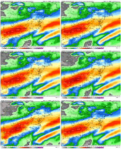
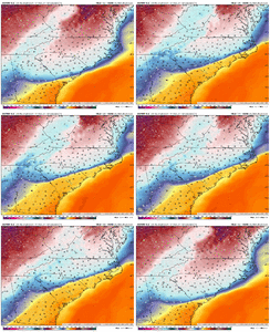
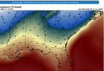
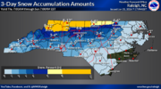
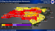
It’s not. The 50/50 is retreating on the euro so there’s not even any blockingGuys a 1040 high sitting over Quebec is more than enough to keep a serious cold air feed going for this storm. The notion that we are losing the CAD or the high is moving away because the euro wants to drive right into it is ridiculous. We can come back here in 4 days and see what ends up being right. Because I know which one I wouldn’t bet against
-
Hello, please take a minute to check out our awesome content, contributed by the wonderful members of our community. We hope you'll add your own thoughts and opinions by making a free account!
You are using an out of date browser. It may not display this or other websites correctly.
You should upgrade or use an alternative browser.
You should upgrade or use an alternative browser.
Wintry January 23rd-27th 2026
- Thread starter SD
- Start date
We don't get overrunning anymore. That just doesn't happen to our area and produce snow anymore. Every single winter we see stuff show up on the models way out in time, and we talk overrunning for a week. And then we get a low pressure that screws the entire area by tracking west of us or over us. If we can't get overrunning with a once in a decade 1050+ arctic high coming into the central US, then we ain't getting an overrunning snowstorm ever. I would be fine if I never heard the term overrunning again.This whole event evolution changed...Monday we were looking at overrunning in E-W fashion and now it's a miller B coastal so we miss the front end and deal with warming from millerB and retreating high.
View attachment 187195
packfan98
Moderator
Will the AI models learn anything from this storm? I don’t even know how they work.
18z Euro run for Charlotte has 1.30 precip, all freezing rain when looking at the soundings (maybe a skiff of reg rain at the end - maybe a skiff of sleet at the beginning). But better chances than not, to me, that the storm continues to climb a little north.
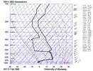
Anyone ever seen a freezing rain sounding with a warm nose of +11C?
View attachment 187197
Intense mid-level overrunning / warm air advection shown
View attachment 187204
Any chance Euro isn't handling the transfer correctly? Driving way up into Ohio Valley? Nice 1040 high to start Sunday and by that afternoon it rapidly weakens...
Webberweather53
Meteorologist
18z Euro run for Charlotte has 1.30 precip, all freezing rain when looking at the soundings (maybe a skiff of reg rain at the end - maybe a skiff of sleet at the beginning). But better chances than not, to me, that the storm continues to climb a little north.
Anyone ever seen a freezing rain sounding with a warm nose of +11C?
View attachment 187197
Intense mid-level overrunning / warm air advection shown
View attachment 187204
Yeah we had an event like that in NC in Feb 1994
12z GSO RAOB from Feb 11th showed a +11C warm nose
Webberweather53
Meteorologist
Left out its triple phaser runThis is nuts. Euro has evolved from an overrunning, to a Miller B, to almost a cold front??
Yertmoo
Member
North Alabama has some serious QPF. Does /IF that falls fast in freezing rain or sleet form keep warm nose further south? Makes sense to me
Any chance Euro isn't handling the transfer correctly? Driving way up into Ohio Valley? Nice 1040 high to start Sunday and by that afternoon it rapidly weakens...
View attachment 187205
I've always thought the Euro performs well with damming. The CMC tends to be too cold. The GFS tends to be too warm (not this time right now cause it's way off with the storm I think). Sure the high res models may hold the damming in a little longer and stronger and be correct, but the bigger question is...how is the whole system going to trend over the next 2 days? If it climbs a little more north, that of course puts more pressure on the CAD to hold. It probably will hold for the most part, but every tick moves the max freezing rain location north.
l was thinking the same thing the AI models have never seen anything like this storm (maybe any other model) it will be interesting to see how all this works out in their data output.Will the AI models learn anything from this storm? I don’t even know how they work.
Mahomeless
Member
No....the torch at all levels is coming....potential 60's at the surface as well for a brief window.North Alabama has some serious QPF. Does /IF that falls fast in freezing rain or sleet form keep warm nose further south? Makes sense to me
I imagine they’ll get better, but it’s still chaos. It’ll never nail it perfectly. Perfection would require it knowing its own contribution to entropy in the system it is trying to predict.Will the AI models learn anything from this storm? I don’t even know how they work.
tonysc
Member
Except in February 2014 Jason.The GFS would be an amazing winter storm. But let's face it, even if we buy it being flatter than the Euro, it is most likely out to lunch with it's depiction of a 3 day winter storm. There's just no way.
Tsappfrog20
Member
Just fyi I heard from Jeremy that the data from the hurricane hunters will be in the 0z models tonight.
Sent from my iPhone using Tapatalk
Sent from my iPhone using Tapatalk
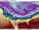
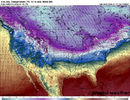
So, actually, it looks like Pivotal has me thinking I'm getting senile. wth?View attachment 187176Then what are we seeing here? Serious question
Webberweather53
Meteorologist
The AIFS ensemble still looks about the same temperature wise at the surface despite all the north trends. The euro is scouring out the cad too quick imho
I agree with you, euro is off its rocker for the first time in a while I believeThe AIFS ensemble still looks about the same temperature wise at the surface despite all the north trends. The euro is scouring out the cad too quick imho
Euro is absolutely cooking at and above 925, its not underestimating cad, its nuking it from the top down and from the SE. Im sure the cad would hold on longer than the euro has it almost always does but there's a ton on pressure of a rapidly decaying cold wedge on that model. Don't dismiss it because "wedges are hard to break" or "this one time".
I agree, I’ve been looking at winter weather modeling for decades and this has been flabbergasting. We used to get excited by a 1040 high coming down the front range for an overrunning, or a 1030 high in New England for CAD storms. No reason to get excited anymore, I guess.We don't get overrunning anymore. That just doesn't happen to our area and produce snow anymore. Every single winter we see stuff show up on the models way out in time, and we talk overrunning for a week. And then we get a low pressure that screws the entire area by tracking west of us or over us. If we can't get overrunning with a once in a decade 1050+ arctic high coming into the central US, then we ain't getting an overrunning snowstorm ever. I would be fine if I never heard the term overrunning again.
olhausen
Member
Couple winters back the gfs scored on some big snows for my area that the euro was showing 2-3 inches and ended up being 7-8. Very localized but for a winter or two I trusted the gfs more. Since then the euro has wiped the floor with the gfs so I’m very curious how this one turns out. Recent run, GFS about 15 inches vs the euro at 4-5. Someone is not going to want to show their face around here come Monday and I’m hoping it’s the euro.Exactly. People love the euro so much (including me) that they take it for gospel. It has had issues just like other models at different points. It’s not the same level of accuracy like 15 years ago
Webberweather53
Meteorologist
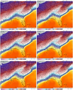
Sure the north trend will impact how much zr and precip we get and how quick this cad erodes later on Sunday into Monday, but the AIFS ensemble is largely the same Sunday morning as it has been even with the northward shifts.
Euro is out to lunch with the CAD erosion, for now at least. If the pattern changes even more in its favor continually the next few days, then yeah it’s believable
Euro is out to lunch with the CAD erosion, for now at least. If the pattern changes even more in its favor continually the next few days, then yeah it’s believable

It does seem to erode the cad faster but yeah for now still a potent ice stormSure the north trend will impact how much zr and precip we get and how quick this cad erodes later on Sunday into Monday, but the AIFS ensemble is largely the same Sunday morning as it has been even with the northward shifts.
Euro is out to lunch with the CAD erosion, for now at least. If the pattern changes even more in its favor continually the next few days, then yeah it’s believable
View attachment 187216
remarkably consistent. that alone makes me believe it more than the euroSure the north trend will impact how much zr and precip we get and how quick this cad erodes later on Sunday into Monday, but the AIFS ensemble is largely the same Sunday morning as it has been even with the northward shifts.
Euro is out to lunch with the CAD erosion, for now at least. If the pattern changes even more in its favor continually the next few days, then yeah it’s believable
View attachment 187216
I wrote about this storm on substack, which is something I've been meaning to start for 3 years. It has light profanity. I don't think there's anything there that I haven't said here, but feel free to check it out regardless.
 open.substack.com

On Snow In 2026
Forecasting "Fern", finessing fact from fiction, and assessing everything that pisses me off about modern winter storm coverage.
Is there a way to pay for your content?I wrote about this storm on substack, which is something I've been meaning to start for 3 years. It has light profanity. I don't think there's anything there that I haven't said here, but feel free to check it out regardless.

On Snow In 2026
Forecasting "Fern", finessing fact from fiction, and assessing everything that pisses me off about modern winter storm coverage.open.substack.com
rburrel2
Member
I trust this more than the euro, just makes more sense to me
The fact that we know we will have Mping Heavy Snow reports in Oklahoma in 48 hours but we don’t know if it will be 65 or 25 in Atlanta 24 hours later to me is crazy
Tsappfrog20
Member
Also the hurricane hunters data will be in both the GFS and Euro.
Sent from my iPhone using Tapatalk
Sent from my iPhone using Tapatalk
Little blurb from ILM tonight:
Within the NBM ensemble dataset, the spread between 25th and 75th
percentile high temps on Sunday now exceeds 25 degrees F across
coastal North and South Carolina, reflecting the exceptionally wide
temperature range that can be scientifically justified at this time
range. Ensemble ranges are smaller inland reflecting somewhat
greater certainty that cold air will remain entrenched across
Lumberton and the Pee Dee region.
Really hope the new data improves upon things one way or another. Local governments will need to start positioning tomorrow.
DylanWx
Member
Shaggy
Member
Little blurb from ILM tonight:
Within the NBM ensemble dataset, the spread between 25th and 75th
percentile high temps on Sunday now exceeds 25 degrees F across
coastal North and South Carolina, reflecting the exceptionally wide
temperature range that can be scientifically justified at this time
range. Ensemble ranges are smaller inland reflecting somewhat
greater certainty that cold air will remain entrenched across
Lumberton and the Pee Dee region.
Really hope the new data improves upon things one way or another. Local governments will need to start positioning tomorrow.
Gfs gives us 1+ inches of ZR the euro has us in the 50-60 degree range. Fun times lol
It's warmer for Alabama.
rburrel2
Member
I guess it’s time to say it out loud. If these far northern/amped models verify… Anderson/gsp/charlotte are getting a generational ice storm. I don’t see much sleet falling with the thermal profiles on the euro. And you’re looking at 1-2 inches of liquid with temps in the 22-28 range.
We may warm to freezing when the back line comes through Sunday afternoon, but it will be with one inch of ice covering everything and trees snapping/transformers blowing in the background.
A model blend consensus gives us an equal mix of sleet and freezing rain and maybe that keeps us below catastrophic ice damage. That’s what we’re rooting for.
At this rate you’ll be all rainI guess it’s time to say it out loud. If these far northern/amped models verify… Anderson/gsp/charlotte are getting a generational ice storm. I don’t see much sleet falling with the thermal profiles on the euro. And you’re looking at 1-2 inches of liquid with temps in the 22-28 range.
Yertmoo
Member
What showing for Huntsville?Congrats Huntsville

