• Hello, please take a minute to check out our awesome content, contributed by the wonderful members of our community. We hope you'll add your own thoughts and opinions by making a free account!

Wintry January 23rd-27th 2026

I think some of you all have unrealistic expectations with this which is leading to some of the meltdowns and bittercasting. Yes, it’s true that it’s nigh impossible for this to become a 12-18” snowstorm for those of us in NC/SC/GA but the table is still set for a sizable front end thump if the cards are aligned right and then a transition to tons of ice pellets and freezing rain (I understand feelings are mixed on this P-type, and for good reason). The GFS is still showing this for some. A lot of major winter storms are like this in our area - snow to ice pellets to freezing rain.
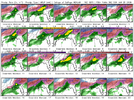
Gfs is on an island right now butnis a devastating ice storm for many even down here at the beaches. It's all alone though right now.
 
This is the model to follow for surface temps. Good news for Atlanta, the rgem is pretty warm there. Bad news for NC/SC, it’s super cold there.
Temps are still dropping across the region on this last panel. She was going at least a few degrees lower than this.
Already damaging ice developing in places.

View attachment 187158View attachment 187159
If it’s 20 degrees at my house I can guarantee you it will either be/or about to be below freezing into Atlanta
 
It depends on the setup. You need a trailing wave / vort max dropping in on the backside of the storm (Dec 2010, Feb 2014). GFS has a small one, but it's on an island with that (well, with a lot of things)

You buying what the GFS is cooking up?
 
GEFS panels. Near-unanimous ZR into Georgia CAD regions and a significant uptick in follow-up snow just beyond this period.

LINK for all panels:https://weather.cod.edu/forecast/
1769036199946-png.187170

1769036306145.png
 

Attachments

  • 1769036199946.png
    1769036199946.png
    387.4 KB · Views: 1,450
Yeah you’re right the high over New England isn’t really trending one way or the other but the high over the Canada/US border certainly is
Actually, no. The Arctic high entering the Northern Plains has been consistently modeled around 1050MB for days. This remains the case.
 
View attachment 187169 Is this not a weakening trend? It certainly is over the Canadian/US border. I wouldn’t call the one over New England trending one way or the other I suppose
It is weakening at that timestamp over the dakotas, but that lobe of high pressure is immaterial to our storm, in terms of cold air by that point.
 
That warm nose in Alabama is a dream crusher
I wouldn't be surprised one bit if Northern Alabama overperforms dramatically before all is said and done. Much as low-level cold is often undermodeled in CAD regions, the same holds in this instance west of the mountains early on before the high moves east into the NE US.

Don't be surprised to get a variety of mixed precipitation further down into northern Alabama before the cold is temporarily scoured out, and hope for a score with the passage of the reinforcing Arctic front on the backend.
 
I wouldn't be surprised one bit if Northern Alabama overperforms dramatically before all is said and done. Much as low-level cold is often undermodeled in CAD regions, the same holds in this instance west of the mountains early on before the high moves east into the NE US.

Don't be surprised to get a variety of mixed precipitation further down into northern Alabama before the cold is temporarily scoured out, and hope for a score with the passage of the reinforcing Arctic front on the backend
And if the low level cold advancement wound up being undermodeled you’d also see a shift south in the precip axis. I wouldn’t count on it, but it’s definitely a realistic possibility, especially at this lead time.
 
sledding down the court of carolina would be pretty freaking cool. Sleet bombs can be dope
Been there and done that. Also busted my azz walking down the slush covered sidewalk there holding a large cup of coffee on the way to an 8:00 class. Got up and went straight back to my apartment
 
For those who have been doing this for a while, how rare is this entire scenario, with how powerful the storm is and seemingly confused the models are.
This is a big storm. No doubt! I’d have to go back to “I believe 12/2000” to remember a storm that was modeled with huge snow totals and we got a few flakes. Totally different setup than this though. 2/2014 if I remember correctly, the warm nose really overperformed, and we ended up with a lot of sleet. Still a fun storm! 12/2010 is the only storm I can remember the the models were locked in several days in advance.
As far as models go, they have messed with me for 25+ years. I have a love/hate relationship with them. As a matter of fact, the entire weather hobby is a toxic relationship. If you stick with it, you’ll see. Lol!
 
In all my years on the wx boards, I don't ever remember a storm changing back to the east, once the storm cut west of the apps on the models,. I'm curious if anyone can think of a time.? I've seen hybrids jump to OBX several times, but not stay east and jump to say, MYR. I'm sure there was a time in the past 20 years but, I can't think of one.

I wasn't sure where to post this. Sorry if it needs to be in the banter.
IDK yet if anyone else chimed in yet but I can't recall any and I have been on this rock a while. My lived experience notes most of the time when it shows looks like this, it trends worse until the show. Also, Miller Bs normally bust low on QPF here. Exceptions to the general trend were Dec 18 where we had a transfer but had great QPF and our 2 sig events last winter maintained a decent front end thump of snow. Sleet crushed it in time but we did at least get a little out front.
 
If it’s 20 degrees at my house I can guarantee you it will either be/or about to be below freezing into Atlanta
Here is a picture illustrating why it will be frigid in upstate SC and 44 degrees in Atlanta. There isn't a surface low southwest of Atlanta to back the flow from the NE. You can see the surface winds are out of the SE, which is not a "cold air" source and will not lead to further temperature drops. Contrast this image to the GFS at the same time and you can see it develops a surface low that is over south central AL that maintains a east northeasterly fetch of wind, maintaining the wedge and creating the conditions for an ice storm.Screenshot 2026-01-21 181655.pngScreenshot 2026-01-21 181350.png
 
You buying what the GFS is cooking up?
The overall trend hasn't stopped here. I'd say better chance than not that it continues on. 5050 low and Montana spreading out like taffy are killin us. Hard to say what value the GFS Suite brings to the process - it seems a little worse these days compared to some other years.

Jan 21 Euro 500 Trend.gif
 
Back
Top