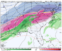
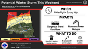
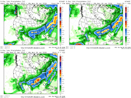
So euro took the south and cold trend away that fast? lol
-
Hello, please take a minute to check out our awesome content, contributed by the wonderful members of our community. We hope you'll add your own thoughts and opinions by making a free account!
You are using an out of date browser. It may not display this or other websites correctly.
You should upgrade or use an alternative browser.
You should upgrade or use an alternative browser.
Wintry January 23rd-27th 2026
- Thread starter SD
- Start date
This is nuts. Euro has evolved from an overrunning, to a Miller B, to almost a cold front??
Flurries at best but you folks in the other states have a great time in the winter wonder land and us bama people will keep the warm nose contain in Alabama for all to enjoy! sorry if this is banterMaybe for the front end thump, but that follow up snow/ice back side looks good so far for us in bama
Probably will have a severe thunderstorm watch issued Sunday afternoon.So euro took the south and cold trend away that fast? lol
Was thinking that earlier today. Looked almost like a frontThis is nuts. Euro has evolved from an overrunning, to a Miller B, to almost a cold front??
Only a 330 mile difference at checks notes…78 hours outGFS v/s Euro day 3...huge differences...I don't know what to thing except more models look like the Euro than the GFS
Will know by the 12z runs tomorrow
View attachment 187187
Euro is off its rocker, GFS is off its rocker. Start looking at NAM and HRRR cues. I guarantee the Euro and GFS will both have shifts soon
What is it looking like for Birmingham and one County south been busy all day and now driving to work haven't had a chance to catch upMaybe for the front end thump, but that follow up snow/ice back side looks good so far for us in bama
accu35
Member
Doesn’t the 0z models tonight ingest from the new data?Euro is off its rocker, GFS is off its rocker. Start looking at NAM and HRRR cues. I guarantee the Euro and GFS will both have shifts soon
Since we aren't going to get the Baja wave out front enough to shear and dampen the SER it seems like the only option we have to keep this more on the frozen side is to pull the upper mid west energy through then trail it with the Baja energy. Any thing else feels like a freezing rain disaster or way way nw. I just don't know if there's enough time to trend far enough to be meaningfulThe overall trend hasn't stopped here. I'd say better chance than not that it continues on. 5050 low and Montana spreading out like taffy are killin us. Hard to say what value the GFS Suite brings to the process - it seems a little worse these days compared to some other years.
View attachment 187186
Oh, we are going to have a freezing rain disaster anyways. The GFS gives me hope for back end snow, the Euro says rain...I think we will have sleet. The location of the high and CAD strength are everything which are often very hard to forecast and require synoptic analysis.Since we aren't going to get the Baja wave out front enough to shear and dampen the SER it seems like the only option we have to keep this more on the frozen side is to pull the upper mid likewest energy through then trail it with the Baja energy. Any thing else feels like a freezing rain disaster or way way nw
AlabamaWxWatcher
Member
iwantsouthernsnow123
Member
Went from a snow bomb, to a sleet bomb to a FZR bomb up here in northeast georgia. Not liking these trends, I never expected it to trend this north. Euro could be wrong, but I despise trusting GFS. That SFC low developing off the coast is causing a ton of problems.Peaks of sunshine Sunday afternoon? View attachment 187188
OHnoSnow
Member
It’s looking like a nice cold rain according to the euro, Canadian and others! Let’s pray that’s the case and the ZR goes north because we sure as shite ain’t getting snow!What is it looking like for Birmingham and one County south been busy all day and now driving to work haven't had a chance to catch up
NEGaweather
Member
Went from a snow bomb, to a sleet bomb to a FZR bomb up here in northeast georgia. Not liking these trends, I never expected it to trend this north. Euro could be wrong, but I despise trusting GFS. That SFC low developing off the coast is causing a ton of problems.
I’m pretty much done model hugging and moving on to prepping for an ice storm.
Sent from my iPhone using Tapatalk
Great call!I’m pretty much done model hugging and moving on to prepping for an ice storm.
Sent from my iPhone using Tapatalk
No kidding!!! I miss the days of looking at the paper and hoping it was wrongThis is a big storm. No doubt! I’d have to go back to “I believe 12/2000” to remember a storm that was modeled with huge snow totals and we got a few flakes. Totally different setup than this though. 2/2014 if I remember correctly, the warm nose really overperformed, and we ended up with a lot of sleet. Still a fun storm! 12/2010 is the only storm I can remember the the models were locked in several days in advance.
As far as models go, they have messed with me for 25+ years. I have a love/hate relationship with them. As a matter of fact, the entire weather hobby is a toxic relationship. If you stick with it, you’ll see. Lol!
DylanWx
Member
I really think the EURO is still underestimating the CAD here
Sunday at 1pm in Atlanta
Euro- 59 degrees
GFS - 33 degrees
ICON - 25 degrees
I hate this hobby
Euro- 59 degrees
GFS - 33 degrees
ICON - 25 degrees
I hate this hobby
That is ridiculous lolSunday at 1pm in Atlanta
Euro- 59 degrees
GFS - 33 degrees
ICON - 25 degrees
I hate this hobby
the rain will help big time with our droughtWhat is it looking like for Birmingham and one County south been busy all day and now driving to work haven't had a chance to catch up
NWMSGuy
Member
This one bears watching here in MS. 18z GFS paints mostly sleet while 18z EURO wants to bring in the ghost of 1994. Question is, which one verifies? I imagine with either solution being ice, Ice Storm Warnings are inevitable.
I don't think it underestimating the CAD but it is the fact the HP is weakening and the 50/50 low is retreating. The GFS was showing similar signs. I am not gunho about the ICON just yet.I really think the EURO is still underestimating the CAD here
only bit of cope i got is that the euro is showing wildly different 500mb signatures from run to run and i don't think has a handle at all on this pattern for some reason. i can't isloate a trend bc there is no trend
34 degree difference between the Euro and Icon u know one of them gotta be wrong but which one is itSunday at 1pm in Atlanta
Euro- 59 degrees
GFS - 33 degrees
ICON - 25 degrees
I hate this hobby
Sent from my SM-S156V using Tapatalk
Euro is absolutely cooking at and above 925, its not underestimating cad, its nuking it from the top down and from the SE. Im sure the cad would hold on longer than the euro has it almost always does but there's a ton on pressure of a rapidly decaying cold wedge on that model. Don't dismiss it because "wedges are hard to break" or "this one time".
iGRXY
Member
Guys a 1040 high sitting over Quebec is more than enough to keep a serious cold air feed going for this storm. The notion that we are losing the CAD or the high is moving away because the euro wants to drive right into it is ridiculous. We can come back here in 4 days and see what ends up being right. Because I know which one I wouldn’t bet against
Please explain where you are seeing the HP weakening on the GFS. I just looked at the last 4 runs of the and they all show the high virtually in the same spot over western NY and all between 1041-1043 MBI don't think it underestimating the CAD but it is the fact the HP is weakening and the 50/50 low is retreating. The GFS was showing similar signs. I am not gunho about the ICON just yet.
iGRXY
Member
Exactly. People love the euro so much (including me) that they take it for gospel. It has had issues just like other models at different points. It’s not the same level of accuracy like 15 years agoonly bit of cope i got is that the euro is showing wildly different 500mb signatures from run to run and i don't think has a handle at all on this pattern for some reason. i can't isloate a trend bc there is no trend
You bring up a point that I’ve been waiting for a met to bring up. The EURO is having wild swings at H5 since last night. Do we typically put so much faith in other models that are doing that?only bit of cope i got is that the euro is showing wildly different 500mb signatures from run to run and i don't think has a handle at all on this pattern for some reason. i can't isloate a trend bc there is no trend
This whole event evolution changed...Monday we were looking at overrunning in E-W fashion and now it's a miller B coastal so we miss the front end and deal with warming from millerB and retreating high.
View attachment 187195
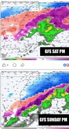
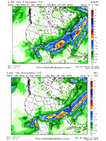
The GFS still gives us the illusion that this could still be a simple overrunning in E-W fashion. I think we know who wins this model war.....
Makeitsnow
Member
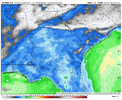
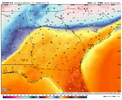
It's ridiculous because the euro is probably on crack with the track of the surface low. In all the years i have watched and studied cad events, i have never once seen a surface low take the track the euro is showing through the heart of the wedge over north ga. So if it happened it would be pretty extraordinary. The more likely scenerio is it will either have to go up west of the apps or slide underneath...and if it's the later you won't see it's absurd level of wedge erosion. and if it's the former, you will see only a slow erosion..so much so that temps in the heart of cad region likely won't recover above freezing in a meaningful way until precip is over. This is from the 12z run since it's running slow on weatherbell but it's pretty much the same on the 18z.That is ridiculous lol
Exactly. People love the euro so much (including me) that they take it for gospel. It has had issues just like other models at different points. It’s not the same level of accuracy like 15 years ago
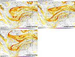
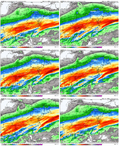
what do you want me to even do with this as far as analyzing what's changing. at least i can track what's going on with the gfs. i mean maybe it's right but to me this seems further away from the consensus than the gfs is (not an endorsement of either model). this looks like the faces the t1000 makes when it's going into the molten steel in terminator 2
18z Euro run for Charlotte has 1.30 precip, all freezing rain when looking at the soundings (maybe a skiff of reg rain at the end - maybe a skiff of sleet at the beginning). But better chances than not, to me, that the storm continues to climb a little north.
Anyone ever seen a freezing rain sounding with a warm nose of +11C?
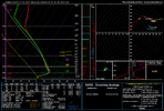
Intense mid-level overrunning / warm air advection shown
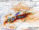
Anyone ever seen a freezing rain sounding with a warm nose of +11C?

Intense mid-level overrunning / warm air advection shown

I feel it’s probably wrong but I’d be lying if I said it doesn’t have some of my attention if it keeps doing it. Either way what you said, a little bit of 34 degree rain at the end would probably not do much for people that received 18-24+ hours of sleet/ZR. That damage would mostly be doneIt's ridiculous because the euro is probably on crack with the track of the surface low. In all the years i have watched and studied cad events, i have never once seen a surface low take the track the euro is showing through the heart of the wedge over north ga. So if it happened it would be pretty extraordinary. The more likely scenerio is it will either have to go up west of the apps or slide underneath...and if it's the later you won't see it's absurd level of wedge erosion. and if it's the former, you will see only a slow erosion..so much so that temps in the heart of cad region likely won't recover above freezing in a meaningful way until precip is over. This is from the 12z run since it's running slow on weatherbell but it's pretty much the same on the 18z.
View attachment 187199View attachment 187200

