Getting more worried about ice and sleet here around Raleigh. It’s naive to think all of our QPF will just go away. Prepare now, this storm is serious
-
Hello, please take a minute to check out our awesome content, contributed by the wonderful members of our community. We hope you'll add your own thoughts and opinions by making a free account!
You are using an out of date browser. It may not display this or other websites correctly.
You should upgrade or use an alternative browser.
You should upgrade or use an alternative browser.
Wintry January 23rd-27th 2026
- Thread starter SD
- Start date
UNCSC
Member
The NWS must see something we do not see because they seem pretty skeptical of northern runs and also are holding a further South storm. Are they seeing something we don’t see or are embarrassed of the models missing this by a mile?
NEGaweather
Member
The NWS must see something we do not see because they seem pretty skeptical of northern runs and also are holding a further South storm. Are they seeing something we don’t see or are embarrassed of the models missing this by a mile?
They see more of the big picture. Doubt they are holding on to a forecast out of embarrassment
Sent from my iPhone using Tapatalk
Yeah, because of that, it needs to resume trending in the right direction. The 6Z actually more or less paused the trending vs the 0Z run. But hopefully that was just a short term pause and this solid trend NW can resume and perhaps take y’all out of this threat.Yeah you can clearly see the heavier amounts of ice have trended northeast towards the Carolinas. Atlanta proper is just a 20 mile additional shift away from almost no ice. The issue though is that unfortunately it might be underestimating the wedge's power. We know these global models historically have not handled wedges very well.
they don't want to windshield wipe/be super reactionary to every model. similar to nhc storm track after big shiftsThe NWS must see something we do not see because they seem pretty skeptical of northern runs and also are holding a further South storm. Are they seeing something we don’t see or are embarrassed of the models missing this by a mile?
Tsappfrog20
Member
Allan Huffman is mentioning the 2002 ice storm in his patreon update this morning said it the icey models are right could be worse than that
Sent from my iPhone using Tapatalk
Sent from my iPhone using Tapatalk
Makeitsnow
Member
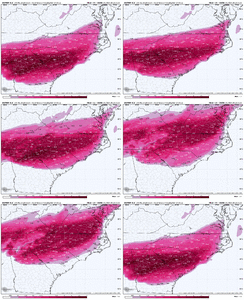
The problem is the euro is not a good model to use when handling the extent and severity of cad...especially during the erosion phase.Euro had all runs yesterday with 2”+ of ZR throughout ATL area. The 6Z Euro has ~1/3 of that (~0.75”). If this isn’t a trend away from a big icestorm there, I don’t know what is:
View attachment 186896
Its seems like the is there? It the placement of the HP for meYeah you can clearly see the heavier amounts of ice have trended northeast towards the Carolinas. Atlanta proper is just a 20 mile additional shift away from almost no ice. The issue though is that unfortunately it might be underestimating the wedge's power. We know these global models historically have not handled wedges very well.
Mpirone12
Member
It’s easy for us all to look at models and take it as the gospel. These Mets go off of years of experiences and have a lot more instincts than we do. That’s why you see them with different view points than a lot of us on here. If they just looked at models and made a forecast based on that exact moment we wouldn’t need professional meteorologists.
Sent from my iPhone using Tapatalk
Sent from my iPhone using Tapatalk
ducketta27
Member
What models have trended away from a big ice storm for Atlanta specifically? They’ve actually trended towards more ice in Atlanta(and less sleet).
[mention]rburrel2 [/mention] In Augusta, Euro went from 1.5 inches of ice to 0.0 in 3 runs. We’re good for a cold rain. Upstate will have to watch close, but trending to a cold rain up there these last few runs too… which may be your saving grace from this ice storm more so than sleet
Sent from my iPhone using Tapatalk
Are you a meteorologist? This storm still has crazy potential for the Augusta area! It most likely won't just be a "cold rain". I mean yes, it is possible but the odds are extremely low given the setup and unpredictability of the low/high.[mention]rburrel2 [/mention] In Augusta, Euro went from 1.5 inches of ice to 0.0 in 3 runs. We’re good for a cold rain. Upstate will have to watch close, but trending to a cold rain up there these last few runs too… which may be your saving grace from this ice storm more so than sleet
Sent from my iPhone using Tapatalk
And there's a very slim chance the upstate goes to rain.Are you a meteorologist? This storm still has crazy potential for the Augusta area! It most likely won't just be a "cold rain". I mean yes, it is possible but the odds are extremely low given the setup and unpredictability of the low/high.
packfan98
Moderator
Fair point, but personally I would put some of the experienced hobbyists' analysis and opinions that post here above many of the mets out there. Not all Mets have the same passion and base knowledge.It’s easy for us all to look at models and take it as the gospel. These Mets go off of years of experiences and have a lot more instincts than we do. That’s why you see them with different view points than a lot of us on here. If they just looked at models and made a forecast based on that exact moment we wouldn’t need professional meteorologists.
Sent from my iPhone using Tapatalk
Are you?Are you a meteorologist? This storm still has crazy potential for the Augusta area! It most likely won't just be a "cold rain". I mean yes, it is possible but the odds are extremely low given the setup and unpredictability of the low/high.
lexxnchloe
Member
Exactly. This is a huge change from just 36 hours ago. They dont want to have massive forecast changes every 6 hours.they don't want to windshield wipe/be super reactionary to every model. similar to nhc storm track after big shifts
NBAcentel
Member
Im a student, 3 years into my degree. I do not claim knowing everything but its comments like "We are only getting a cold rain" that can mislead the public. If you don't know something just stay quietAre you?
They are a lot slower to react. They wait a few cycles. If this continues north and warmer at 12Z I guarantee you they'll shift northThey see more of the big picture. Doubt they are holding on to a forecast out of embarrassment
Sent from my iPhone using Tapatalk
Keep going. Columbia almost in the clear.Not interested in being just south of the main axis of modeled ZR...
View attachment 186900
Mpirone12
Member
Fair point, but personally I would put some of the experienced hobbyists' analysis and opinions that post here above many of the mets out there. Not all Mets have the same passion and base knowledge.
Agreed, don’t get me wrong. I’ve followed here and Americanwx for over 10 years and the amount of times I knew what was coming before the news said something is unreal. A ton of people hit it right on the head here. I’m just more so making a point to why they may be leaning a certain way. They know climo and are basing their predictions based off that as well
Sent from my iPhone using Tapatalk
packfan98
Moderator
These euro maps from weatherbell don't capture the sleet correctly and count it as freezing rain. I would think that the middle 50% of the strong CAD regions would be much more sleet and less freezing rain. Now if it continues to shift, so would the proportions.Not interested in being just south of the main axis of modeled ZR...
View attachment 186900
ducketta27
Member
Are you a meteorologist? This storm still has crazy potential for the Augusta area! It most likely won't just be a "cold rain". I mean yes, it is possible but the odds are extremely low given the setup and unpredictability of the low/high.
This is banter… but commenting on the current northerly trend… combined with the fact that Augusta area is at the razors edge of CAD range (which usually does not err on the cold side like upstate/NC areas). CAD overperforms in those areas. A lot less consistent here in Augusta since it’s on the razor’s edge of CAD tange. I could be wrong…. Time will tell, for sure.
Sent from my iPhone using Tapatalk
Hence why I don't like being just south of the main axis. Pretend for a moment that's how it looks 24 hours before the storm, and chances are it is a sleet nuke for GSO and an ice storm just south of I-85These euro maps from weatherbell don't capture the sleet correctly and count it as freezing rain. I would think that the middle 50% of the strong CAD regions would be much more sleet and less freezing rain. Now if it continues to shift, so would the proportions.
CltNative90
Member
I don’t have access to Weatherbell personally, but I think it’s unfortunate that there isn’t a depiction of sleet accumulation separated out from freezing rain for the Euro. I would think the northern 2/3rds of that freezing rain area depicted ends up predominantly sleet. I’m in the heaviest area on the 6z run, and the soundings would indicate the 85 corridor is mostly freezing rain. I’m more skeptical for I-40 up to Virginia, even on the super amped Euro.Not interested in being just south of the main axis of modeled ZR...
View attachment 186900
iGRXY
Member
I’m leaning into a potential front end thump of snow still but definitely feel like we are trending into ice and not sleet in the upstate and a lot of it at that. As far as th CAD wedge goes with the Lp going that far north. I’ll stick to my knowledge of living in prime CAD region of SC that historically trends stronger with surface level cold and it holds on way longer and that’s with weaker HP and less cold air than we have available here.
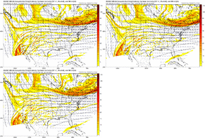
What I is funny is that the EURO handled rhe CAD fine in the previous runs only to go to this somewhat hybrid Ukmet solution.But the NW trend isn’t just leading to much less modeled ZR. It’s also leading to much less qpf, which is an important contributor to lessening the amount of ZR:
View attachment 186902
blueheronNC
Member
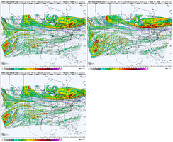
The N/S digging over Montana is relentless. Even though the Baja low is further SW on the 12z ICON, there’s still more phasing because of that Montana back-building
Btownheel
Member
We’re in a weird spot for the next 24-36 hrs. Globals will likely settle out track, which certainly appears to be settling north at this point but they are notoriously bad with modeling CAD. NAM is much better with the thermal profile but doesn’t get into its sweet sport range wise until later tomorrow.
Shrug.
Sent from my iPhone using Tapatalk
Shrug.
Sent from my iPhone using Tapatalk
There is a sleet map, the maps just aren’t very good. Can’t take the ZR maps at face value because of this. Plus, of course, not all falling ZR would accrete, though, with temperatures as low as they will be, that will help.I don’t have access to Weatherbell personally, but I think it’s unfortunate that there isn’t a depiction of sleet accumulation separated out from freezing rain for the Euro. I would think the northern 2/3rds of that freezing rain area depicted ends up predominantly sleet. I’m in the heaviest area on the 6z run, and the soundings would indicate the 85 corridor is mostly freezing rain. I’m more skeptical for I-40 up to Virginia, even on the super amped Euro.
That is starting to look more like a reasonable ice/wedge footprint there. Pretty classic signature there through upstate SC. Heavy axis sagging NE to SW through northernmost counties. Will tighten more.Not interested in being just south of the main axis of modeled ZR...
View attachment 186900
If it keeps going, Columbia might not even have to worry about moisture in general until the main front passes.Keep going. Columbia almost in the clear.
The N/S digging over Montana is relentless. Even though the Baja low is further SW on the 12z ICON, there’s still more phasing because of that Montana back-building
That would actually eventually lead to an even sharper cut of the low (more digging of the Baja Low) once it phases with the piece from Montana.
LovingGulfLows
Member
- Joined
- Jan 5, 2017
- Messages
- 1,499
- Reaction score
- 4,100
But the NW trend isn’t just leading to much less modeled ZR. It’s also leading to much less qpf, which is an important contributor to lessening the amount of ZR:
View attachment 186902
What was once a drought busting storm...
.If I wasn't facing the threat of life threatening ice and power outages, I would be quite angry at this...
I’ve seen many posts from metrologists here last night that said they expected the north trend to continue and then slowly back up.
If anything you can see the ice map on the euro 6z ever so slightly supports that
If anything you can see the ice map on the euro 6z ever so slightly supports that
packfan98
Moderator
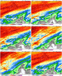
Yeah, the surface map looks a lot different than the nam.In search of a ray of hope? Yes, yes, I am. View attachment 186904
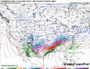
This is an excellent post my friend.That is starting to look more like a reasonable ice/wedge footprint there. Pretty classic signature there through upstate SC. Heavy axis sagging NE to SW through northernmost counties. Will tighten more.
If you notice the past 3 or 4 trends on the Euro, you are seeing the adjustment and classic tightening of a traditional CAD set up vs that elongated damming that was almost to Beaufort, SC. Whether it reaches the ATL area or not will have to be watched closely by the professionals.
Last edited:
blueheronNC
Member
Indeed. By 06z Saturday it’s amping our 500mb ridge even more. This is going even further north.That would actually eventually lead to an even sharper cut of the low (more digging of the Baja Low) once it phases with the piece from Montana.

