-
Hello, please take a minute to check out our awesome content, contributed by the wonderful members of our community. We hope you'll add your own thoughts and opinions by making a free account!
You are using an out of date browser. It may not display this or other websites correctly.
You should upgrade or use an alternative browser.
You should upgrade or use an alternative browser.
Wintry January 23rd-27th 2026
- Thread starter SD
- Start date
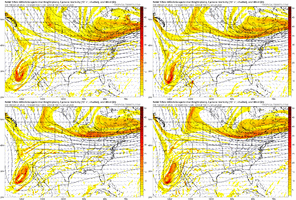
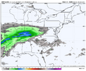
Maybe that SW heading into MT can continue trending west to the point that it avoids eventually interacting with the baja low until way later...idkBut when you need it to, it won’t View attachment 186879
I mean they are already interacting and in a relationship on the nam now. Gfs should go nw bigMaybe that SW heading into MT can continue trending west to the point that it avoids eventually interacting with the baja low until way later...idk
Makeitsnow
Member
nam is a bit slower with the precip and faster/colder with 925mb temps/cold press through hour 69
yeah... I'm just trying to find a thingI mean they are already interacting and in a relationship on the nam now. Gfs should go nw big
SnowNiner
Member
NWS I guess is still following the WPC guidance and holding off on the amped trend. After 12Z I'm sure all the snow and sleet will likely be removed from the guidance. I've come to the acceptance part that Euro went to a cutter, so that's what it's going to be. Probably haven't stopped that trend, so maybe we get freezing rain, but maybe we don't. I'll just sit and watch how far this trends. Still 3 days to go.
Let’s hope this true
The one thing that leaves a shimmer of hope for me to have more of a big time storm, maybe more sleet. My gut tells me though this is just going to continue to amp up.
Hoping for ATL-AHN to keep trending away from a big icestorm on the models. In this case the trend is your friend. I’ve been a bit concerned for ATL-AHN peeps I know possibly getting the worst icestorm in decades. Hopefully models will keep trending NW especially like the Euro, allow the area to get out of this mess for them, and allow me to give my family and friends great news. Fingers crossed!NAM looks like the Euro at the edge of it's reliable range, that's about all you can glean from it IMO
- Joined
- Jan 2, 2017
- Messages
- 1,566
- Reaction score
- 4,279
Agreed unfortunately..unless a perfectly timed High sets up in Northeast Virginia an over amped low pressure can do what it wants and bring in low level warmth all it wants to...sighThe quicker you guys can come to terms with the fact that we’ve lost the snow storm aspect of this the better.
Then we can focus on the ice portion of the storm which is trending worse and will continue to do so.
The same mechanisms that are sending our storm farther north are also getting our high pressure in to a better position faster for CAD. Expect warmer mid levels and colder low levels as a result. This ice storm is going to be an all-timer. Either get on board with that and enjoy tracking it or continue to wallow in sorrow over the snow that’s not happening.
Brandon10
Member
How many times have we hoped the BAJA would eject and it it didnt. Now we dont want it to and it is determined to. How have we ruined a -NAO, -AO, -EPO, +PNA, and MJO 8....
a funny thing about cad that a lot of people miss is that it creates natural pressure falls/warmth of the lee side of the impacted mountain chain. people from Chattanooga can attest. that's the pressure signature everyone is seeing
Brandon10
Member
NAM def pulling a Euro
We are cooked for snow in NC
We are cooked for snow in NC
So based on what I’ve read here and witnessed in the latest Euro update, how safe would you guys say it is to tell my family in Atlanta that we have a significant chance of just a cold rain with ice being practically out of the picture at this point? Wanting to get more of a confirmation since they’ve been quite worried of having a rerun of the 2000 ice storm that brought trees down on their house.
LukeBarrette
im north of 90% of people on here so yeah
Meteorology Student
Member
2024 Supporter
2017-2023 Supporter
Just hold tight. We got 2 to 3 more daysSo based on what I’ve read here and witnessed in the latest Euro update, how safe would you guys say it is to tell my family in Atlanta by telling them we have a significant chance of just a cold rain with ice being practically out of the picture at this point? Wanting to get more of a confirmation since they’ve been quite worried of having a rerun of the 2000 ice storm that brought trees down on their house.
The 12z NAM would be a catastrophic ice storm in the Carolinas, I think. Too bad we don’t have the DGEX anymore.
rburrel2
Member
What models have trended away from a big ice storm for Atlanta specifically? They’ve actually trended towards more ice in Atlanta(and less sleet).Hoping for ATL-AHN to keep trending away from a big icestorm on the models. In this case the trend is your friend. I’ve been a bit concerned for ATL-AHN peeps I know possibly getting the worst icestorm in decades. Hopefully models will keep trending NW especially like the Euro, allow the area to get out of this mess for them, and allow me to give my family and friends great news. Fingers crossed!
Snowflowxxl
Member
This has always been a slop storm. I don’t understand why some thought they were getting powder.
NEGaweather
Member
What models have trended away from a big ice storm for Atlanta specifically? They’ve actually trended towards more ice in Atlanta(and less sleet).
Not much of escape route from ice AtL northeast imo
Sent from my iPhone using Tapatalk
SnowNiner
Member
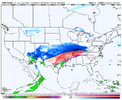
I will never doubt BAM again...these guys nailed this. Precip axis well into the Ohio Valley
View attachment 186884
Maybe we can just trend west of the Apps and we can stay dry.
Makeitsnow
Member
yep...i'm pretty dismayed because instead of a ton of sleet (snows been eliminated for quite a while), crippling ice is looking likely here. It's been so long since we have had a strong wedge that i think many have forgotten it's characteristics and how the models handle them. A 1040mb high in perfect damming position with this type of airmass is not something that is going to be scoured out easily. I'd love to be wrong because i don't want 2 inches of freezing rain.What models have trended away from a big ice storm for Atlanta specifically? They’ve actually trended towards more ice in Atlanta(and less sleet).
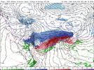
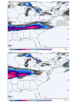
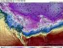
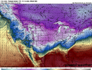
Well, despite it all, the 12Z NAM has actually trended colder at the surface.View attachment 186887
View attachment 186887View attachment 186891
It's because the surface low is much further west/slower...when it approaches it will warm dramatically.
NEGaweather
Member
So based on what I’ve read here and witnessed in the latest Euro update, how safe would you guys say it is to tell my family in Atlanta that we have a significant chance of just a cold rain with ice being practically out of the picture at this point? Wanting to get more of a confirmation since they’ve been quite worried of having a rerun of the 2000 ice storm that brought trees down on their house.
Please follow KATL guidance for being prepared. They have ton of experience with CAD ice storms in Georgia
Sent from my iPhone using Tapatalk
Thats what I am thinking...and this miller B transfers just north of us and we dry slot. That's my hope...I really feel much better about not having to deal with a freezing rain event this weekend. Maybe it will be golf weather.Maybe we can just trend west of the Apps and we can stay dry.
I must be confused, because from what I can tell with the euro there’s supposed to be freezing rain in the evening that will switch over to a regular cold rain over metro Atlanta Sunday morning and then through the entire day. Based on that, I’m confused as to how we would get a major ice storm outside of some minor accumulation Saturday night. I’m admittedly an amateur, so I’m trying to see where the danger still truly is here.What models have trended away from a big ice storm for Atlanta specifically? They’ve actually trended towards more ice in Atlanta(and less sleet).
The best for CAD events is Robert Gamble with WxSouth. He generally sees them before most.
it fits with the narrative i'll admit but personally i am not getting too worked up about an an amped long range nam, beautiful precip shield though
Webberweather53
Meteorologist
The long range (>48-60 hr) NAM is usually trash, there’s a reason it’s being decommissioned in March. Unfortunately, I’d rather see it stick around because no model handles cad better inside 48 hours or so than it does
I mean lol look at this most recent winter storm as an example
I mean lol look at this most recent winter storm as an example
What models have trended away from a big ice storm for Atlanta specifically? They’ve actually trended towards more ice in Atlanta(and less sleet).
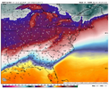
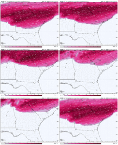
Euro had all runs yesterday with 2”+ of ZR throughout ATL area. The 6Z Euro has ~1/3 of that (~0.75”). If this isn’t a trend away from a big icestorm there, I don’t know what is:
Spot on!! It was atrocious with this past system….The long range (>48-60 hr) NAM is usually trash, there’s a reason it’s being decommissioned in March. Unfortunately, I’d rather see it stick around because no model handles cad better inside 48 hours or so than it does
I mean lol look at this most recent winter storm as an example
Stormsfury
Member
Slightly more separation but literally just a b it of noiseBut when you need it to, it won’t View attachment 186879
snowlover91
Member
Fwiw the fv3 looked a bit better compared with the 00z run. Northern energy ticked easy and Baja a little slower/west.
LovingGulfLows
Member
- Joined
- Jan 5, 2017
- Messages
- 1,499
- Reaction score
- 4,100
Euro had all runs yesterday with 2”+ of ZR throughout ATL area. The 6Z Euro has ~1/3 of that (~0.75”). If this isn’t a trend away from a big icestorm there, I don’t know what is:
View attachment 186896
Yeah you can clearly see the heavier amounts of ice have trended northeast towards the Carolinas. Atlanta proper is just a 20 mile additional shift away from almost no ice. The issue though is that unfortunately it might be underestimating the wedge's power. We know these global models historically have not handled wedges very well.
lexxnchloe
Member
Thats a significant trend. In one hour we will know if the GFS caves.Euro had all runs yesterday with 2”+ of ZR throughout ATL area. The 6Z Euro has ~1/3 of that (~0.75”). If this isn’t a trend away from a big icestorm there, I don’t know what is:
View attachment 186896

