-
Hello, please take a minute to check out our awesome content, contributed by the wonderful members of our community. We hope you'll add your own thoughts and opinions by making a free account!
You are using an out of date browser. It may not display this or other websites correctly.
You should upgrade or use an alternative browser.
You should upgrade or use an alternative browser.
Wintry January 23rd-27th 2026
- Thread starter SD
- Start date
The guys at NBC 3 in Chattanooga were doing it as well, probably elsewhere.Especially that poor Atlanta met. Ouch...
Unless the HRRR shows something, it’s not worth anyone’s time.
RollTide18
Member
How do Mets explain this? lol I would hate to have to make that video first thing in the morning.
And the thing is, it spread like wildfire on Twitter, even Spann honked the horn, and it spread to outside the wx community as well and not everyone follows model runs like we do so there’s still gonna be people doing winter storm prep shopping for nothing tomorrow
GoDuke
Member
Maybe they’ve been ingesting bad data since yesterdayEither the models are really jacked up right now or the models were really jacked up 35 hours ago either way it's horrible for confidence and tracking these are in the mid-short range approaching
It legitimately shouldn't be really logical to go from 20 degrees to flipping 65-70 I'm 24 hours of Models runs
It’s happened before.
37 in one county both u go south 1 and it's a 25 degree difference?
Sent from my SM-S156V using Tapatalk
Don't let your guard down on several models' first run on the 3rd day out from the party. This seems to happen more so than not. A over correction with new data.
Damnit Euro still gives me an inch of ice. Upstate needs one more big jump like that and we might be clear
As far as hurricane hunter no that appears to be tomorrow night runsIs the euro run with the new data or is that tomorrow?
One hell of an extreme overreaction if that’s the case.Don't let your guard down on several models' first run on the 3rd day out from the party. This seems to happen more so than not. A over correction with new data.
I'm just a dumbass who likes to read weather boards, but how in the heck do you go from such consistency (relative) to this in the last 12 hours? Either something was massively wrong for 3 days or so or it is now. Help me understand.
It will be interesting to see how much further this thing goes with that data injection.As far as hurricane hunter no that appears to be tomorrow night runs
How many runs does it take the GFS to figure it out? Another 48 hours?
I'm just a dumbass who likes to read weather boards, but how in the heck do you go from such consistency (relative) to this in the last 12 hours? Either something was massively wrong for 3 days or so or it is now. Help me understand.
I don't know, I want to say it had to be bad data, but the problem with that theory is the Ukmet and CMC have been amped.
That's what we all trying to figure out how can something that's had this much confidence now become something that is all over the place with crazy temperature swingsI'm just a dumbass who likes to read weather boards, but how in the heck do you go from such consistency (relative) to this in the last 12 hours? Either something was massively wrong for 3 days or so or it is now. Help me understand.
Sent from my SM-S156V using Tapatalk
For central NC, the euro still gives a concerning amount of freezing rain. RDU stays below freezing threw most of the precipitation (1.7" QPF). Just not sure if it's not done trending warmer.
Seen plenty of fails following weather.... unless specifically the UKMET/Euro ate some bad tacos this would rank up there as a all time fail!!!I'm just a dumbass who likes to read weather boards, but how in the heck do you go from such consistency (relative) to this in the last 12 hours? Either something was massively wrong for 3 days or so or it is now. Help me understand.
BUT cmc has been bad like this for days similar to us joking about ICON the CMC has been very bad in recent years so maybe there's a hope there that Euro and others are chasing ghosts
saielA10462
Member
this was the storm. You lose this at day 5 i’m not looking at 300hr 500mb EPS charts lol. Winter is forgotten and in infamy for many hereSince this storm will be a miss for most everyone on this thread…maybe we can scrap it and look ahead to late January into February. MJO looks good. Blocking also looks good. I hope the WPO stays negative.
hr 54 eps is weaker, slightly further west with baja low
AIFS-ENS is about to follow suite. Very warm.
One thing that this indicates to me is that the issue is entirely related to initial conditions. Either the ECM/UKM camps are reading something wrong or the GFS/ICON camps are.. likely related to the complex features in the arctic circle which will affect the Canadian trough.
One thing that this indicates to me is that the issue is entirely related to initial conditions. Either the ECM/UKM camps are reading something wrong or the GFS/ICON camps are.. likely related to the complex features in the arctic circle which will affect the Canadian trough.
Webberweather53
Meteorologist
0z EPS is more amped again.
blueheronNC
Member
The way it’s pumping the southeast ridge and bringing Wilmington, NC into the upper 60s Sunday afternoon, no way the CAD holds for destructive freezing rain.For central NC, the euro still gives a concerning amount of freezing rain. RDU stays below freezing threw most of the precipitation (1.7" QPF). Just not sure if it's not done trending warmer.
Yep worst case scenario for us is getting something like this Euro run when all is said and done. Hoping wishing praying it continues to trend north/warmer so we just end up with cold rain, if it isn’t going to trend back down south as we obviously would preferFor central NC, the euro still gives a concerning amount of freezing rain. RDU stays below freezing threw most of the precipitation (1.7" QPF). Just not sure if it's not done trending warmer.
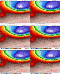
heaven forbid a man try to find a silver lining in trying timesIt’s the energy in Canada heading into Montana. Still shifting west and that’s gonna cause amping View attachment 186779
LittleMountain
Member
We went from yesterday morning (and many days prior) talking about how everything was aligning for a classic southern snowstorm (overrunning). Shades of 1988. To a cutter. Wouldn’t be a big deal if it was a week out and only weather weenie world was watching. But all local stations and Mets across the Carolinas were hyping it
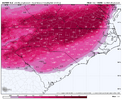
i went from relatively safe 10-15 inches to p-type battleground in 12 hours i've never seen anything like this beforeView attachment 186780
Might as well show this
Yes, it would be a catastrophe as modeled (1.7" ZR for RDU).Is there any freezing rain for areas of Sc into NC?
So now I don't have to worry about driving down to my cousins' in south FL to avoid hypothermia induced by power outages from 3" of ZR...we're so back
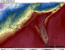
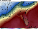
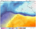
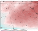
A difference of 20 miles of the perimeter of downtown Atlanta on the Euro is the difference between seeing 45 degrees and 60+ degrees. What on earth is that?This is so dumb. How are these at the same time? Is the GFS and ICON really that bad?? View attachment 186781View attachment 186782
Sent from my SM-S156V using Tapatalk
i went from relatively safe 10-15 inches to p-type battleground in 12 hours i've never seen anything like this before
All those people who had a foot+ of legit snow on every EPS member...
There's your wedge, gotta draw the line somewhere. Couple MARTA stops south of me and the Euro doesn't show a single minute of precip below 32ºFA difference of 20 miles of the perimeter of downtown Atlanta on the Euro is the difference between seeing 45 degrees and 60+ degrees. What on earth is that?
Sent from my SM-S156V using Tapatalk
uptwnnycwx
Member
The cold back west to Ark areas is actually improved it appears more snow south now just figure out how to make that happen eastward again less amping
Have to put a lot of weight towards the euro. I would expect the GFS/ICON to follow soon (maybe 6z). Hopefully the models meet more in the middle. Would love to see the 6z euro back off some.
This is completely bizarre. I thought ensembles mitigated this sort of wild swinging thing? I haven't been paying attention on that level, so maybe it was there all along? Or do we have a garbage in, garbage out situation?
Windergawx
Member
What if the icon/gfs held.. all the mets jumped ship to euro.. just to get an ice storm of the century .. popcorn time!Have to put a lot of weight towards the euro. I would expect the GFS/ICON to follow soon (maybe 6z). Hopefully the models meet more in the middle. Would love to see the 6z euro back off some.

