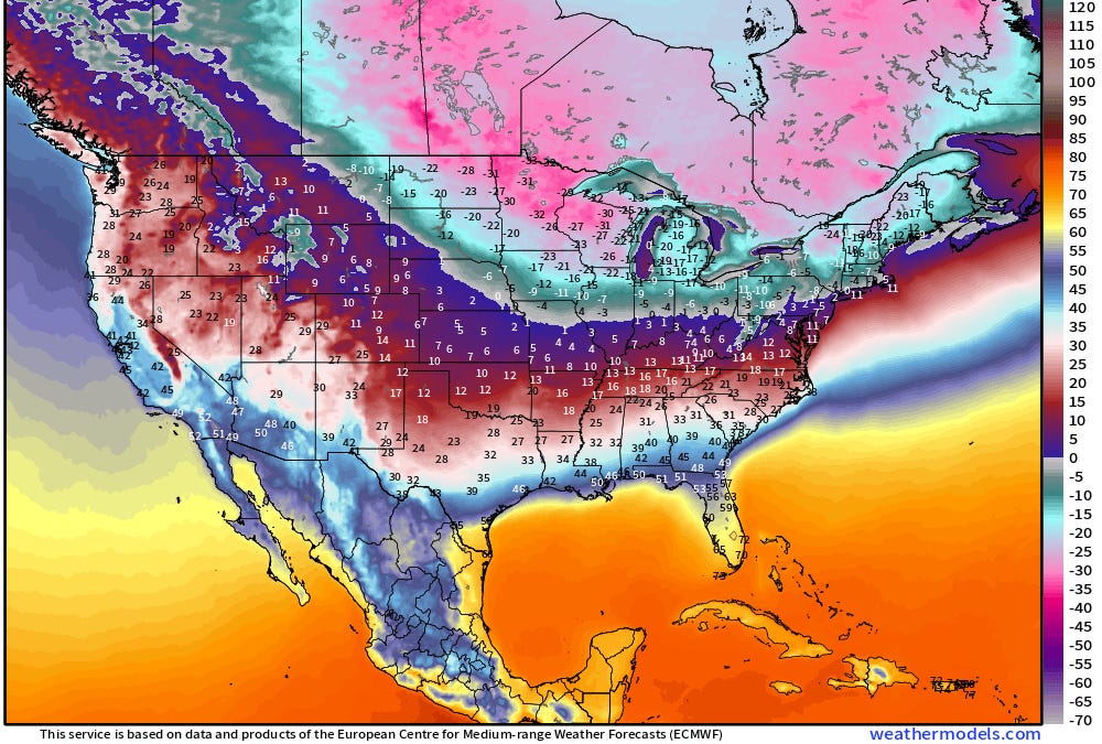
I don’t see a reasonably possible scenario where there’s no ZR associated with this storm due to the strong CAD wedge. Unfortunately, the highest risk as of now for wintry precip in your area and for others in the coastal/deep SE is ZR per the models. Thus, the storm’s setup is a bit worrisome in that regard.
Many GEFS ensemble members unfortunately have been showing ZR in the deep SE over the last few runs. For example, this image of precip types is from the 18Z GEFS and something similar is on several other panels during a 30 hour period: note that the pinks dominate over greens (plain rain), orange (sleet), and blue (snow):
View attachment 185989


.gif")