I've been lurking... but we hope and pray the the server doesn't fail and we don't lose all our precious images.
-
Hello, please take a minute to check out our awesome content, contributed by the wonderful members of our community. We hope you'll add your own thoughts and opinions by making a free account!
You are using an out of date browser. It may not display this or other websites correctly.
You should upgrade or use an alternative browser.
You should upgrade or use an alternative browser.
Wintry January 23rd-27th 2026
- Thread starter SD
- Start date
It is hollering in our faces right now. The fail modes are amp to kingdom come (even that could potentially ice some folks) or suppress and choke. It would take a pretty shocking trend for the latter to happen given the increasing QPF on most models and almost 100% hit rate on several ensembles for QPF existing, and we have outlined multiple ways that the former can be blocked.
I mean about the only thing I'm near certain about is the funhouse-mirror freezing rain totals won't verify. Still potential for a lot of trouble but not the end of days scenarios posted recently.
These East-West systems always surprise where the snow cutoff is and it's usually very sharp. Big difference from our coastal storms that ride the Gulf Stream and dump on the coastal plains.
Webberweather53
Meteorologist
It’s totally possible this storm starts on Friday morning in the carolinas and doesn’t end until sometime on Monday. That is insane
Remember that storm well. No power for over a week. No tv blaring.. just quiet. Other than the constant *crack*.... *crashhh* of limbs nad treetops falling to the groundFrom my memory from "THE" Ice Storm in Atlanta in Jan 1973 I saw 'ice loading" on trees of about 3/4-1 inch . With that even hardwood (oaks/hickory) came down by being uprooted. along with pines snapping from the ice load.
DONT GET MY HOPES UP MR WEBBIt’s totally possible this storm starts on Friday morning in the carolinas and doesn’t end until sometime on Monday. That is insane
Sorry I know I shouldn’t post this but I am too hyped rn
hope backups are being done on the regI've been lurking... but we hope and pray the the server doesn't fail and we don't lose all our precious images.
I drug out the Honda generator this afternoon to give it a tune up. Thankfully we remembered to drain the gas but unfortunately I lost the key. With it being so long since our last decent ice storm the trees are loaded with limbs to come down.2 inches of ZR somewhere in in North Georgia on the 18z Euro. Just plain stupid amounts and it wasn't done yet. Even 1/3 of these amounts would be devastating
I expect these numbers from models like the CMC. Not used to seeing biblical ZR from Euro. Hope its wrong
View attachment 185903
My parents/grandparents talk about that event. They were in Cobb County and also lost power for over a week. It is the benchmark when it comes to ATL ice events. Its interesting, according to ERA5, it only dropped around 0.5" of QPF. 1"+ would be even more devastating.Remember that storm well. No power for over a week. No tv blaring.. just quiet. Other than the constant *crack*.... *crashhh* of limbs nad treetops falling to the ground
I found some of my mom’s pictures from that one in Cherokee county. They were mostly when the melting started but there were tree limbs everywhere.My parents/grandparents talk about that event. They were in Cobb County and also lost power for over a week. It is the benchmark when it comes to ATL ice events. Its interesting, according to ERA5, it only dropped around 0.5" of QPF. 1"+ would be even more devastating.
Webberweather53
Meteorologist
Lol the AIFS has 2 more storms coming down the pipe after this one. Couldn’t even imagine seeing another event after this big dog rumbles through
Sctvman
Member
Maue already hinting at historic
Blue_Ridge_Escarpment
Member
The scent of pine was pervasiveI found some of my mom’s pictures from that one in Cherokee county. They were mostly when the melting started but there were tree limbs everywhere.
iwantsouthernsnow123
Member
Even that is rather conservative compared to FFC further south.View attachment 185929
As bullish as I’ve ever seen GSP at this range
GeorgiaGirl
Member
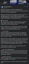
Local mets have started barking a little. Here is an article from one of them...
Makeitsnow
Member
I'm hopeful this is over done and much of it will at least be sleet over north ga. 850 to surface temps will be very cold. In general, the euro has the EWL at 700mb. Precip will be falling through thousands of feet of well below freezing air. With the coldest layer around 925mb bottoming out at an incredible -7 to -10c depending on the run. I feel like the worst of the freezing rain will be over north central to central ga.2 inches of ZR somewhere in in North Georgia on the 18z Euro. Just plain stupid amounts and it wasn't done yet. Even 1/3 of these amounts would be devastating
I expect these numbers from models like the CMC. Not used to seeing biblical ZR from Euro. Hope its wrong
View attachment 185903

this is the 12z EURO. Do you have 18z Euro?I'm hopeful this is over done and much of it will at least be sleet over north ga. 850 to surface temps will be very cold. In general, the euro has the EWL at 700mb. Precip will be falling through thousands of feet of well below freezing air. With the coldest layer around 925mb bottoming out at an incredible -7 to -10c depending on the run. I feel like the worst of the freezing rain will be over north central to central ga.
View attachment 185931View attachment 185932
Showmeyourtds
Member
Slightly OT- but its always been my understanding that once falling snow melts, it can't become snow again. This sounds like an atmospheric example of when guys camping out in the Yukon or N. Alaska toss a pot of boiling water outside when 2m temps are -30ish & the water droplets basically turn to crystallized snow before hitting the ground.Yeah that was the storm! Dr Lackmann talked about this in my synoptic class nearly a decade ago and it was because the rain that fell into the cold nose froze so fast it shattered, and the shattered remnants of the now ice nuclei recombined back into small snow dendrites before they hit the ground. I’ve seen this happen a few times over the years
Was this professor speaking to that effect, only coming out of the 950mb layer onto surface temps with that much contrast in thermal profiles?
LukeBarrette
im north of 90% of people on here so yeah
Meteorology Student
Member
2024 Supporter
2017-2023 Supporter
Definitely different evolution showing up now. Not sure exactly the implications except maybe a larger more expansive snow shield
iGRXY
Member
That’s incredibly bullish and kind of gives credence to the snow uptick possibilityView attachment 185929
As bullish as I’ve ever seen GSP at this range
Am I wrong to be worried about where that mix line sets up? I feel like here in Raleigh if it sets up near us our snow totals will be cut by sleet. I want a snow storm not a sleet storm…
Webberweather53
Meteorologist
Slightly OT- but its always been my understanding that once falling snow melts, it can't become snow again. This sounds like an atmospheric example of when guys camping out in the Yukon or N. Alaska toss a pot of boiling water outside when 2m temps are -30ish & the water droplets basically turn to crystallized snow before hitting the ground.
Was this professor speaking to that effect, only coming out of the 950mb layer onto surface temps with that much contrast in thermal profiles?
Well like anything there are always exceptions to any rule
This is a good real life example of that:
The colder model solutions would keep Raleigh solidly in snow for a good portion of the storm. In the past, many winter storms would have a ptype transition somewhere in Wake County. It would be nice to not have to worry about it for this storm.Am I wrong to be worried about where that mix line sets up? I feel like here in Raleigh if it sets up near us our snow totals will be cut by sleet. I want a snow storm not a sleet storm…
My best advice as far as being an information science professional is to start archiving all these images because this event could become the benchmark for all storms going forward.
View attachment 185911
Am I seeing this right. 60-70% chance of greater than 12 inch snowfall?
Keep in mind that the WxBell Euro AIFS snow maps have a major flaw in the algorithms being used as I posted earlier. Even Bastardi admitted there’s a problem.
Here’s more proof of that from the 18Z run (this is just one example of the many dozens of these each run has):
Check out the bubble of heavy snow well out in the Gulf on member 46 snow map hour 66:

It’s not an issue with bad temperature data as 2m is near normal (70s). Thus, it literally has heavy snow with temps in the 70s!! Bastardi knows this is a problem and admitted it:

Anyone notice that the full run Euro AIFS snow means have been quite a bit higher than the same run’s EPS every time recently?
0Z AIFS through 162: higher than EPS and has those bubbles of snow over the water

0Z EPS through 162: lower than AIFS and no bubbles of snow over water

6Z AIFS through 144: higher than EPS
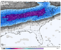
6Z EPS through 144: lower than AIFS
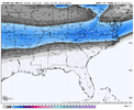
12Z AIFS through 150: higher than EPS
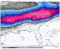
12Z EPS through 150: lower than AIFS
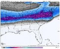
18Z AIFS through 144: higher than EPS
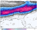
18Z EPS through 144: lower than AIFS

It’s no wonder that the AIFS is always higher in these examples when it shows snow in the Gulf with temps in the 70s. The AIFS overdoes its snow maps. That’s why they’ve been insane.
Thus I continue to feel that the EPS snow output, which itself is showing some of the heaviest snows in NC I can remember seeing this far out from the event, is much better to use for forecasting than the AIFS snow output.
Last edited:
If some how it’s phased like euro showed would that bring another storm up right after or just continue the precip feed thaksIt’s totally possible this storm starts on Friday morning in the carolinas and doesn’t end until sometime on Monday. That is insane
KatrinaRuns
Member
Can anyone give me an idea about Jackson, MS area? I’m in Tuscaloosa area. But I have elderly parents and grandparents on outer edges of Hinds County and the last event this big was the Feb ‘94. I’m getting plenty of maps for TTown, but I may need to take a day off and go help family prepare?
If some how it’s phased like euro showed would that bring another storm up right after or just continue the precip feed thaks
I would assume it would be a more continuous precipitation event with some breaks instead of a totally new storm.
Sorry just got to this.Thanks for this analysis. This is great. Given the strong HP to our north, does that limit the flex of the SE ridge at all? Therefore limiting the ZR getting too far north? Or these two different levels of the atmosphere that don’t interact?
Sent from my iPhone using Tapatalk
The SE Ridge just shows that the 500mb height is above normal for January, signifying a warmer/higherpressure (by January standards) situation above the surface. Strong HP to our north (especially one of this strength) + a southeast ridge nudging in will favor an icy/sleety situation for many with cold air at the surface but warmer air aloft.
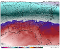
From the 18z Euro, sfc air well below freezing for many:

925mb temps below freezing:
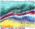
850mb temps above freezing for some and below for others:
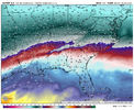
and 700mb toeing the line or crossing it as well:
And then 500mb heights showing just above normal:
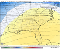
If you didn't need all this, well, sorry haha.
lexxnchloe
Member
Can you compare the WeatherBell AIFS Ensemble total snow map to the one from Stormvista? It could show how far off the WeatherBell map is. Also, could the AIFS Ensemble total snow maps actually include sleet and freezing rain in addition to snow?Keep in mind that the WxBell Euro AIFS snow maps have a major flaw in the algorithms being used as I posted earlier. Even Bastardi admitted there’s a problem.
Here’s more proof of that from the 18Z run (this is just one example of the many dozens of these each run has):
Check out the bubble of heavy snow well out in the Gulf on member 46 snow map hour 66:
View attachment 185926
It’s not an issue with bad temperature data as 2m is near normal (70s). Thus, it literally has heavy snow with temps in the 70s!! Bastardi knows this is a problem and admitted it:
View attachment 185927
Anyone notice that the full run Euro AIFS snow means have been quite a bit higher than the same run’s EPS every time recently?
0Z AIFS through162: higher than EPS and has those bubbles of snow over the water
View attachment 185933
0Z EPS through 162: lower than AIFS and no bubbles of snow over water
View attachment 185934
6Z AIFS through 144: higher than EPS
View attachment 185935
6Z EPS through 144: lower than AIFS
View attachment 185936
12Z AIFS through 150: higher than EPS
View attachment 185939
12Z EPS through 150: lower than AIFS
View attachment 185940
18Z AIFS through 144: higher than EPS
View attachment 185947
18Z EPS through 144: lower than AIFS
View attachment 185949
It’s no wonder that the AIFS is always higher in these examples when it shows snow in the Gulf with temps in the 70s. The AIFS overdoes its snow maps. That’s why they’ve been insane.
Thus I continue to feel that the EPS snow output, which itself is showing some of the heaviest snows in NC I can remember seeing this far out from the event, is much better to use for forecasting than the AIFS snow output.
NCWeatherhound
Member
Ya know ... I've always wondered if there was something similar for FAY or Ft. Bragg? If so, could you share it please?First run of the Euro AI with big snow for RDU for this weekend. It’s also has that day 9-10 potential for several runs now.
View attachment 185919
They don’t. Just snow and it counts sleet as snow.Does SV put out maps with GEFS mean amounts of sleet and ZR? If so, please post if you get the chance for the 18Z GEFS.
Can you compare the WeatherBell AIFS Ensemble total snow map to the one from Stormvista? It could show how far off the WeatherBell map is. Also, could the AIFS Ensemble total snow maps actually include sleet and freezing rain in addition to snow?
Excellent questions!
1. I don’t have SV. So, I don’t know whether theirs is far different from WxBell’s.
2. I’d love to know whether or not SV’s also has the bubbles of snow way offshore on individual members.
3. If SV’s is similar to WxBell’s and also has the bubbles, it may mean the problem actually lies with the source itself, ecmwf, rather than with WxBell algos.
Edit: 4. It’s quite possible AIFS at least at WxBell includes IP/ZR as snow whereas WxBell EPS doesn’t. That, itself, could be a major reason for WxBell AIFS to be significantly higher than EPS. But regardless, there’s still be an issue evidenced by the ocean snow bubbles. So, I suspect that there could be two separate issues contributing to the discrepancy.
Last edited:
- Joined
- Jan 2, 2017
- Messages
- 1,566
- Reaction score
- 4,279
Well like anything there are always exceptions to any rule
This is a good real life example of that:
Thats an unbelievably good explanation and I have definitely learned something here...Thanks Webb!
Dynamics like that will be impossible for models to pick up on imo.
Makeitsnow
Member
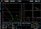
You should specify where you are talking about because north of atlanta and athens it's a different story taking the euro at face value. Yes south of atlanta it's warmer but north of there, in the heart of the cad, it's quite a bit colder not only aloft but in the ECL. As i said, expect the worst of the freezing rain to be south of atlanta. Of course if the gfs is correct this is all a pointless conversation..which i sure hope it is.Here is my sounding from the 18z Euro. Huge warm nose between 850mb and 700mb. Pretty balmy up there (nearly 50 degrees F). That's not going to be sleet, unfortunately, (hoping it's wrong).View attachment 185945
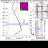
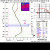
Soundings for gainesville and athens...from the 18z euro at the same time stamp.
edit to add one for the northern perimeter. at hour 135. atlanta will be the war zone between the two probably.
