NCWeatherhound
Member
Watches would probably go up Thursdayif these maps all continue showing these crazy numbers when would the watches and warnings begin being issued for GA/SC/NC?
If I remember correctly believe that Winter Weather Advisories/Watches are 36 to 48 hours prior to the event onset.if these maps all continue showing these crazy numbers when would the watches and warnings begin being issued for GA/SC/NC?
If anything, the longer it sits there, I would imagine the effects of the arctic high would become even more pronounced in the precip shield by shunting it further south and causing a more widespread transition over into snow/pushing the ice even further south.BAM weather said that the slower Euro would give it time to gain strength and come north. Doesn’t look like that’s being now. The euro has been know to hold energy too long in the south west too. Don’t know if that’s in play with this or not.
I'm in the sweet spot, cashing in now, lol
BAM weather said that the slower Euro would give it time to gain strength and come north. Doesn’t look like that’s being now. The euro has been know to hold energy too long in the south west too. Don’t know if that’s in play with this or not.
Winter storm watches go up <48hrs ahead of the event. So that'd mean Thursday or Friday we'd likely see watches.if these maps all continue showing these crazy numbers when would the watches and warnings begin being issued for GA/SC/NC?
Especially in the CAE-AUG corridor.One factor I have not seen any discussion about... with the combination of drought over the past several months and damage to trees (pines) from Helene in 2024 a lot of the Southeast may very well have more impacts from this event than in past events as far as tree impacts etc.
Especially in the CAE-AUG corridor.
From my memory from "THE" Ice Storm in Atlanta in Jan 1973 I saw 'ice loading" on trees of about 3/4-1 inch . With that even hardwood (oaks/hickory) came down by being uprooted. along with pines snapping from the ice load.2 inches of ZR somewhere in in North Georgia on the 18z Euro. Just plain stupid amounts and it wasn't done yet. Even 1/3 of these amounts would be devastating
I expect these numbers from models like the CMC. Not used to seeing biblical ZR from Euro. Hope its wrong
View attachment 185903
How’s our confluence looking for the 18z suite? I would imagine it’s holding strong or continuing to tick west with the southern trends.This is what I love to see View attachment 185902
EPS definitely trending into phase with Baja low but the overrunning already working
View attachment 185904
Do you have the mean ZR for the last few GEFS runs?
That’s just gonna beef up our QPF and IP totals even more


That's what this forum is for! lolMy best advice as far as being an information science professional is to start archiving all these images because this event could become the benchmark for all storms going forward.
View attachment 185911
Unsurprisingly just like where the 18z OP was going. Seems like we’ve gotten a lot of our snow by this point. Assuming this were to happen we add a bag of sleet and zr on top if this phases after with the HP well entrenchedEPS definitely trending into phase with Baja low but the overrunning already working
View attachment 185904
Still looking for my 12" storm. Feb 2014 got up to 8-9" with surprise ULL deform band but it was very short lived. I knew I had to wait for a Jan '88 type storm to make it happen.My best advice as far as being an information science professional is to start archiving all these images because this event could become the benchmark for all storms going forward.
View attachment 185911
So, what you're telling me, is multiple drastically different (plausible) synoptic scenarios bring a major winter storm to our areas. That increases confidenceEPS snow clown trend:
View attachment 185905
Comparing some of the looks at H5, EPS AI and EPS pretty tight. More of a Baja influence evident on the AIFS but also is further southwest. Slightly better cold press on the EPS, but minute differences really. Still a big SER and thus big ZR signal here:
View attachment 185906
View attachment 185907
EPS has trended positively with TPV/cold press, but like @KyloG mentioned it wants that Baja. Meanwhile, OP Euro and GFS looks:
View attachment 185909
View attachment 185910
The very different look a result of the GFS leaving the Baja ULL behind entirely. I think I favor picking up the Baja at this point but perhaps a bit later than the Euro is showing atm.
Never mind. I have a feeling the GEFS mean ZR doesn’t exist. I just checked Pivotal and don’t see it. Unless SV has it.Do you have the mean ZR for the last few GEFS runs?
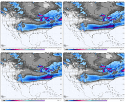
EPS snow clown trend:
View attachment 185905
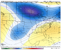
Comparing some of the looks at H5, EPS AI and EPS pretty tight. More of a Baja influence evident on the AIFS but also is further southwest. Slightly better cold press on the EPS, but minute differences really. Still a big SER and thus big ZR signal here:
View attachment 185906
View attachment 185907
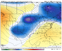
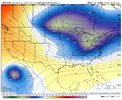
EPS has trended positively with TPV/cold press, but like @KyloG mentioned it wants that Baja. Meanwhile, OP Euro and GFS looks:
View attachment 185909
View attachment 185910
The very different look a result of the GFS leaving the Baja ULL behind entirely. I think I favor picking up the Baja at this point but perhaps a bit later than the Euro is showing atm.
Am I seeing this right. 60-70% chance of greater than 12 inch snowfall?My best advice as far as being an information science professional is to start archiving all these images because this event could become the benchmark for all storms going forward.
View attachment 185911
Yep. It goes up even higher a few frames laterAm I seeing this right. 60-70% chance of greater than 12 inch snowfall?
It is hollering in our faces right now. The fail modes are amp to kingdom come (even that could potentially ice some folks) or suppress and choke. It would take a pretty shocking trend at this range for the latter to happen given the increasing QPF on most models and almost 100% hit rate on several ensembles for QPF existing, and we have outlined multiple ways that the former can be blocked.So, what you're telling me, is multiple drastically different (plausible) synoptic scenarios bring a major winter storm to our areas. That increases confidence
My best advice as far as being an information science professional is to start archiving all these images because this event could become the benchmark for all storms going forward.
View attachment 185911
