• Hello, please take a minute to check out our awesome content, contributed by the wonderful members of our community. We hope you'll add your own thoughts and opinions by making a free account!

Wintry January 23rd-27th 2026

I have been a weather nerd since I was a child. I have lived here in Atlanta all my life and that's nearly 40 yrs. One thing I have noticed is that typically our best storms here in the deep south are when models show storms that popup inside 5-6 days lead time. My gut tells me that this storm has legs and will be a board-wide event to make everyone happy!

If Glenn Burns starts talking this far out, then the threat has legs.
 
This whole system will be determined by one thing…

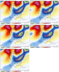
Does it capture the Baja low or not?

We know cold will keep trending better it’s all up to what happens with that energy.

And we are probably couple of days away before we know who wins...but dang, how many times have we see the baja low bury in the southwest....
 
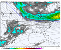
Would be nice if the CMC would be the worst case scenario for a more nothern track...

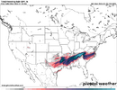
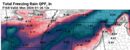
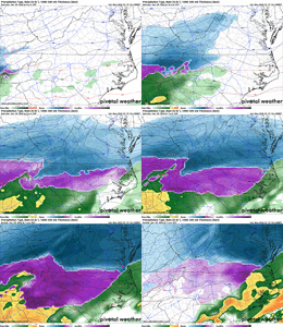
I think the CMC is trash at this range but dang, that is one icy run.

View attachment 185639
Looks like it miller-B's from central Ga to off Norfolk. That's one heck of a northeast jump. Has to be assuming a weaker HP which I'm not sure would give up like that. Maybe more of a miller-B off Wilmington or Hatteras if even that, but not Norfolk.
 
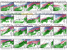
In my experience the GFS camp is not one you particularly want to be in. I’ve seen it be wrong with its ensembles on placement of precipitation inside 84 hours.

Now grant it the large and in charge high pressure certainly could bring about a more suppressed look but usually I’d expect WAA to have a more expanded precipitation shield north than what the GFS is showing.. something like the CMC and euro.

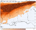
All that to say maybe the GFS is onto something here or maybe it’s just consistently wrong .. again.. but regardless a widespread winter storm is coming for many in the south. I personally just lean on the side of ice storm vs snow
Normally I would have to agree, however, this is an anomalous strong high and one where the GFS can shine and has in the past in regards to cold presses. (Though, we won't count the Feb 2010 snowstorm that drove the low to Cuba lol).

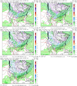
Gonna have to give some credence to the GFS here for now. The CMC was even stronger with the high than the GFS at 1052mb but it wants to eject out the Baja feature (which I think is going to its bias showing here, progressive).
 
This is unlikely to happen... a LP plowing into a CAD. No sir. HOWEVER, I would take this look and run for ATL 🤣🤣🤣
That low is not "plowing" into a CAD, one still frame can make it look like that without any other explanation provided. But what is occurring is transferring to coastal low, which is a good possibility.... CAD Miller B, how much low level cold press, when where that transfer occurs, lots to still fine tune. Some post need more explanation
 
Would be nice if the CMC would be the worst case scenario for a more nothern track...

I think the CMC is trash at this range but dang, that is one icy run.

View attachment 185639
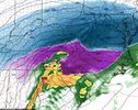
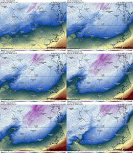
Many of us would be praying to be on the sleet side. Again, I would think there would be a more expansive sleet area within the FZ zone. CMC has one frame with the downtowns of both Charlotte and Raleigh at 22 degrees with heavy FZ.
 
That low is not "plowing" into a CAD, one still frame can make it look like that without any other explanation provided. But what is occurring is transferring to coastal low, which is a good possibility.... CAD Miller B, how much low level cold press, when where that transfer occurs, lots to still fine tune. Some post need more explanation
Thank you so much for the explanation
 
Looks very icy
e3ad6b2ab48d5dace04defbffebb59d3.jpg


Sent from my iPhone using Tapatalk
 
So it appears worst case scenario is a full on ejection of the Baja wave which still results in a widespread destructive winter storm. And the other option is the kicker giving it a little kiss with it hanging back resulting in more of sheared southerly cross conus overrunning look. So atm it appears middle ground still results in a winter storm
 
So it appears worst case scenario is a full on ejection of the Baja wave which still results in a widespread destructive winter storm. And the other option is the kicker giving it a little kiss with it hanging back resulting in more of sheared southerly cross conus overrunning look. So atm it appears middle ground still results in a winter storm
When multiple options are showing a winter storm you're cooking, seen it before but been awhile. What scenario to deliver the goods obviously way up in the air but it's like ensembles at this point, all indicators point to winter weather threat. Gotta love it
 
Back
Top