• Hello, please take a minute to check out our awesome content, contributed by the wonderful members of our community. We hope you'll add your own thoughts and opinions by making a free account!

Wintry January 23rd-27th 2026

I don’t want to believe it either and hope the good ole Euro and GFS are right
We ( HWY 64 from Murphy to Manteo ) would win with latest gfs, can,icon. Even euro stripes hwy 64 north several inches ( burries southern VA) before several inches of sleet.

I have little faith in the other AI models outside the euro AI. And even the Euro AI, will have to notch a few more feathers, before I start riding it as new king over the Op.
 
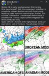
So here we are. GFS/CMC/ICON vs Euro, Euro AI, GFS AI....

I find it hard to believe given the teleconnections and forecasted strength of the high that a Low will plow through Tennessee and directly over the Mid Atlantic....

I won't be surprised if this is actually trends south to near suppression to then trend back a tad north. This has the typically look to me of splitting NC in half along 264.. north of there snow and sleet. South of there, sleet and ZR.

Just my best guess.
If things play out as advertised for now, it won't simply plow through but most likely transfer to coastal LP. When, where that happens plays a huge roll too. For now just know a strong signal for a impactful winter storm exist and Details will eventually reveal themselves
 
Gonna have to reverse that 850mb jet that keeps trending stronger and more southerly.

I'm not worried. Looks like more chances on the horizon.
We’ll find a way to miss out on those too. 😅
I hope it trends far enough north that we miss out on the ice though.
 
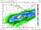
Here's the 48-hour QPF for hour 174 on the 6z euro AI. Most of this would be some form of ice in NC. And then less as ice going into NE Ga (as the CAD builds down).

View attachment 185537
This whole orientation of qpf seems off ( chicken feed down along Gulf ) and 2.5 east TN seems excessive. Does it miller A? surely its not just from over runing
 
If things play out as advertised for now, it won't simply plow through but most likely transfer to coastal LP. When, where that happens plays a huge roll too. For now just know a strong signal for a impactful winter storm exist and Details will eventually reveal themselves
If it does a transfer, Gurantee its got some more learning to do. Just like CAD, It will have to learn about the ole Carolina split. Lord I hate that term, but it's a Miller B staple
 
Massive battle between AI Guidance & our models we’ve grown up with over the years. This storm IMO would change our outlooks how which models to respect more going forward. Pivot point in model history upcoming IMO.
Yep...will be interesting to see. The AI models clearly won with yesterdays event at day 5...but like a few have pointed out, different setup, different variables so maybe they don't do as well with this one. No narrative, just spitting facts and will be interested to see who wins.
 
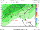
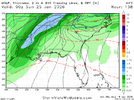
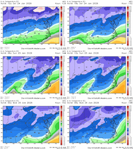
6z WN and 6z AIFS with remarkably similar placement of important thermo features:

1768830222005.png

1768830233756.png

It's close, but I think NW NC is mostly snow here. Btw, that 32F sfc line does move south in future frames. We're talking about a storm that is 120-138 hours away from starting in the Carolinas, so there is time to move things around some still.

EPS looked to me to be bringing the TPV pressed down a tick more over the last few runs VS the AIFS ENS disagreeing and beefing the SER.
 
There are two possible outcomes for this event:
1. A major ice storm affects southern CAD zones, and DC and points north get a major snowstorm. (Euro AI, UKMET, GFS AI, Euro)
2. A major snowstorm affects southern CAD zones, and DC and points north receive little to nothing. (GFS, CMC)

What do we know of each model?
The Euro AI is often locked onto an event inside D5 and is often deadly inside that range, but can be locked onto an incorrect solution, only to fold 48 hours before the event. It also often has a QPF bias.
The Euro often tends to overamp low pressure systems, but it also tends to hold back energy in the Baja. It also often has a QPF bias.
The GFS tends to show more suppressive, progressive solutions, and often tends to verify NW.
The CMC has a major cold bias, and tends to overdo Arctic HPs. It also, generally, has a suppressive bias, but it is less prominent than the GFS.
The UKMET tends to struggle on thermals, often being too warm. It also tends to overamp systems.
Since the GFS AI is new, I don't know much about it.

Although more operational models (that I'm aware of; I have no idea what Google's model outputs) support the northern solution, ensembles have been trending colder and snowier towards the southern solution over the last 24-36 hours. This is why I am skeptical to declare victory for the northern solution just yet.

It would be easy to go with the Euro AI, just because that has been the best performing operational this winter inside D5. However, a major caveat to this is that the upcoming HP may be so anomalous that it hasn't received enough training data to output the correct solution, just due to its inexperience. This should be a good test for the AI Euro.

Now, it's too early to declare anything, but I am leaning towards the northern solution. 1050 HPs are extremely rare and often overdone in setups like these, and I don't think it'll be able to suppress it enough. However, if a ultra-strong HP does pan out, the Euro AI may have a greater probability of being wrong.

Stay tuned...
Quick note: Google's AI model (WeatherNEXT) also shows a northern solution. I guess it's truly a battle of AI vs physics.
 
6z WN and 6z AIFS with remarkably similar placement of important thermo features:

View attachment 185540

View attachment 185541

It's close, but I think NW NC is mostly snow here. Btw, that 32F sfc line does move south in future frames. We're talking about a storm that is 120-138 hours away from starting in the Carolinas, so there is time to move things around some still.

EPS looked to me to be bringing the TPV pressed down a tick more over the last few runs VS the AIFS ENS disagreeing and beefing the SER.
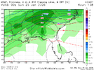
Compared with 6z Euro OP. I would not be shocked if the AIs are underdoing CAD here as others have mentioned. That matters for the placement of that SFC 32F and H8 0C line.

1768830463500.png
 
My hope is that(we know ai models are a little better), but we see them at least move slightly in the direction of the traditional models. Even if the traditionals make 80% of the move to consensus, that would be enough to keep snow in the mix for NC especially.

I think that probably happens since the google model is basically right at that point already. It’s probably got the final solution solved if things go like I described above.
 
Precip stripe goes north and the 32 degree line comes south. oof
Brutal...this would be, verbatim, a really bad ice storm. Only saving grace is the heavier precip is to our NW and maybe we get millerB dryslot, which, central NC usually gets.

Doesn't get above freezing from Saturday until Tuesday afternoon. Yikes...

696e37a7a2814.pnge173a52a-4136-4e5e-9a9a-ddce472a1b6e.gif
 
Is it fair to say that this is the first major test of the AI models when it comes to a classic, strong CAD event?
If so, will be absolutely fascinating to compare their performance with legacy models.
Couldn’t agree more. Let’s also remember that globals have never done particularly well with the strength of CAD. That’s what makes these model runs showing temperatures in the teens in the daytime on the EURO and GFS even more impressive.
 
I’m just going off memory, but I’m pretty sure the gfs Graphcast was awful and way too warm with surface temps at this range for the January 10th in-situ cad storm last year. I believe that’s the same thing as the gfs AIFS? I want to say it had us in the 50s/60s for some runs… complete wedge breakdown. (And we verified below freezing for the whole event)
 
I know right now the models are showing us getting an ice storm but we are still 4 to 5 days away for models to get a better handle on this potential winter storm. Yes a lot can change from now until then so i say let’s just enjoy the weather because it’s the only weather we got
 
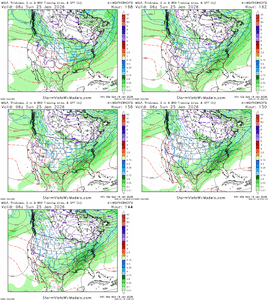
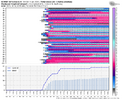
Can clearly see why Euro AI ens shifting more north and probably will continue

View attachment 185514

Thanks to all that have posted overnight! This trend in the Euro AIFS ENS is very disappointing to me. We had a nice tall PNA, eastern trough, and enough STJ energy to give us snow in NC. Now, we whine that the SW low energy never kicks out, but now it a ALL kicks out and troughs the west, pumping the SE ridge, pushing our snow to the MA. Of course. 🤦‍♂️ All with a great looking -NAO. Just got to have a PNA for snow in NC IMO.

Rolling with AI models for me (I've seen enough to trust them the most), and we've got to stop this trend here or we'll probably have a cutter and mess the whole thing up. Ice/sleet is better than nothing but we're a ways away and I'm worried we're trending to a cutter; And I agree with @Rain Cold that the highs up top are likely not going to be as strong as modeled. Maybe we still winter storm with a cutter, but Oof, that stings based on what we were looking at the last 2 days from the AIFS.

It would be stunning to me if this wasn't a major winter storm for most on this board...now it might be more ice than snow but can take what we can get.
 
It would be stunning to me if this wasn't a major winter storm for most on this board...now it might be more ice than snow but can take what we can get.
Banter, but I would rather have a cold rain than accumulating ice that’s currently being forecasted! Power outages and dang near impossible to drive anywhere for a few days if not more!
 
Back
Top