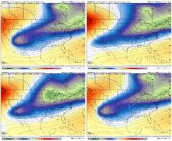
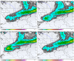
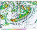
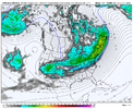
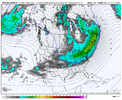
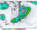
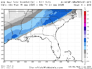
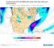
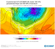
06z euro looks like a better version of that 12z run yesterday
-
Hello, please take a minute to check out our awesome content, contributed by the wonderful members of our community. We hope you'll add your own thoughts and opinions by making a free account!
You are using an out of date browser. It may not display this or other websites correctly.
You should upgrade or use an alternative browser.
You should upgrade or use an alternative browser.
Pattern January 21-24 2025
- Thread starter SD
- Start date
Cary_Snow95
Member
Aka not suppressed like 0z then06z euro looks like a better version of that 12z run yesterday
6z euro definitely more in ukmet/canadian/icon camp with that energy out west. Gfs looks totally different than any other model. Euro had more negative tilt than 0z run wasn’t gonna be as suppressed as last nights run
Sent from my iPhone using Tapatalk
Sent from my iPhone using Tapatalk
It's not quite as good as 12z in terms of amplification. However, it's better than 00z and nowhere near the sheared mess of the GFS. I also like that the lobe over the Great Lakes has been trending stronger and further west, which would delay the warm-up.
- Joined
- Jan 23, 2021
- Messages
- 3,641
- Reaction score
- 11,166
- Location
- Lebanon Township, Durham County NC
UKMET showing a baller solution + EPS looking great has me as optimistic as I've been about this event.
packfan98
Moderator
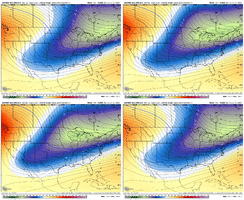
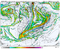
What’s your current thinking?The 06z EPS and 00z UKMET were very close. In fact, I think the 00z UKMET is more in line with the EPS than the op Euro as far as the southwestern US energy and how it brings it out.
View attachment 163681
View attachment 163683
View attachment 163684
Big picture wise, I think we're still trending towards a significant to possibly major winter storm. Seeing the EPS slowly increase the signal and not jumping around a ton at H5 and with support from the GEPS and various other op runs all looks promising. Good long ways to go, but liking where we are at the moment.What’s your current thinking?
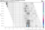
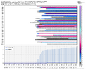
Yeah big difference vs the last one at this lead time was we wasn’t getting consistently good or better runsBig picture wise, I think we're still trending towards a significant to possibly major winter storm. Seeing the EPS slowly increase the signal and not jumping around a ton at H5 and with support from the GEPS and various other op runs all looks promising. Good long ways to go, but liking where we are at the moment.
View attachment 163687
View attachment 163685
- Joined
- Jan 23, 2021
- Messages
- 3,641
- Reaction score
- 11,166
- Location
- Lebanon Township, Durham County NC
0z Canadian focused at 12z 1/22:
10Fº +SN N10/G20 16:1 ratios
That is something you'd see in Detroit or Cleveland. I dont know how many of yall have ever experienced such a cold snow but its like an actual snow globe.
10Fº +SN N10/G20 16:1 ratios
That is something you'd see in Detroit or Cleveland. I dont know how many of yall have ever experienced such a cold snow but its like an actual snow globe.
rburrel2
Member
Man that EPS run looks like it a carbon copy of exactly what we need for a board wide 12+ snowfall.
rburrel2
Member
06z Euro AI is good bit colder and a little weaker with the wave. Snow to ice for Columbia to Raleigh. Precip doesn't make it as far north on this run. Overall, a nice run though.
- Joined
- Jan 23, 2021
- Messages
- 3,641
- Reaction score
- 11,166
- Location
- Lebanon Township, Durham County NC
rburrel2
Member
Euro AI has another widespread snowstorm at hr240 and then again at hr336, lol.
This setup is somewhat unconventional for us to get our big snows. Looking back at January 1940, arguably our most board-wide storm, you'll notice that the wave deepened in the Southeast as it tilted positive off of Cape Hatteras. Meanwhile, even with our best-case scenario models (CMC, UKMET), the wave can't deepen over the Southeast, or it's heading northeast by the time it does.
With a Miller-A, a deeper low can bring in more cold air, while with this overrunning setup, we have to worry more about timing and mixing issues. The magnitude of the air mass is so extreme that it's hard to find anything to compare to this one. The only storm that comes to mind is December 2017. But, the air mass was much more marginal. Compare it with the UKMET:
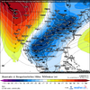
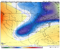
If anyone has any other similar storms in mind, let me know.
With a Miller-A, a deeper low can bring in more cold air, while with this overrunning setup, we have to worry more about timing and mixing issues. The magnitude of the air mass is so extreme that it's hard to find anything to compare to this one. The only storm that comes to mind is December 2017. But, the air mass was much more marginal. Compare it with the UKMET:


If anyone has any other similar storms in mind, let me know.
rburrel2
Member
Honestly. The CMC/UKmet/Euro/EPS/Euro AI/Spire/JMA/icon are all aligned pretty well. Only thing to be ironed out is strength of the wave and how much cold air in the mid levels we will have to work with.
The GFS is completely lost right now, we can toss.
The GFS is completely lost right now, we can toss.

