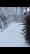
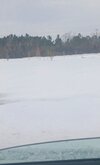
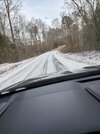
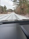
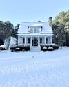
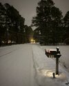
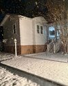
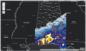
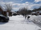
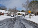
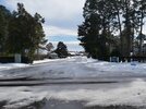
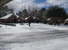
Sun seems to be doing work in the Atlanta area based on a quick check of webcams. Imagine it’ll only be the shady spots causing issues tonight
-
Hello, please take a minute to check out our awesome content, contributed by the wonderful members of our community. We hope you'll add your own thoughts and opinions by making a free account!
You are using an out of date browser. It may not display this or other websites correctly.
You should upgrade or use an alternative browser.
You should upgrade or use an alternative browser.
Wintry January 21-23 2025
- Thread starter SD
- Start date
- Joined
- Jan 23, 2021
- Messages
- 4,602
- Reaction score
- 15,197
- Location
- Lebanon Township, Durham County NC
Took the train from Durham so I could work as I travel to Charlotte today and the yadkin wetlands were mostly frozen along with lots of ponds in the woods. Looked almost like New England
WolfpackHomer91
Member
I used to work for Norfolk Southern... apparently that Terminal in Linwood was built on a Swamp. Many a Freezing night in that area. Did you take Amtrack ? My last ever trip we hit a car right there at that station dude was drunk and got stuck on the tracks and ditched the car. We were headed to SelmaTook the train from Durham so I could work as I travel to Charlotte today and the yadkin wetlands were mostly frozen along with lots of ponds in the woods. Looked almost like New England
albertwilsonjr
Member
Any storm systems on the horizon? What is our pattern looking like
Sent from my iPhone using Tapatalk
Sent from my iPhone using Tapatalk
WEATHERBOYROY
Member
PRETTY SURE THAT IS ORANGE BEACH ! WOW!
Avalanche
Member
Seems to be what everybody wanted for themAll time record low territory was reached for parts of Louisiana, the damage will become apparent once it warms up but they will have thousands and thousands of dead trees, bushes, and shrubs to take down... the gulf coast will look like Iowa now. How pretty.
30F rn. Fun day
LukeBarrette
im north of 90% of people on here so yeah
Meteorology Student
Member
2024 Supporter
2017-2023 Supporter
Pretty sure this is the same system. Seeing model outputs trying to go as low as 930
I had to drive around midtown earlier. There was a metric crap ton of salt on the main roads. Only on the rarely used side streets was there any issue.Sun seems to be doing work in the Atlanta area based on a quick check of webcams. Imagine it’ll only be the shady spots causing issues tonight
Heelyes
Member
30F rn. Fun day
Nice ride
Shaggy
Member
A few roads were closed in Wilmington today as they were impassable. One of them is a major road and I'm sure caused major headaches
@Disco_Lemonade you see where they had MLK shut down?
@Disco_Lemonade you see where they had MLK shut down?
Webberweather53
Meteorologist
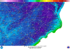
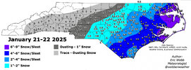
Working on the post event snow map. Should have it done shortly
The local news just said Charleston got 4 inches and that ranks eight largest snowfall in history...hmmm. I think it depends on what part of Charleston you were in. It was sleeting until 2:00 a.m. so it must have turned into a heavy snow if it did that.
Webberweather53
Meteorologist
Shaggy
Member
I measured close to 5 inches in the cape fear region that map is low in that area
Stormsfury
Member
Officially the NWS picked up 2" of snow/sleet from what I've seen..The local news just said Charleston got 4 inches and that ranks eight largest snowfall in history...hmmm. I think it depends on what part of Charleston you were in. It was sleeting until 2:00 a.m. so it must have turned into a heavy snow if it did that.
Edit: 2.8" officially at KCHS WFO.
(0.9" Tues, 1.9" We'd)
Last edited:
That 0.4 in Transylvania Co, interesting
rburrel2
Member
rburrel2
Member
Pretty normal in these set ups, somebody with elevation that didn’t have to wait for the last 2,000 feet of air to become saturated. But far enough south to be in the precip shield that passed overhead.That 0.4 in Transylvania Co, interesting
Shaggy
Member
Sctvman
Member
Roads are still a mess here. Probably 1.5” of sleet on JI and maybe 1/4 or 1/3 of snow at the end. James Island Connector still closed because of ice.Officially the NWS picked up 2" of snow/sleet from what I've seen..
Edit: 2.8" officially at KCHS WFO.
(0.9" Tues, 1.9" We'd)
Shady spots are still well covered. Easily the snowiest walk to class I’ve ever had which isn’t saying much
Sctvman
Member
dsaur
Member
You know you got something when you can sled down your steps! 29.8 after a low of 12.5.
Shaggy
Member
This is what real cold will do to roads. When it takes 2 hours to start sticking on the roads versus instant accums. We are cloudy today so the sun won't do as much work on the roads as it did yesterday afternoonMy wife sent me these, the roads on her drive in to work.... yep her school system opened today.
View attachment 166972
View attachment 166973
GeorgiaGirl
Member
One more post for the road...
My dad is claiming 0.39 total liquid for the storm.
I find the claim to be very skeptical though even though he explained why. It's probably more likely we were around 0.2 QPF at the most, maybe a little lower.
I'd say the snow that saw full sun is pretty much completely gone, but it held on well in shady spots. If I didn't have to work, I'd have probably walked towards near the wooded line again this morning.
EastmanGAWX
Member
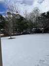 I took this image from my backyard a few moments ago, we are still holding on to a rather extensive snow cover here in Eastman. My final measurement for the system ended up being right around 5.5 inches. The only other time that I have witnessed more snow in my lifetime was from the March 2009 ULL snow whenever I was a student at UGA. In terms of records, this snowfall was the second biggest ever recorded in Dodge County, GA. The only storm that eclipsed the totals from Tuesday was the legendary 1973 event, this storm produced at a rate that eclipsed around an inch more in most spots than the February 1914 system. I cannot express enough gratitude to everyone on here that has put up with all of us Deep South posters complaining about not getting snow, I hope that certain sections of NC and other points that have largely missed out this winter get pounded before time runs out.
lj0109
Member
lj0109
Member
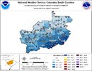
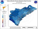
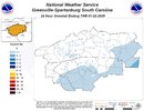
Why did GSP even bother?Snow Total maps from the 3 SC NWS WFOs: View attachment 166988View attachment 166989View attachment 166990
rburrel2
Member
Looks like they purposely are underreporting to match their forecast with that map. I got 1/4inch in Clemson for example and they have nothing there. Most of anderson county and southern greenville county got .5 to 1 inch of snow, but looking at that map you'd think it was mainly a trace that fell. Also probably worth making a map for the event when it had high impacts, (100s of wrecks, abandoned cars, etc that night in anderson and greenville county). Will be a good lesson for them when deciding whether or not to issue products for a light event under those circumstances.Why did GSP even bother?

