• Hello, please take a minute to check out our awesome content, contributed by the wonderful members of our community. We hope you'll add your own thoughts and opinions by making a free account!

January 11th and 12th Severe Weather

...DISCUSSION...
The latest medium-range guidance (including the ECENS/GEFS and
ECMWF/GFS) appear similar with the depiction of the evolving pattern
late this week. Of particular note, one vigorous short wave impulse
(emanating from the northern mid-latitude Pacific, before digging
inland across the Pacific coast into the Great Basin by early
Thursday) is forecast to continue digging across the southern
Rockies and Southwestern international border vicinity during the
day Thursday, before rapidly pivoting across the southern Great
Plains/lower Mississippi Valley through the upper Ohio Valley/lower
Great Lakes by 12Z Saturday. As it does, there appears increasing
consensus that it will support strong surface cyclogenesis across
the Mid South through lower Great Lakes vicinity late Thursday night
through Friday evening.

Latest guidance indicates that this will be accompanied by
sufficient low-level moisture return off the Gulf of Mexico to
support a destabilizing warm sector across parts of eastern Texas
into the lower Mississippi Valley late Thursday through Thursday
night, aided by strengthening mid/upper forcing for ascent. Coupled
with intensifying wind fields and shear, this is expected to support
the initiation of severe thunderstorm development, which seems
likely to organize and be maintained within the swath of mid/upper
support overspreading much of the Gulf through southern Atlantic
Coast states by Friday night. This may be accompanied by a swath of
strong, damaging winds and the risk for tornadoes.
 
Nws BMX already distinctly mentioning tornadoes. Also says we will deal with a similar gradient wind issue to this first sytem. This is going to be a wild week.


Broad troughing remains across much of the CONUS through the end
of the week. Within this trough a fast-moving low-amplitude
shortwave trough will round the base of the larger scale trough
Thursday night, taking on a negative tilt as it lifts
northeastward from the Lower Mississippi Valley to the Ohio Valley
on Friday. A surface low will take advantage of the strong thermal
gradient between warm moist air over the Gulf and an Arctic air
mass moving down the Plains to rapidly deepen as it lifts
northeastward on Friday on an overall similar path as today`s
system. Showers and storms will increase across the area after
midnight Thursday night with warm air advection north of a lifting
warm front. There could be at least some small hail with this
activity with cold temperatures aloft. A narrow but robust warm
sector with low to mid 60s dew points and a few hundred J/kg of
CAPE across should lift northward Friday morning into at least
some of our southern counties with very strong 0-6km bulk shear
values of 80 to 90 kts. At minimum this should be favorable for at
least damaging winds, with hail also possible given decent mid-
level lapse rates with cool temperatures aloft as well as a
westerly component to the flow aloft. There also appears to be a
threat for tornadoes assuming activity is able to develop in the
warm sector and remain surface-based before crossing the warm
front. Some models indicate veered winds at the surface though
this seems suspect to me given the rapidly deepening low. Plenty
of uncertainty regarding details this far out, but there does
appear to be enough model/ensemble agreement to mention a threat
of severe storms in the HWO. Will also mention a threat of
gradient wind gusts once again reaching wind advisory criteria.
 
SPC still has a lot of uncertainty with this event. Especially on the day 4 outlook.


ZCZC SPCSWOD48 ALL
ACUS48 KWNS 090958
SPC AC 090958

Day 4-8 Convective Outlook
NWS Storm Prediction Center Norman OK
0358 AM CST Tue Jan 09 2024

Valid 121200Z - 171200Z

...DISCUSSION...
Medium-range model output (including the ECENS/GEFS and ECMWF/GFS)
continues to indicate that rapid, strong cyclogenesis will proceed
Friday across the Mississippi Valley through Atlantic Seaboard, as a
vigorous short wave impulse pivots northeast of the southern Great
Plains. As the center of the growing cyclone tracks from Arkansas
into and through the lower Ohio Valley during the day Friday, lowest
surface pressures may fall as much as 15-20 mb in 12 hours.

Latest guidance is more suggestive that the stronger mid/level
cooling might tend to shift north of the moistening warm sector
overspreading the central into eastern Gulf Coast states by midday.
While warm mid/upper layers could potentially be mitigating to
destabilization and severe weather potential during the afternoon
through evening across Alabama and Georgia into the Carolinas, this
may be compensated for by a continued increase in low-level
moisture.

Increased inhibition and weaker mid/upper support might actually be
more conducive to discrete supercell development in the presence of
intense wind fields (including 50-80+ kts in the 850-700 mb layer)
and low-level shear. And models suggest that a dryline structure
might develop ahead of the cold front trailing the cyclone as it
progresses eastward. Due to lingering uncertainties severe weather
probabilities are being maintained at 15 percent across the eastern
Gulf into southern Atlantic Coast states vicinity. However, it is
still possible that severe weather probabilities will need to be
increased in later outlooks for this period. Conditionally the
environment appears potentially conducive to strong tornadoes and
high convective wind gusts.

Following diminishing convective potential over the coming weekend,
model output remains quite varied concerning the possibility for
another developing surface cyclone across the Gulf of Mexico through
Atlantic Seaboard vicinity early next week.
 
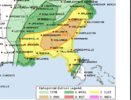
Damn already a D3 enhanced for SC and parts of NC. I could see why this time looks like less forcing hence could be a different type of storm mode, along with a dry air punch in the mid levels E801632B-0768-4303-8E45-D5015D52A71C.png
 
SPC still mentioning a lot of uncertainty for this one. Looks like it has a pretty high ceiling. Still some uncertainty especially with regards to instability. Seems like a lot if the current data is pointing to the possibility of the warm moist air at the surface not being in sync with the area of coldest air aloft. Going to be interesting to see what the mesoscale models start showing today.

Snippet of SPC outlook:

There remains some uncertainty just how expansive of an unstable
warm sector may develop, with perhaps low-level warming and
moistening becoming sufficient for weak boundary-layer
destabilization northeast of the lower Mississippi Valley through
parts of the Tennessee and lower Ohio Valleys during the day.

More substantive low-level moistening seems probable off the north
central/northeastern Gulf of Mexico, into the eastern Gulf through
southern Atlantic Coast states. It appears that this may remain
south of the mid-level cold pool, with relatively warm layers aloft,
even in advance of mid-level subsidence warming nosing
east-northeastward across coastal areas, possibly inhibiting
destabilization.

However, strong to severe thunderstorm development initiating
Thursday night across the southeastern Great Plains into lower
Mississippi Valley may spread east/northeast of the Mississippi
River Friday morning, before perhaps weakening. Thereafter, it
appears that a corridor of stronger surface pressure falls will
develop near the Southeastern Piedmont, from Alabama through the
Carolinas, Friday afternoon into Friday evening. Near the southern
periphery of the mid-level height falls, this might become the
primary focus for organized storm development. Otherwise, models
suggest that a pre-frontal dryline structure may develop across east
central/southeastern Alabama during the mid to late afternoon,
before surging across central Georgia into the Carolinas by late
Friday evening.

Although storm mode remains uncertain, there is concern that this
environment may support and maintain discrete supercell development
with a risk for strong tornadoes. Otherwise, the evolution of at
least a small organized cluster might also be possible, accompanied
by potential for very strong and damaging convective gusts.

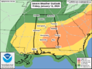
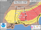
New risk areas and probs:AL_swody3.pngAL_swody3_PROB.png
 
SPC still mentioning a lot of uncertainty for this one. Looks like it has a pretty high ceiling. Still some uncertainty especially with regards to instability. Seems like a lot if the current data is pointing to the possibility of the warm moist air at the surface not being in sync with the area of coldest air aloft. Going to be interesting to see what the mesoscale models start showing today.

Snippet of SPC outlook:

There remains some uncertainty just how expansive of an unstable
warm sector may develop, with perhaps low-level warming and
moistening becoming sufficient for weak boundary-layer
destabilization northeast of the lower Mississippi Valley through
parts of the Tennessee and lower Ohio Valleys during the day.

More substantive low-level moistening seems probable off the north
central/northeastern Gulf of Mexico, into the eastern Gulf through
southern Atlantic Coast states. It appears that this may remain
south of the mid-level cold pool, with relatively warm layers aloft,
even in advance of mid-level subsidence warming nosing
east-northeastward across coastal areas, possibly inhibiting
destabilization.

However, strong to severe thunderstorm development initiating
Thursday night across the southeastern Great Plains into lower
Mississippi Valley may spread east/northeast of the Mississippi
River Friday morning, before perhaps weakening. Thereafter, it
appears that a corridor of stronger surface pressure falls will
develop near the Southeastern Piedmont, from Alabama through the
Carolinas, Friday afternoon into Friday evening. Near the southern
periphery of the mid-level height falls, this might become the
primary focus for organized storm development. Otherwise, models
suggest that a pre-frontal dryline structure may develop across east
central/southeastern Alabama during the mid to late afternoon,
before surging across central Georgia into the Carolinas by late
Friday evening.

Although storm mode remains uncertain, there is concern that this
environment may support and maintain discrete supercell development
with a risk for strong tornadoes. Otherwise, the evolution of at
least a small organized cluster might also be possible, accompanied
by potential for very strong and damaging convective gusts.

New risk areas and probs:View attachment 141092View attachment 141093
Dryline in jan. Gotta love it. We can’t snow but we sure are good at severe
 
Peachtree NWS update:


.LONG TERM...
(Thursday night through Tuesday)
Issued at 422 AM EST Wed Jan 10 2024

Key Messages:

- Another storm system will bring showers and thunderstorms to the
area late Thursday night and Friday. Thunderstorms may be strong
to severe.

- Much colder temperatures forecast for early next week.

Another storm system will approach the area Thursday night, bringing
a chance of showers and thunderstorms. This system will lift NE on
Friday as a negatively tilted trough, reaching the Great Lakes by
Friday night. A large area of isentropic lift is forecast to
precede the low, with increasing MUCAPE and wind shear across most
of the forecast area. There will be a threat of severe weather with
this system during the day Friday across most of the County Warning
Area, although the threat will be lower across the extreme N due to
lingering cool air associated with a weak wedge. GFS MUCAPE values
are forecast to reach near 1000 J/kg as effective shear increases to
to near 45 knots in the Atlanta metro area. This will coincide
maximum daytime heating in the early afternoon, with surface
temperatures reaching over 60 degrees and dew points reaching the
mid 50s.
Storm total rainfall amounts with this system are forecast
to range from around a third of an inch S of Columbus to close to an
inch across the NE GA mountains. Residents should continue to
monitor the latest forecast regarding this storm system.

A bit of snow will linger over the N mountains Friday night, but dry
weather is forecast to return on Saturday. Temperatures will be
rather cold over the weekend, with the potential of even colder
weather early next week. A weak southern stream storm system may
move along the Gulf Coast on Monday, bringing light rain amounts and
the chance for frozen precipitation across N GA. Temperatures by
Tuesday and Tuesday night may be 10 to 15 degrees below normal, but
there remains a substantial spread in ensemble temperatures during
this time frame. /SEC

&&
 
NWS Atlanta not backing off concerns for Friday.

Challenge remains how much instability is available. Wedge may save us, or not - still chance of some strong t-storms and a couple of tornadoes.
 
NWS Birmingham still says the greatest questions are in regards to the northward progression of the warm sector. It appears clear to them though that wherever that war sector is that it will be an environment supportive of supercells and strong tornadoes.

While there are some
similarities to yesterday`s system in the track of the low, there
are also some important differences. While there will be a
subtropical impulse over the Gulf, it will be located further to
the east towards the Florida peninsula and probably not be a
factor causing disruptive coastal convection. Also the trough will
be further to the north and negatively tilted, in a placement
typically more favorable for supercells in Central Alabama, with
even global models indicating convection being more cellular.
Elevated convection north of the warm front will also be
developing overtop of the CWA rather than south of it. Thus models
are indicating a narrow but relatively robust warm sector with 62
to 65 dew points lifting northward into at least our southern
counties, with around 500 to 1000 J/kg of SBCAPE.

As is typical, shear will be more than sufficient for organized
storms with 0-6km bulk shear values around 90 kts, though it`s
possible that this shear could be too strong if updrafts aren`t
strong enough to avoid being sheared apart. The main question will
be how far north the warm front will lift, especially if it will
lift into the area of strongest forcing, and whether storms will
out-run the relatively small warm sector. Will note that while the
500mb shortwave will be lifting quickly northeastward away from
the area by midday, there is still a pronounced 700mb trough to
our west aiding forcing, with some 500mb height falls continuing
through the afternoon. It`s also worth noting that some models may
be veering winds too quickly at the surface given the isobaric
response to the deepening low to our northwest. Overall this is a
low floor but relatively high ceiling event, as any supercell that
is able to remain sustained in the warm sector before crossing to
the cool side of the front would have a conditional threat for a
strong tornado.
 
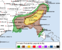
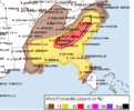
Day 2 enhanced maintained

1704954927945.png

1704954893853.png
1704954957549.png
Day 2 Convective Outlook
NWS Storm Prediction Center Norman OK
1205 AM CST Thu Jan 11 2024

Valid 121200Z - 131200Z

...THERE IS AN ENHANCED RISK OF SEVERE THUNDERSTORMS FRIDAY
AFTERNOON AND INTO FRIDAY EVENING ACROSS PARTS OF EAST CENTRAL AND
SOUTHEASTERN ALABAMA...MUCH OF CENTRAL GEORGIA AND SOUTH CAROLINA
INTO SOUTHERN NORTH CAROLINA...

...SUMMARY...
Severe thunderstorms, with potential to produce high winds and a few
strong tornadoes, are possible across parts of the Southeast Friday
through Friday evening.

...Discussion...
There appears little substantive change in the latest available
ECENS/ECMWF and GEFS concerning the forecast evolution for this
period. Strong surface cyclogenesis is likely to proceed Friday
across the Mississippi Valley through Atlantic Seaboard, as a
vigorous supporting short wave trough pivots northeast of the
southern Great Plains. It still appears that the center of the
growing cyclone will undergo a period of rapid deepening across the
lower Ohio Valley during the day, including minimum surface
pressures falling on the order of 15-20 mb in a 12 hour period,
though the 00Z NAM/03Z RAP take a track to the northwest of the
other guidance into the Great Lakes region through late Friday
night.

Regardless, associated strengthening of deep-layer wind fields
probably will including a developing swath of 90-120+ kt
cyclonic/southwesterly flow at 500 mb across the lower Mississippi
Valley, through portions of the Northeast and Mid Atlantic by the
end of the period. In the 850-700 mb layer, 50-90 kt south to
southwesterly flow is generally forecast to overspread the inland
advancing warm sector.

There remains some uncertainty concerning just how expansive of an
unstable warm sector may develop, with perhaps low-level warming and
moistening becoming sufficient, in the presence of strong forcing
for ascent, for weak boundary-layer destabilization northeast of the
lower Mississippi Valley through parts of the Tennessee and lower
Ohio Valleys during the day.

More substantive low-level moistening is probable off the north
central/northeastern Gulf of Mexico, into the eastern Gulf through
south Atlantic coast states. However, with the mid-level cold pool
forecast to shift north of this region, relatively warm layers
aloft, even in advance of mid-level subsidence warming nosing
east-northeastward across coastal areas, could inhibit
destabilization.

More problematic, concerning the severe weather potential, the NAM
and Rapid Refresh forecast soundings are slow to erode the initially
cool boundary layer, and maintain at least a shallow near surface
stable layer. If this verifies, convective potential will probably
be mitigated. However, a corridor of strong surface pressure falls
still appears likely to develop across the Southeastern Piedmont,
from Alabama through the Carolinas midday Friday through Friday
evening, near the southern periphery of the mid-level height falls.
Associated forcing may contribute to more rapid modification of the
boundary-layer, in the presence of an environment otherwise becoming
conditionally supportive of significant severe weather potential.

Strong to severe thunderstorm development, initiating Thursday night
across the southeastern Great Plains into the lower Mississippi
Valley, may be ongoing at the outset of the period, spreading
east-northeast of the Mississippi River Friday morning, before
perhaps weakening. Renewed thunderstorm intensification is then
expected near/ahead of a developing pre-frontal dryline structure
developing across east central/southeastern Alabama by early
afternoon, particularly near where it intersects a strengthening
frontal zone across the Piedmont. This probably will be maintained
while spreading east-northeastward across Georgia into the Carolinas
by late Friday evening.

Although the evolution of an organized convective cluster still
appears possible, discrete supercell development may remain the
primary convective mode, accompanied by a risk for strong tornadoes.
 
In going to be honest and say I still have no idea why the forecast is so bullish for mby. Like, what am I missing? Cape is basically 0 ..... How discreet supercell with 0 cape?
 
In going to be honest and say I still have no idea why the forecast is so bullish for mby. Like, what am I missing? Cape is basically 0 ..... How discreet supercell with 0 cape?

Guess we'll find out.


Sent from my iPhone using Tapatalk
 
In going to be honest and say I still have no idea why the forecast is so bullish for mby. Like, what am I missing? Cape is basically 0 ..... How discreet supercell with 0 cape?
This setup is far more favorable for discrete activity vs a couple days ago but I like you have a hard time finding much in our area right now
 
NWS Birmingham still says the greatest questions are in regards to the northward progression of the warm sector. It appears clear to them though that wherever that war sector is that it will be an environment supportive of supercells and strong tornadoes.

While there are some
similarities to yesterday`s system in the track of the low, there
are also some important differences. While there will be a
subtropical impulse over the Gulf, it will be located further to
the east towards the Florida peninsula and probably not be a
factor causing disruptive coastal convection. Also the trough will
be further to the north and negatively tilted, in a placement
typically more favorable for supercells in Central Alabama, with
even global models indicating convection being more cellular.
Elevated convection north of the warm front will also be
developing overtop of the CWA rather than south of it. Thus models
are indicating a narrow but relatively robust warm sector with 62
to 65 dew points lifting northward into at least our southern
counties, with around 500 to 1000 J/kg of SBCAPE.

As is typical, shear will be more than sufficient for organized
storms with 0-6km bulk shear values around 90 kts, though it`s
possible that this shear could be too strong if updrafts aren`t
strong enough to avoid being sheared apart. The main question will
be how far north the warm front will lift, especially if it will
lift into the area of strongest forcing, and whether storms willThats
out-run the relatively small warm sector. Will note that while the
500mb shortwave will be lifting quickly northeastward away from
the area by midday, there is still a pronounced 700mb trough to
our west aiding forcing, with some 500mb height falls continuing
through the afternoon. It`s also worth noting that some models may
be veering winds too quickly at the surface given the isobaric
response to the deepening low to our northwest. Overall this is a
low floor but relatively high ceiling event, as any supercell that
is able to remain sustained in the warm sector before crossing to
the cool side of the front would have a conditional threat for a
strong tornado.
Thats how it usually works
 
This setup is far more favorable for discrete activity vs a couple days ago but I like you have a hard time finding much in our area right now

There's a very brief period where something could spin up right before the front blasts through.


Sent from my iPhone using Tapatalk
 
Very conditional threat, but a volatile one for any storm that takes advantage of the environment could become a long track supercell and produce long tracked tornadoes. There's a narrow window, and also the low pressure itself is expected to deepen very rapidly for a window of time.

This definitely doesn't look like any widespread threat but with dryline like features out ahead of the main cold front itself... Shear is plentiful and SRH are effectively greater than 400 s²/m²..
Their is a massive gap between the floor and ceiling with this event
 
Very conditional threat, but a volatile one for any storm that takes advantage of the environment could become a long track supercell and produce long tracked tornadoes. There's a narrow window, and also the low pressure itself is expected to deepen very rapidly for a window of time.

This definitely doesn't look like any widespread threat but with dryline like features out ahead of the main cold front itself... Shear is plentiful and SRH are effectively greater than 400 s²/m²..
Yeah tough one to forecast. I feel for SPC. They have to go enhanced because of the ceiling but there's a very plausible scenario where only a few storms get going and people claim bust.

I think we might see some trimming of the northern edge of the new day 2 outlook coming out in a few hours.
 
Their is a massive gap between the floor and ceiling with this event
Yeah, right now, only individuals I see that are extremely bullish on this event is Reed Timmer, and the SPC to some degree.

Guidance isn't of much help, as some are very meager on convective development, some are messy mode, the FV3-1km has some very strong cells in lower SC in the evening but with little SBCAPE.

Tough one to forecast. One to two cells producing multiple tornadoes, and couple strong would verify the ENH risk assessment. Almost feels like this kind of setup.
It's tough to get a good read from Timmer he hypes up everything
 
Back
Top