• Hello, please take a minute to check out our awesome content, contributed by the wonderful members of our community. We hope you'll add your own thoughts and opinions by making a free account!

January 11th and 12th Severe Weather

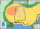
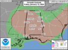
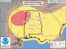
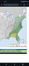
Day 2 enhanced maintained

1704954927945.png

1704954893853.png
1704954957549.png
Day 2 Convective Outlook
NWS Storm Prediction Center Norman OK
1205 AM CST Thu Jan 11 2024

Valid 121200Z - 131200Z

...THERE IS AN ENHANCED RISK OF SEVERE THUNDERSTORMS FRIDAY
AFTERNOON AND INTO FRIDAY EVENING ACROSS PARTS OF EAST CENTRAL AND
SOUTHEASTERN ALABAMA...MUCH OF CENTRAL GEORGIA AND SOUTH CAROLINA
INTO SOUTHERN NORTH CAROLINA...

...SUMMARY...
Severe thunderstorms, with potential to produce high winds and a few
strong tornadoes, are possible across parts of the Southeast Friday
through Friday evening.

...Discussion...
There appears little substantive change in the latest available
ECENS/ECMWF and GEFS concerning the forecast evolution for this
period. Strong surface cyclogenesis is likely to proceed Friday
across the Mississippi Valley through Atlantic Seaboard, as a
vigorous supporting short wave trough pivots northeast of the
southern Great Plains. It still appears that the center of the
growing cyclone will undergo a period of rapid deepening across the
lower Ohio Valley during the day, including minimum surface
pressures falling on the order of 15-20 mb in a 12 hour period,
though the 00Z NAM/03Z RAP take a track to the northwest of the
other guidance into the Great Lakes region through late Friday
night.

Regardless, associated strengthening of deep-layer wind fields
probably will including a developing swath of 90-120+ kt
cyclonic/southwesterly flow at 500 mb across the lower Mississippi
Valley, through portions of the Northeast and Mid Atlantic by the
end of the period. In the 850-700 mb layer, 50-90 kt south to
southwesterly flow is generally forecast to overspread the inland
advancing warm sector.

There remains some uncertainty concerning just how expansive of an
unstable warm sector may develop, with perhaps low-level warming and
moistening becoming sufficient, in the presence of strong forcing
for ascent, for weak boundary-layer destabilization northeast of the
lower Mississippi Valley through parts of the Tennessee and lower
Ohio Valleys during the day.

More substantive low-level moistening is probable off the north
central/northeastern Gulf of Mexico, into the eastern Gulf through
south Atlantic coast states. However, with the mid-level cold pool
forecast to shift north of this region, relatively warm layers
aloft, even in advance of mid-level subsidence warming nosing
east-northeastward across coastal areas, could inhibit
destabilization.

More problematic, concerning the severe weather potential, the NAM
and Rapid Refresh forecast soundings are slow to erode the initially
cool boundary layer, and maintain at least a shallow near surface
stable layer. If this verifies, convective potential will probably
be mitigated. However, a corridor of strong surface pressure falls
still appears likely to develop across the Southeastern Piedmont,
from Alabama through the Carolinas midday Friday through Friday
evening, near the southern periphery of the mid-level height falls.
Associated forcing may contribute to more rapid modification of the
boundary-layer, in the presence of an environment otherwise becoming
conditionally supportive of significant severe weather potential.

Strong to severe thunderstorm development, initiating Thursday night
across the southeastern Great Plains into the lower Mississippi
Valley, may be ongoing at the outset of the period, spreading
east-northeast of the Mississippi River Friday morning, before
perhaps weakening. Renewed thunderstorm intensification is then
expected near/ahead of a developing pre-frontal dryline structure
developing across east central/southeastern Alabama by early
afternoon, particularly near where it intersects a strengthening
frontal zone across the Piedmont. This probably will be maintained
while spreading east-northeastward across Georgia into the Carolinas
by late Friday evening.

Although the evolution of an organized convective cluster still
appears possible, discrete supercell development may remain the
primary convective mode, accompanied by a risk for strong tornadoes.
 
In going to be honest and say I still have no idea why the forecast is so bullish for mby. Like, what am I missing? Cape is basically 0 ..... How discreet supercell with 0 cape?

Guess we'll find out.


Sent from my iPhone using Tapatalk
 
In going to be honest and say I still have no idea why the forecast is so bullish for mby. Like, what am I missing? Cape is basically 0 ..... How discreet supercell with 0 cape?
This setup is far more favorable for discrete activity vs a couple days ago but I like you have a hard time finding much in our area right now
 
NWS Birmingham still says the greatest questions are in regards to the northward progression of the warm sector. It appears clear to them though that wherever that war sector is that it will be an environment supportive of supercells and strong tornadoes.

While there are some
similarities to yesterday`s system in the track of the low, there
are also some important differences. While there will be a
subtropical impulse over the Gulf, it will be located further to
the east towards the Florida peninsula and probably not be a
factor causing disruptive coastal convection. Also the trough will
be further to the north and negatively tilted, in a placement
typically more favorable for supercells in Central Alabama, with
even global models indicating convection being more cellular.
Elevated convection north of the warm front will also be
developing overtop of the CWA rather than south of it. Thus models
are indicating a narrow but relatively robust warm sector with 62
to 65 dew points lifting northward into at least our southern
counties, with around 500 to 1000 J/kg of SBCAPE.

As is typical, shear will be more than sufficient for organized
storms with 0-6km bulk shear values around 90 kts, though it`s
possible that this shear could be too strong if updrafts aren`t
strong enough to avoid being sheared apart. The main question will
be how far north the warm front will lift, especially if it will
lift into the area of strongest forcing, and whether storms willThats
out-run the relatively small warm sector. Will note that while the
500mb shortwave will be lifting quickly northeastward away from
the area by midday, there is still a pronounced 700mb trough to
our west aiding forcing, with some 500mb height falls continuing
through the afternoon. It`s also worth noting that some models may
be veering winds too quickly at the surface given the isobaric
response to the deepening low to our northwest. Overall this is a
low floor but relatively high ceiling event, as any supercell that
is able to remain sustained in the warm sector before crossing to
the cool side of the front would have a conditional threat for a
strong tornado.
Thats how it usually works
 
This setup is far more favorable for discrete activity vs a couple days ago but I like you have a hard time finding much in our area right now

There's a very brief period where something could spin up right before the front blasts through.


Sent from my iPhone using Tapatalk
 
Very conditional threat, but a volatile one for any storm that takes advantage of the environment could become a long track supercell and produce long tracked tornadoes. There's a narrow window, and also the low pressure itself is expected to deepen very rapidly for a window of time.

This definitely doesn't look like any widespread threat but with dryline like features out ahead of the main cold front itself... Shear is plentiful and SRH are effectively greater than 400 s²/m²..
Their is a massive gap between the floor and ceiling with this event
 
Very conditional threat, but a volatile one for any storm that takes advantage of the environment could become a long track supercell and produce long tracked tornadoes. There's a narrow window, and also the low pressure itself is expected to deepen very rapidly for a window of time.

This definitely doesn't look like any widespread threat but with dryline like features out ahead of the main cold front itself... Shear is plentiful and SRH are effectively greater than 400 s²/m²..
Yeah tough one to forecast. I feel for SPC. They have to go enhanced because of the ceiling but there's a very plausible scenario where only a few storms get going and people claim bust.

I think we might see some trimming of the northern edge of the new day 2 outlook coming out in a few hours.
 
Their is a massive gap between the floor and ceiling with this event
Yeah, right now, only individuals I see that are extremely bullish on this event is Reed Timmer, and the SPC to some degree.

Guidance isn't of much help, as some are very meager on convective development, some are messy mode, the FV3-1km has some very strong cells in lower SC in the evening but with little SBCAPE.

Tough one to forecast. One to two cells producing multiple tornadoes, and couple strong would verify the ENH risk assessment. Almost feels like this kind of setup.
It's tough to get a good read from Timmer he hypes up everything
 
Back
Top