-
Hello, please take a minute to check out our awesome content, contributed by the wonderful members of our community. We hope you'll add your own thoughts and opinions by making a free account!
You are using an out of date browser. It may not display this or other websites correctly.
You should upgrade or use an alternative browser.
You should upgrade or use an alternative browser.
Wintry Jan 2-4 2022 Winter Weather Event/Obs
- Thread starter SD
- Start date
NBAcentel
Member
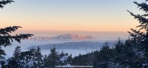
You got it!Just out of curiosity, is that an inversion below the snow line in the mountains creating a dense fog?
It is inversion but the valley floor there got pasted as well.Just out of curiosity, is that an inversion below the rain/snow in relation to elevation creating a dense fog?
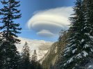
Ask because I have seen these out in PACNW, specifically Olympic and Cascades, right after a significant wave.
Great picture!
View attachment 101875
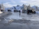
It is inversion but the valley floor there got pasted as well.
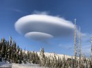
Makes sense, early season these are about 3K’ in the NW, but they always almost occur after big waves. With elevation they increase chances for lenticular clouds in the Cascades a day or two after dependent on things I still don’t understand but learning.
Last edited:
Overall no changes from me, I’m still thinking the first widespread 3”+ east of mountains is weeks away.
3+ now huh lolOverall no changes from me, I’m still thinking the first widespread 3”+ east of mountains is weeks away.

