-
Hello, please take a minute to check out our awesome content, contributed by the wonderful members of our community. We hope you'll add your own thoughts and opinions by making a free account!
You are using an out of date browser. It may not display this or other websites correctly.
You should upgrade or use an alternative browser.
You should upgrade or use an alternative browser.
Jan. 17-18, 2026 SE Winter Weather Threat
- Thread starter RBR71
- Start date
iwantsouthernsnow123
Member
Not quite how this is going to work. Atlanta and Savannah is not going to win at the same time. Generally with these anafrontal overrunners you prefer to be closer to the NC mountains but right now it's a questionable spot. NW ticks are in the right direction.. Honestly the only way for this to be a "big win" is if it moves NW into GA, AL, MS. These are the only areas with temps that actually favor a legit snow chance. Will it happen, no tellingHere are my current thoughts on the snow:
Raleigh: 2-4"
Charlotte: Trace-1" (Charlotte gets the change-over later)
Savannah, GA: 4-8"
Atlanta, GA: 2-4"
HailCore
Member
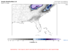
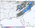
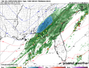
Yea pretty significant nw jump in qpf on the nam
accu35
Member
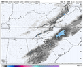
Big NW shift on the 3k
iwantsouthernsnow123
Member
Been warning about this for a while. NW trend often wins in overrunners like this closer to the mountains. Hopefully these trends continue.
Would be nice to get some precipitation in any form at this point. It has been so dry. Praying for frozen but will take liquid form too.
It has been fun finally tracking a storm regardless of the final outcome.
Good luck all
It has been fun finally tracking a storm regardless of the final outcome.
Good luck all
accu35
Member
If these NW trends continue in the morning then someone on the FL PHD gonna get Nuked by the Nam
iGRXY
Member
If we can get 2 more shifts like we just got on the NAM ….
Makeitsnow
Member
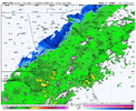
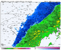
NAM continues to keep precip going and crashes the column, once again being snowier across our area than other models. I know I sound like a broken record but usually it's the NAM with warmer thermals.... keeps piquing my interest
Nice rain event on the nam we need it
HailCore
Member
I must say this recent NAM run looks a bit similar to the recent GRAF evolution other than the tilt aside from the fact that the GRAF had most of the moisture as rain in NC/SC. I have had beef with the GRAF after two events last year which it did not do well with the rain/mix/snow line (Jan 10 it showed most of northern GA seeing all snow when there was mixing and Feb 20 it showed a lot more snow in spots that got rain), however it did decently with the northern extent of the precipitation shield on the Jan 21 storm over the ATL area, and maybe this time it is just struggling with thermals. This at least gives me hope that this NW trend may be legit, but the fact that the GRAF was over the Atlantic just a few runs ago does not help with the uncertainty part.
Makeitsnow
Member
scncborderwx
Member
I said what I saidBruh... Lol
View attachment 184413
iwantsouthernsnow123
Member
Things are uptrending for our area, think we may actually have a chance to pull this in? Waiting for other models to come in since NAM loves to take what it gives.
GeorgiaGirl
Member
Yeah, but I kept quiet lol. If I had posted about it, it would've been in banter, and I would've been like "results in which we'd like to see happen."
Though I think it was one of the other experimental models I saw.
A chance? I guess, but it is extremely unlikely. My forecast is still flurries at most for ATL and Toccoa.Things are uptrending for our area, think we may actually have a chance to pull this in? Waiting for other models to come in since NAM loves to take what it gives.
I keep saying this too, but the NAM isn't to dissimilar from what the WeatherNext2 has been showing. 3k NAM thermals usually are darn accurate
You been hanging with JShetley!?Nice rain event on the nam we need it
I think a good compromise would be a NAM / GFS blend, at this juncture
The NAM keeps on showing good things for most of Central North Carolina. It has been consistent if nothing else.
There we go! Tilt is getting more favorable.
Crow
Member
What’s the reason the NAM outputs seem to be getting ignored by the NWS and local mets here in NC?
HailCore
Member
Tokenfreak
Member
If it keeps shifting NW does this help the eastern parts of the Carolinas have more time to drop in temperature to possibly get snow instead of rain when the precipitation gets there?
Sent from my iPhone using Tapatalk
Sent from my iPhone using Tapatalk
Fwiw, FV3 mostly rain
GeorgiaGirl
Member
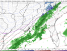
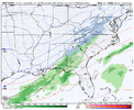
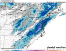
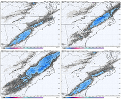
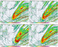
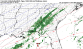
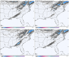
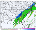
The WRF sisters are coming in with the initial precip shield further west than the 12z modeling. Not sure about snow with these, but definitely some models to add to the NW trend list
View attachment 184419
It starts showing up at hr 32 and there's a fairly consolidated band now at the end of the precip shield at hr 35, it's just to the southeast.
Not necessarily, precip expansion to the NW is due to some WAA which is obviously warming layers and you get rain. Best bet is some coastal enhancement that keeps precip going while allowing the column to cool sufficiently. I think this is what the NAMs and even the Google AI model are showingIf it keeps shifting NW does this help the eastern parts of the Carolinas have more time to drop in temperature to possibly get snow instead of rain when the precipitation gets there?
Sent from my iPhone using Tapatalk
Noticing its been rain predominately every time i check past couple days for mby. Like mainly the only one that does it. Who knows, looks like webbbers call map everytime it runs.Fwiw, FV3 mostly rain
Makeitsnow
Member
accu35
Member

