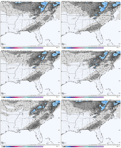
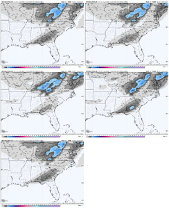
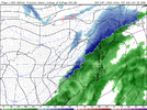
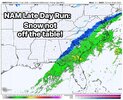
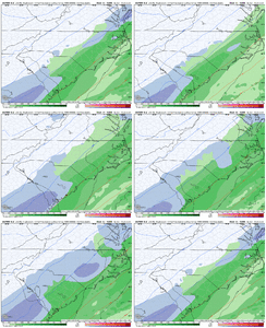
What I like about these trends is that even if the cold isn't there, we desperately need the rain
-
Hello, please take a minute to check out our awesome content, contributed by the wonderful members of our community. We hope you'll add your own thoughts and opinions by making a free account!
You are using an out of date browser. It may not display this or other websites correctly.
You should upgrade or use an alternative browser.
You should upgrade or use an alternative browser.
Jan. 17-18, 2026 SE Winter Weather Threat
- Thread starter RBR71
- Start date
RollTide18
Member
From NWS Mobile:
Best
timing and placement of frozen precipitation mixed in with the
liquid precipitation are two items that are consistent, with
placement being along and south of a Perry County to Wilcox County
line, and beginning soon after midnight Saturday night. Amounts that
hit the ground vary, with varying strength of the upglide, along
with temperatures of the boundary layer. Anywheres from several
inches to nothing at all is advertised by the guidance. Consensus is
less than 0.10" over most of the area where it falls, with up to
0.25" over the eastern border of the forecast area. Accumulation on
the ground will vary, with the ground, roadways and bridges seeing
too much above freezing time Saturday (with temperatures expected to
top out in the low 50s northwest of the Alabama River to low 60s
over the Florida Panhandle near coastal areas). Elevated surface may
see a bit of an accumulation. Too soon for a Winter Wx Advisory to
be issued, so am holding off.
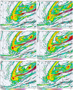
Massive NW shift on the RAP from 21z run -> 03z run.
SegTindo
Member
Ordinarily, those of us wishing for an NW trend rob those to the east of their snow. That isn't the case here. The further NW the precip shield manages to make it, the better those in the jackpot zones to the east do.
I wouldn’t want that tbh I hope that everyone scores even if it’s a snow flake
Sent from my iPhone using Tapatalk
accu35
Member
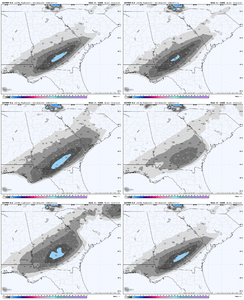
Gonna be a nice increase on the GEFS
GeorgiaGirl
Member
What I like about these trends is that even if the cold isn't there, we desperately need the rain
Yeah, it's "boring," but a rain event is much welcome along with the possible snow.
Didn't even realize that there is a lot of D1 drought shaded around the state and D2 in spots and I think the only rain that we've received is a little over an inch earlier in the month.
SegTindo
Member

Sent from my iPhone using Tapatalk
iwantsouthernsnow123
Member
Never expected 00z runs to be this big for north georgia. If euro and euro AIFS follows suite, things get very interesting.Massive NW shift on the RAP from 21z run -> 03z run.
dsaur
Member
These things move around back and forth. We end up with a tilted line 100 miles wide, or so, and in there are some heavy rates. I've seen them go from Jonesboro to Macon, and give a nice highway sledding surface 5 times, that I can remember, meaning over two inches of sn,ip, and zr. The good ones were 3 or so. Lots of lessor, and all have been meager since that damn y2k, lol. So the first 30 years, 5 good sledding storms....the absolute best, and a wicked bad ice storm, and then many 1 inch, or dustings, but couldn't sled the state road... and to be honest there were some good ones before I found the state road hills.. and some deep melty spring snows, at least three....oh, and a blizzard but the last 25 have been very lean. I want at least 5 inches to break the drought but getting snow from a clipper in the deep...deep..down here below I 20, is harder than water from a rock.I was surprised the NAM was as good as it was tbh after seeing the initial move further eastward over Texas. All else being equal, just slowing it down a few hours would have done the trick here to give more time for CAA out of the NW. Which, by the way, is usually slower than forecast here east of Atlanta.
It just goes to show how maddeningly close it is for those pulling for that NW trend. Hanging in there!
Mahomeless
Member
This is still a cold chasing moisture setup that rarely works out for anyone…especially east of the Apps. Need a neutral tilt 150 miles west of where the NAM has it right now, SLP would pop in the northern GOM….that is the game we need.
HailCore
Member
I was optimistic and cautiously hoping that the RAP would look better on this run because of how far SE it was before. This only strengthened my belief in this NW trend being able to actually do something considering the RAP and HRRR are basically versions of each other, and the HRRR at the end of the day I have seen handle the NW shield of precipitation the best. Just need some more cold air there.
iwantsouthernsnow123
Member
This is a little bit less of a cold air chasing moisture system outside of the Carolinas. Front is generally pretty well set by time the front arrives.This is still a cold chasing moisture setup that rarely works out for anyone…especially east of the Apps. Need a neutral tilt 150 miles west of where the NAM has it right now, SLP would pop in the northern GOM….that is the game we need.
iwantsouthernsnow123
Member
HRRR has just silently been uptrending ever since 00z.
NBAcentel
Member
Never expected 00z runs to be this big for north georgia. If euro and euro AIFS follows suite, things get very interesting.
The recon data that was first out in for the 0Z run was likely a reason in addition to the typical NW trend due to too far SE bias of the models being corrected to reality as we get closer. The odds are that this NW trend will continue as the bias keeps unwinding.
iwantsouthernsnow123
Member
Yeah I was well aware of it. Still given just how unlucky we've been in recent years I was rather surprised to see obs data work out in our favor, for instance seperating the shortwave from the rest of the trough.The recon data that was first out in for the 0Z run was likely a reason in addition to the typical NW trend due to too far SE bias of the models being corrected to reality as we get closer. The odds are that this NW trend will continue as the bias keeps unwinding.
Yeah I was well aware of it. Still given just how unlucky we've been in recent years I was rather surprised to see obs data work out in our favor, for instance seperating the shortwave from the rest of the trough.
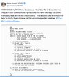
For those who didn’t see this, this was the tweet about recon data to be input in time for 0Z 1/17 runs:
HailCore
Member
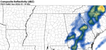
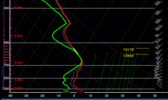
Might be getting overly optimistic from this run alone, but despite the lack of snow showing up on p-type for places around north GA including Atlanta on the 03Z RAP, after the main light rain exits to the east, these composite reflectivities remain for a bit in small blobs moving from SW to NE over the area and normally one would think this is virga, but the sounding from the Atlanta area I think makes it plausible that light snow could still be falling here as the surface temps have now cooled off, or at least it would not take too much moisture to re-saturate the column from these secondary waves of precip


Pilotwx
Member
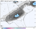
528 line and 540 line are packing tight up against the mountains, should squeeze every bit of moisture out of the airNW trend again. View attachment 184444
Cad Wedge NC
Member
Webber has been all over this one. It is playing out just like he predicted. NW trend and warmer...
Yeah I was well aware of it. Still given just how unlucky we've been in recent years I was rather surprised to see obs data work out in our favor, for instance seperating the shortwave from the rest of the trough.
On second thought, with the jump at 0Z that likely was influenced by recon data, I wonder if there will be no more NW jumps based on the idea that perhaps this recon data was enough to get the models close to reality. Opinions?
On second thought, with the jump at 0Z that likely was influenced by recon data, I wonder if there will be no more NW jumps based on the idea that perhaps this recon data was enough to get the models close to reality. Opinions?
Perhaps but there is Teal 72, which will be ingested into the 12z suite.
iwantsouthernsnow123
Member
Generally you'll continue the NW tick regardless of OBS data primary because of the precip shield.On second thought, with the jump at 0Z that likely was influenced by recon data, I wonder if there will be no more NW jumps based on the idea that perhaps this recon data was enough to get the models close to reality. Opinions?
NBAcentel
Member
RollTide18
Member
Hope to get a Winter Weather Advisory out of this if nothing else
Southernwx meet up at the Buccees south of Macon?
View attachment 184504
Too bad I have work, but maybe the snowfall will be an excuse for crappy travel lol
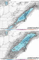
Anyways, here is the Euro Ens:
