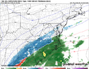
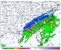
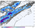
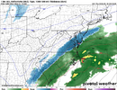
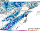
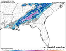
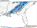
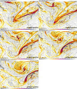
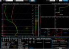
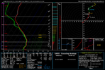
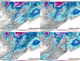
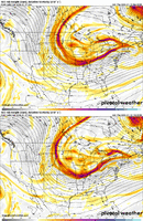
I agree, but overrunning implies a storm starting as snow, with warm air overrunning a cold air mass initially, that will later warm the column and change it to rain. This scanario is the opposite. Again, I am just trying to clarify terms, which has a major effect on how we are viewing a storm.Winter storm types always fall on a spectrum, but this isn’t a classic miller type a setup where you have a strong coastal cyclone throwing precip back into the colder air to the NW and then the coastal low is really driving in strong cold advection that crashes the entire column. It’s there of course but this is very weak in this case and not the main driver of your precipitation, as I showed earlier.
When you get these types of Miller A events, usually we have blocking to the north to slow everything down & amp the trough/coastal, that’s obviously not happening here because the background flow is very fast and progressive.
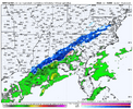
View attachment 183691
The background pattern is more like Jan 2014 (overrunning) than it is a coastal low
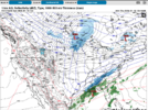
View attachment 183694
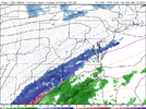
View attachment 183695
The surface features also don’t look right for a miller type an event in NC. There’s a surface low over the Great Plains where a surface high should be! Again, no high-latitude blocking either with the wrong sign of anomalies over Greenland.
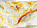
View attachment 183698
View attachment 183699
-
Hello, please take a minute to check out our awesome content, contributed by the wonderful members of our community. We hope you'll add your own thoughts and opinions by making a free account!
You are using an out of date browser. It may not display this or other websites correctly.
You should upgrade or use an alternative browser.
You should upgrade or use an alternative browser.
Jan. 17-18, 2026 SE Winter Weather Threat
- Thread starter RBR71
- Start date
iGRXY
Member
Bigedd09
Member
Ridging much stronger as well
front end thump is where the goods are usually. Beat the WAA issues. and precip always arrives 3 hours earlier than modeled
- Joined
- Jan 2, 2017
- Messages
- 1,566
- Reaction score
- 4,279
You raise a good point about the lack of a blocking HP. For one, it provides an additional cold air feed and it keeps whatever cold air is present from escaping. If this were in place, I'd be more confident if I were outside of the western parts of the Carolinas but since this is not the case, I get the feeling that this will be mostly rain for the folks in Eastern NC/SC. The track of this LP, while it is important, can't do enough on its own to provide cold air unless it was much stronger.Winter storm types always fall on a spectrum, but this isn’t a classic miller type a setup where you have a strong coastal cyclone throwing precip back into the colder air to the NW and then the coastal low is really driving in strong cold advection that crashes the entire column. It’s there of course but this is very weak in this case and not the main driver of your precipitation, as I showed earlier.
When you get these types of Miller A events, usually we have blocking to the north to slow everything down & amp the trough/coastal, that’s obviously not happening here because the background flow is very fast and progressive.
View attachment 183691
The background pattern is more like Jan 2014 (overrunning) than it is a coastal low
View attachment 183694
View attachment 183695
The surface features also don’t look right for a miller type an event in NC. There’s a surface low over the Great Plains where a surface high should be! Again, no high-latitude blocking either with the wrong sign of anomalies over Greenland.
View attachment 183698
View attachment 183699
I'm am not a meteorologist, just a person who enjoys keeping up with the weather and whatever it brings in most cases. I hope my gut feelings about this event are wrong but looking at the cards we may be dealt, I would fold right now with this hand. Hopefully, things will turn out differently and this post will give more the more optimistic folks a chance to say "See, I told you so."
iGRXY
Member
NWG_WX14
Member
Surface temperatures are an issue for just about everyone on the NAM
iGRXY
Member
It would help our chances if the NAM is right about the precipitation arriving earlier than expected. My residence in Wake County is right on the rain/snow transition line which is the case for many winter events. Looking at the last frame of the NAM, it looks like whatever snow falls will be washed away by a cold rain at the end of the storm. Heavier precipitation rates might help out with that.Nam is way quicker with precip verse its 6Z run. I'd cash out in a heartbeat with this run , if it worked that easy
View attachment 183718
- Joined
- Jan 2, 2017
- Messages
- 1,566
- Reaction score
- 4,279
Great run for NW of 85 crowd! Cold through the column to a 30-32 degree surface.
iGRXY
Member
I will say, I think the NAM was having some reflectivity issues on the precip towards the last couple of panels, so it probably should be higher.
It would be a pretty bad fail by the Euro if a scenario even close to the NAM was to play out.
Lot left to be decided. One thing is for certain though.
The ceiling on this thing is slightly above the ankles / very wet heavy snow. You hit the 5 inch mark with all these variables, moving parts, you're backyard has hit the jackpot.
The ceiling on this thing is slightly above the ankles / very wet heavy snow. You hit the 5 inch mark with all these variables, moving parts, you're backyard has hit the jackpot.
- Joined
- Jan 2, 2017
- Messages
- 1,566
- Reaction score
- 4,279
In its defense it is closer synoptically to the NAM than we may be giving it credit for but very minor differences go a long way in such a setupIt would be a pretty bad fail by the Euro if a scenario even close to the NAM was to play out.
Webberweather53
Meteorologist
I agree, but overrunning implies a storm starting as snow, with warm air overrunning a cold air mass initially, that will later warm the column and change it to rain. This scanario is the opposite. Again, I am just trying to clarify terms, which has a major effect on how we are viewing a storm.
Yeah exactly, that’s part of the problem I’ve been bringing up. These overrunning events usually start as snow then change to ice, tho that’s not always the case. We may be starting out as rain because the cold air doesn’t get here first, that could be a huge problem...
This looks like an overrunning event in some sense because of how the moist ascent is overriding the Arctic front and the precip is largely co-located with warm advection aloft. The coastal low itself also isn’t super strong or giving us a ton of cold advection and that’s tied to the pattern being highly unfavorable for it as noted earlier. This whole setup just doesn’t look right at all no matter how you slice it.
broken025
Member
That rain line is dangerously close for us just south of 85. Hope this can come in colder going forward.
SegTindo
Member

Guess I’ll take that over snow i guess
Sent from my iPhone using Tapatalk
Brandon10
Member
I do not like how the NAM is starting to look like the RGEM and other short range models with the RS line much more west than the operations and Ensembles.
You and me both. I hope that rain/snow line will shift back to the south and east by at least 100 miles.That rain line is dangerously close for us just south of 85. Hope this can come in colder going forward.
- Joined
- Jan 2, 2017
- Messages
- 1,566
- Reaction score
- 4,279
You honestly wanna be on the razors edge. Heaviest rates will occur there but its a gamble...lolThat rain line is dangerously close for us just south of 85. Hope this can come in colder going forward.
broken025
Member
Lol that gamble doesn’t work out well here. We will see. Models are still all over so who knows what happens.You honestly wanna be on the razors edge. Heaviest rates will occur there but its a gamble...lol
Thank you for clarifying. For more snow in the Carolinas, we have to hope the stronger dynamics will outweigh the negatives you mentioned, but it will be a challenge.Yeah exactly, that’s part of the problem I’ve been bringing up. These overrunning events usually start as snow then change to ice, tho that’s not always the case. We may be starting out as rain because the cold air doesn’t get here first, that could be a huge problem...
This looks like an overrunning event in some sense because of how the moist ascent is overriding the Arctic front and the precip is largely co-located with warm advection aloft. The coastal low itself also isn’t super strong or giving us a ton of cold advection and that’s tied to the pattern being highly unfavorable for it as noted earlier. This whole setup just doesn’t look right at all no matter how you slice it.
At least we will see some much needed precipitation out of this, whether it be rain or snow. RDU has only recorded .01 inches of precipitation so far in January and the dry fall didn't help matters any.
iGRXY
Member
Which is usually I85. The 2 best places to be is immediately south and east of the NC/SC mountains on the state line where you get additional lift and probably 5-10 miles north of the transition lineYou honestly wanna be on the razors edge. Heaviest rates will occur there but its a gamble...lol
That's still very much up for debateAt least we will see some much needed precipitation out of this, whether it be rain or snow. RDU has only record .01 inches of precipitation so far in January and the dry fall didn't help matters any.
I feel much better for most of us here in Alabama and portions of Georgia in regards to the cold. We simply just need precip and thats exactly where we want to be in this situation. Someone in south central Alabama is going to get clocked imo.
Webberweather53
Meteorologist
Thank you for clarifying. For more snow in the Carolinas, we have to hope the stronger dynamics will outweigh the negatives you mentioned, but it will be a challenge.
No worries.
I just feel like we’re between a rock and a hard place with the way this is setup in the Carolinas.
Pattern doesn’t quite fit temperature wise with your usual overrunning event as you noted, whereas we also don’t have enough blocking over the top to slow this event trough down and really amp the coastal to feed us more cold air. Gotta really thread the needle here to make this work out at all
ducketta27
Member
Yeah exactly, that’s part of the problem I’ve been bringing up. These overrunning events usually start as snow then change to ice, tho that’s not always the case. We may be starting out as rain because the cold air doesn’t get here first, that could be a huge problem...
This looks like an overrunning event in some sense because of how the moist ascent is overriding the Arctic front and the precip is largely co-located with warm advection aloft. The coastal low itself also isn’t super strong or giving us a ton of cold advection and that’s tied to the pattern being highly unfavorable for it as noted earlier. This whole setup just doesn’t look right at all no matter how you slice
One thing is for sure if model guidance holds.... it won't be a "typical" overrunning look for us in the Carolinas... Thanks, Webber!
Mahomeless
Member
20/59 corridor in AL is going to get absolutely smoked if this continues. Precip continues to rise and shift NW (and its still way underdone), the neutral tilt continues to inch west with each run, and shorter range guidance is all on board.....saddle up!

