Good morning everyone! We are all excited at the potential winter weather threat that may include many (or not lol) but it's fun tracking! Anyway, I'll be moderating pretty tight in here today, one liners, gifs, memes, banter, post like it's a social media thread and just having conversation, etc etc, will get deleted. Not gonna move these post, not gonna explain why each one gets deleted, just trying to keep this as clean as possible for threat specific discussion. Thank you for your attention to this matter.
-
Hello, please take a minute to check out our awesome content, contributed by the wonderful members of our community. We hope you'll add your own thoughts and opinions by making a free account!
You are using an out of date browser. It may not display this or other websites correctly.
You should upgrade or use an alternative browser.
You should upgrade or use an alternative browser.
Jan. 17-18, 2026 SE Winter Weather Threat
- Thread starter RBR71
- Start date
- Joined
- Jan 23, 2021
- Messages
- 4,602
- Reaction score
- 15,197
- Location
- Lebanon Township, Durham County NC
Another short term thing I dont like to see is BUFKIT oscillating between runs. Its okay if it's QPF but if it isnt..
Webberweather53
Meteorologist
Ok I understand that. However, as depicted by the GFS and the other amped models, this is a dynamically driven trough that is creating the dynamics not by typical WSW to slightly NNE up glide and advection as seen by our typical overrunning events. Even the Mets at GSP and Raleigh note this on their AFDs. If the GFS is right, we will be dealing with rain here in central NC followed by a dynamically driven column crash, not by just warm air advection. Maybe you can explain this better, because this looks nothing like our historical overrunning events.
This looks more like an overrunning style event in the southeast than anything else, tho the air mass is much more marginal than what I’m accustomed to normally seeing with these, which concerns me. The coastal cyclone itself isn’t very strong which tells me that this isn’t a more dynamic, miller type a setup, nor do we have a big closed off upper low, like say Jan 16-18 2018 or Mar 1-2 2009 for ex. Heck, if we set everything else equal and just had the stronger coastal, I would be more enthused than I am now about snow in the Carolinas.
Usually, when it comes to these kind of storms, the debate is over whether we get snow/sleet/zr, not whether we’re actually cold enough to get any wintry precip to begin with.
Most of your precip is being driven by sloped, moist ascent aloft over top of the Arctic frontal boundary, which by definition is an overrunning event. Sure, the DPVA is helping here too but precip is only occurring in areas where this sloped moist ascent is ongoing.
Note that most of your heavier precip on the model forecast is co-located with the strongest mid-level/700mb warm advection aloft, with a minor offset if anything to the north & west as this warm advection intersects the DGZ, which is above 700mb/back into the cooler air aloft to the NW
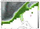
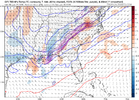
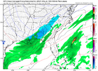
NCHighCountryWX
Member
- Joined
- Dec 28, 2016
- Messages
- 699
- Reaction score
- 1,918
Great question! As I mentioned in my earlier post, the synoptics are the same but the dynamics that drive this storm between the amped GFS camp and the flat overrunning Euro camp is totally different. Amped solutions have to be seen from a Miller A standpoint, not overrunning, and seems to be causing a lot of confusion here.Question: are we back to overruning look or still a Miller A deal?
iwantsouthernsnow123
Member
So would this possibly favor an area like northeastern georgia?This looks more like an overrunning style event in the southeast than anything else, tho the air mass is much more marginal than what I’m accustomed to normally seeing with these, which concerns me. The coastal cyclone itself isn’t very strong which tells me that this isn’t a more dynamic, miller type a setup, nor do we have a big closed off upper low, like say Jan 16-18 2018 or Mar 1-2 2009 for ex. Heck, if we set everything else equal and just had the stronger coastal, I would be more enthused than I am now about snow in the Carolinas.
Usually, when it comes to these kind of storms, the debate is over whether we get snow/sleet/zr, not whether we’re actually cold enough to get any wintry precip to begin with.
Most of your precip is being driven by sloped, moist ascent aloft over top of the Arctic frontal boundary, which by definition is an overrunning event. Sure, the DPVA is helping here too but precip is only occurring in areas where this sloped moist ascent is ongoing.
Note that most of your heavier precip on the model forecast is co-located with the strongest mid-level/700mb warm advection aloft, with a minor offset if anything to the north & west as this warm advection intersects the DGZ, which is above 700mb/back into the cooler air aloft to the NW
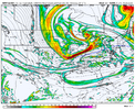
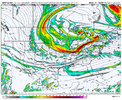
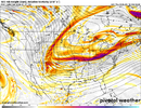
View attachment 183679
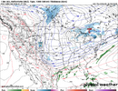
View attachment 183680
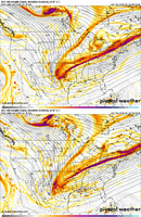
View attachment 183678
I think it is just a matter of semantics, but how the “overrunning” occurs is very different between the two camps, and the dynamics that cause the lift is more like a Miller A storm in my opinion with the GFS camp.This looks more like an overrunning style event in the southeast than anything else, tho the air mass is much more marginal than what I’m accustomed to normally seeing with these, which concerns me. The coastal cyclone itself isn’t very strong which tells me that this isn’t a more dynamic, miller type a setup, nor do we have a big closed off upper low, like say Jan 16-18 2018 or Mar 1-2 2009 for ex. Heck, if we set everything else equal and just had the stronger coastal, I would be more enthused than I am now about snow in the Carolinas.
Usually, when it comes to these kind of storms, the debate is over whether we get snow/sleet/zr, not whether we’re actually cold enough to get any wintry precip to begin with.
Most of your precip is being driven by sloped, moist ascent aloft over top of the Arctic frontal boundary, which by definition is an overrunning event. Sure, the DPVA is helping here too but precip is only occurring in areas where this sloped moist ascent is ongoing.
Note that most of your heavier precip on the model forecast is co-located with the strongest mid-level/700mb warm advection aloft, with a minor offset if anything to the north & west as this warm advection intersects the DGZ, which is above 700mb/back into the cooler air aloft to the NW
View attachment 183679
View attachment 183680
View attachment 183678
Blue_Ridge_Escarpment
Member
They’ll show up at the 11th hour as usualWPC will need to come around on this today or Friday.
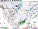
View attachment 183681
rburrel2
Member
Wetbulb 925s are cold. Shouldn’t be an issue to rapidly cool the surface.id guess it starts as snow, and usually when you start snow you drop the surface temps fast bc the boundary layer is so thin.Just have to have good enough rates if we are to be 33-37F at onset around here. Still reason to doubt that
This is assuming we get precip, lol.
RollTide18
Member
Spann continues to call for a nothingburger
Different people tend to use Miller A/B and overrunning in various contexts. Miller A vs. Miller B is very surface low track centric. As Raleigh NWS noted, this is Miller A, it's just a Gulf to SE Coastal low that is weak in strength. Whether Miller A or Miller B, you're always going to have varying features that are going to cause the forcing for rising motion, depending on the setup (low to mid level convergence, mid-level warm advection / overrunning, mid-level frontogenesis, vorticity advection from the approaching upper wave, upper-level divergence associated with jet streak placement)Great question! As I mentioned in my earlier post, the synoptics are the same but the dynamics that drive this storm between the amped GFS camp and the flat overrunning Euro camp is totally different. Amped solutions have to be seen from a Miller A standpoint, not overrunning, and seems to be causing a lot of confusion here.
For our area (central NC), the model trends have been good. Even the 6z GFS backing off (stopped westward trend/less amped) was better specifically for us, and folks down east. I really liked the look of the 6z NAM. It was about to drop the hammer on RDU. 850s were already dropping, surface 2m temps were in the upper 30s, with dew points in the mid teens.Another short term thing I dont like to see is BUFKIT oscillating between runs. Its okay if it's QPF but if it isnt..
6z NAM hour 84 _mid-day Sunday:
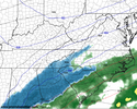
Now do I believe it? Not really. But no less than all the other models.
Spann continues to call for a nothingburger
My man has conviction. Better than a lot of these back and forth Mets on social media these days. Go down with the ship if need be
Exactly my point. Which is why their is so much confusion about this system, dynamics are complex. Here in RDU for example, I hope the GFS is right since it has much more dynamics than your typical simple warm air advection from what we describe as “overrunning”. So even though we don’t have that high pressure to the north, powerful frontogenesis should switch rain to snow, and likely a good bit, as the trough swings through.Different people tend to use Miller A/B and overrunning in various contexts. Miller A vs. Miller B is very surface low track centric. As Raleigh NWS noted, this is Miller A, it's just a Gulf to SE Coastal low that is weak in strength. Whether Miller A or Miller B, you're always going to have varying features that are going to cause the forcing for rising motion, depending on the setup (low to mid level convergence, mid-level warm advection / overrunning, mid-level frontogenesis, vorticity advection from the approaching upper wave, upper-level divergence associated with jet streak placement)
Well yeah the precip is still my hangup. I buy the NAM/GFS if the precip is right.Wetbulb 925s are cold. Shouldn’t be an issue to rapidly cool the surface.id guess it starts as snow, and usually when you start snow you drop the surface temps fast bc the boundary layer is so thin.
This is assuming we get precip, lol.
Yes, the American model output (GFS/NAM) have more of a heavy mid-level frontogenesis look to them as opposed to a prolonged warm advection / overrunning look - and this is because cold air is crashing in from the west as the precip gets going and the mid level isotherms are packing. But it becomes moot if the weaker coastal scraper solution comes to passExactly my point. Which is why their is so much confusion about this system, dynamics are complex. Here in RDU for example, I hope the GFS is right since it has much more dynamics than your typical simple warm air advection from what we describe as “overrunning”. So even though we don’t have that high pressure to the north, powerful frontogenesis should switch rain to snow, and likely a good bit, as the trough swings through.
CltNative90
Member
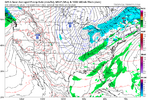
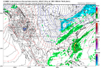
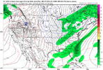
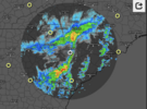
Obviously a different setup but as of 0z Monday, neither the GFS, Euro or AIFS showed rain making it north of Columbia yesterday. I ended up seeing rain for a couple hours in Pineville, just south of Charlotte, and saw some heavy reflectivity yesterday down towards the Chester and Lancaster areas. Below is a screenshot of the radar at 10 am yesterday morning.
LongRanger
Member
So for places like upstate, is this a Rate Driven type deal?
For our area (central NC), the model trends have been good. Even the 6z GFS backing off (stopped westward trend/less amped) was better specifically for us, and folks down east. I really liked the look of the 6z NAM. It was about to drop the hammer on RDU. 850s were already dropping, surface 2m temps were in the upper 30s, with dew points in the mid teens.
6z NAM hour 84 _mid-day Sunday:
View attachment 183682
Now do I believe it? Not really. But no less than all the other models.
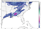
The NAM is well the NAM with the truck loads of salt attached to the nonliability waiver one must sign to look at at the thing. That said, this may be an all time NAM'ing for south AL. It has 7 inches on the ground and still puking snow.
iGRXY
Member
iGRXY
Member
It's rate driven basically everywhere east of the mountains.So for places like upstate, is this a Rate Driven type deal?
Brent
Member
My man has conviction. Better than a lot of these back and forth Mets on social media these days. Go down with the ship if need be
I can't say I really blame him in Alabama. I get 2014 happened and it makes me laugh too but on the other side I thought my parents were guaranteed to get buried last year and it didn't happen haha
iGRXY
Member
Mahomeless
Member
Fully expecting additional changes today. Globals have been in their worst verification timeframe over the past couple of days, shorter range models are in pretty good agreement, and this has the 500mb look for a classic Deep South snowstorm. A full on NAM'ing will happen today across AL/GA/NC....should be fun to see. Outside of watching it fall from the sky, this is one of the best things about being a weather nerd.
Ok, then do you agree with Webb that the Carolinas are going to see LESS snow from this system if it is amped up like the GFS, which brings in more snow than the flat overrunning Euro? Not trying to be difficult but trying to make the semantics clear for everyone on the forum. Plus, everyone keeps saying “NW trend”, as if this would make it rain in their neighborhood, when in reality this just creates more dynamics that would help feed a southern snowstorm, not turn it to rain.Yes, the American model output (GFS/NAM) have more of a heavy mid-level frontogenesis look to them as opposed to a prolonged warm advection / overrunning look - and this is because cold air is crashing in from the west as the precip gets going and the mid level isotherms are packing. But it becomes moot if the weaker coastal scraper solution comes to pass
jetstream30
Member
Is there still an option for the storm to be a coastal/eastern nc hit or is that looking less likely? Or are will still at all options possible?
Webberweather53
Meteorologist
I think it is just a matter of semantics, but how the “overrunning” occurs is very different between the two camps, and the dynamics that cause the lift is more like a Miller A storm in my opinion with the GFS camp.
Winter storm types always fall on a spectrum, but this isn’t a classic miller type a setup where you have a strong coastal cyclone throwing precip back into the colder air to the NW and then the coastal low is really driving in strong cold advection that crashes the entire column. It’s there of course but this is very weak in this case and not the main driver of your precipitation, as I showed earlier.
When you get these types of Miller A events, usually we have blocking to the north to slow everything down & amp the trough/coastal, that’s obviously not happening here because the background flow is very fast and progressive.
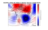
The background pattern is more like Jan 2014 (overrunning) than it is a coastal low
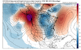
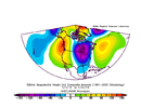
The surface features also don’t look right for a miller type an event in NC. There’s a surface low over the Great Plains where a surface high should be! Again, no high-latitude blocking either with the wrong sign of anomalies over Greenland.
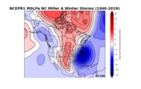
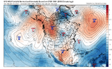
iGRXY
Member
Looking at the 850 and 700 FGEN on the NAM through hr 51 and you're already getting more of it
Oof paywallAllan has a good update this morning.
Sent from my iPhone using Tapatalk
So far, so good. In fact, it looks to be tilting a bit sooner on this run so far. The money frames coming soon.
View attachment 183702
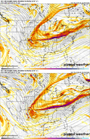
Doesn't that backside energy into New Mexico also appear stronger too? It'll one hell of a run if it uses it.
iGRXY
Member
The base already looks stronger so farSo far, so good. In fact, it looks to be tilting a bit sooner on this run so far. The money frames coming soon.
View attachment 183702
Bigedd09
Member
NAM definitely looks a tad more amped over Texas at hour 54
Sent from my iPhone using Tapatalk
Sent from my iPhone using Tapatalk
Tsappfrog20
Member
Oof paywall
Sorry here is the just of what he said..
At this point I do not trust the regional/hi-res models like the NAM/RRFS in the 60-84 hour time frame as they are very dependent on GFS boundary conditions and will often look like the previous run of the GFS. When we get inside 48-60 hours, then I will use those more.
So right now, I think the ECMWF is probably too suppressed/dry. But this is not a slam dunk winter storm because of the lack of an established cold air mass in place. We will be in the 50s on Saturday! So cold air will need to work in and meet the moisture at the right time. Right now, I would likely favor a light to perhaps moderate snow event over the interior SE including much of NC east of the mountains, but I am no where near ready to narrow it down more than that. Hopefully we get some model convergence today.
Sent from my iPhone using Tapatalk
Webberweather53
Meteorologist
NWS RAH AFD is generally how I feel about this event.
There’s a very narrow/limited range of scenarios where this system works out for the Carolinas. We will have to thread the needle much more than usual to get this to play out in our favor and I see a lot of red flags here that make me hesitant to fully buy in

And even if it does, getting accumulating snow will be a challenge with very marginal surface temperatures and poor diurnal timing (during the daytime).

There’s a very narrow/limited range of scenarios where this system works out for the Carolinas. We will have to thread the needle much more than usual to get this to play out in our favor and I see a lot of red flags here that make me hesitant to fully buy in

And even if it does, getting accumulating snow will be a challenge with very marginal surface temperatures and poor diurnal timing (during the daytime).

iGRXY
Member
I will be shocked if this isn't a big boom run by the NAM. At least precip wise
Yes, indeed. That caught my eye, too. Some light snow is associated with that bundle in TX.View attachment 183704
Doesn't that backside energy into New Mexico also appear stronger too? It'll one hell of a run if it uses it.
