• Hello, please take a minute to check out our awesome content, contributed by the wonderful members of our community. We hope you'll add your own thoughts and opinions by making a free account!

Wintry Jan 15-16 Winter Storm Discussion & Obs

1PM Update
27.3°F
Extreme SW Mitchell County, NC
Mainly sleet for the last 2-3 hours…looks like we’ve picked up 6-8 inches of snow
 

Attachments

  • 0E827BB1-9679-4C4D-8227-37C49BACF2B6.jpeg
    0E827BB1-9679-4C4D-8227-37C49BACF2B6.jpeg
    3 MB · Views: 31
I guess we’re going to escape with minimal icing at this point given surface temps are creeping up close to freezing and the IP continues. Might changeover for a little bit, but no way we’re getting 0.2”+ like forecasted.
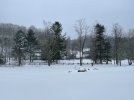
I'm getting freezing rain now, but even here it shouldn't be too bad:
aaaa1.jpg
 
Transferring energy to coastal and it's about to go boom, look at the cooling cloud top streaks along SC coast

1642357319328.gif

pmsl.gif
 
I’m honestly surprised how long sleet has held on here.
Ditto. It hammered to.
Noticed we get snow sounding back around 6 to 630. Future radar shows a nice little band around 830 to 930. Mtns have a big backside band at this time. Be a great way to cap off with a half inch to inch. We have had to had over 2 inches of sleet heading toward 3. This on the inch of snowfall.
 
Light freezing rain here but you with 850’s crashing and under freezing this is due to no moisture yet in the DGZ but snow reports back in Greenville tells me that’s changing quickly. Honestly looks like some snow trying to mix with it but it’s too hard to tell yet.
 
Back
Top