HugeSnowStick
Member
Yes, welcome to April! It looks like these temps will be here for three days and then, after a short "normal" period, returning next weekend. It will probably erase all of the negative departures so far and most locations will end up at or above normal for the overall monthly average. My average temp for the month is already up to 39 degrees just from today alone. It was at 36 prior to this. I think the daily average is about 45 for my area. I have 7.5" of rain since 1/1/2024!REALLY?

I just got back home and emptied 4.1" out of my gauge and I'm right there with you at 10.7" for the month.It's not even over yet and this is what I have for the month so far. Too bad this wasn't the snow total but the drought's almost gone.
View attachment 143388

It will be at or above before January ends, though.Crazy we have these precip totals and we’re running around 5 degrees below normal for the month of January and no snow

I’m not sure where you’re getting 5 degrees below normal but Atlanta is at 2 below normal for the month.Crazy we have these precip totals and we’re running around 5 degrees below normal for the month of January and no snow
You’re normally better than this. It’s been documented well enough on here that Atlanta is skewed well above stations nearby and in all directions.I’m not sure where you’re getting 5 degrees below normal but Atlanta is at 2 below normal for the month.
You’re normally better than this. It’s been documented well enough on here that Atlanta is skewed well above stations nearby and in all directions.
Take him to school @J.C.
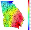
Today and tomorrow will erase all deficits, everywhere in GA.KPDK is -3
KFTY is -3.4
Carrollton is -3.8
Dallas is -4.8
KATL is -2.4
All of these are after factoring in yesterday.
Unfortunately.Today and tomorrow will erase all deficits, everywhere in GA.
Makes sense, you are around 38.85 for a daily average and I'm at 40.5. Average is around 45 I think, though it's rising daily now that we are approaching February. I doubt she holds below average. Got a good bit of rain, which is expected. I think this winter season has played out as expected for my area. Hopefully we can keep the "cool" season going to suppress the severe season in April.Unfortunately.
I'm at 48.1F/29.6F and rapidly going up.