You’re talking about the Crusher in 2000… these discussions are from the 1/23-24/2003 storm that gave CLT 9” of 40:1 ratio powder when the forecasts were for 1-2”. It was from a very strong clipper that was enhanced by a mesolow that formed over the western SC upstate. The mesolow began showing on short range models during the afternoon with 8 hours of the snow expected to start… GSP referred to it a “the fly in the ointment” in there afternoon discussions.Never forget this one. Had just had like .2 frzng rain minor event still on limbs from Saturday. Monday morn news they talking how models had missed ns energy by a 1000 miles and that light snow,beleive atlanta, n ga was occuring. Then later that day had got up to charlotte. But at 6pm news triad ,nws said maybe 1-3 overnight,more off to east. The Fish on chanel 5 evening news Triangle, started honking Raleigh was gonna see its bigest storm ever possibly overnight. As of 11pm triad news guys where filming from Montgomery county, snow was pouring, we where getting lighter snow, about 2 inches and they still insisted 1 to 3 max down our way. Well overnight we caught the pivot as storm went beast mode and I had 15, time you got to eastern part county into chatham triangle 20+ by sunrise. Back towards winston, yadkinvilke, almost nada.
Yall have to understand internet was dial up,new,infant stages still. Only way we got weather was radio,tv. What made bastardi so famous,would come on AM radio every morning wsjs and talk weather for 4 mins max. The good ole days. That dable of ice helped catch every snowflake on trees. Lost power for 7 straight days. Temps hit near 0 next couple nights. Then a few days latter we caught another 5 incher all snow on top
-
Hello, please take a minute to check out our awesome content, contributed by the wonderful members of our community. We hope you'll add your own thoughts and opinions by making a free account!
You are using an out of date browser. It may not display this or other websites correctly.
You should upgrade or use an alternative browser.
You should upgrade or use an alternative browser.
Pattern Jammin January 2024
- Thread starter SD
- Start date
olhausen
Member
48 degrees with rain did the snow in Finally. The next 8 days are going to bring that average January temp back up!


StormStalker
Member
We still have snow/ice in many yards and some roads. It’s unreal the staying power this stuff has.
NCHighCountryWX
Member
- Joined
- Dec 28, 2016
- Messages
- 476
- Reaction score
- 1,323
Snow Reports from Saturday from Raysweather:
Howard's Knob
Watauga
8
There is about 8 inches total at the end of 1/20/24. The strong winds created deep (~24 inches) drifting in this area.
Wolf Laurel
Madison
7.5
Finished with 7.5 inches. Total includes report from yesterday. Snow lasted until 7pm. Currently-3°
Calloway Gap
Ashe
2.5
0.5 new snow overnight. Soft, powdery, fluffy and brrrr
Livingston Farms (Fletcher)
Buncombe
0.25
A light dusting
Grassy Creek Community (Spruce Pine)
Mitchell
3
Total snowfall for yesterday, 1/19/24 is 3 inches
Kenilworth, Asheville
Buncombe
0.3
Although snow showers continued, the accumulation at 9 am is the same as 5 pm yesterday.
Mountain City, TN
Johnson
4
Snow continued falling all through the night
Dogtown Reporter (Minneapolis, NC)
Avery
5.8
At 12:30 today we have a total of almost 6 inches. It's hard to measure with the wind and the leftover snow from the Monday and Tuesday event. It's currently snowing lightly (arctic haze) at 2:30. I will report at the end of the day or late evening, if we have more accumulation.
Upper Laurel
Madison
1.5
Snow flurries accumulated an additional 1.5 inches of snow overnight (measured at 8AM). The snow flurries started this morning and tapered off at about 5 PM. Moderate dusting but not measurable except for the 1.5 inches recorded early this morning.
Creston (Sutherland Valley)
Ashe
10.5
Snow total so far from today and yesterday. Was 4" by sunset Friday night, then another 6.5" overnight. Total 10.5 by 8:20 am Saturday. Still snowing, but light as of noon. Wind starting to pick up. Never mind, it's snowing again.
Fines Creek
Haywood
4
steady light to moderate snow fell overnight only flurries remain as of 8am, temp at 8am is 3 degrees
Valle Crucis -- Mast Store Annex
Watauga
1.5
Additional snow accumulation overnight. Strong winds and brutally cold single digit temps.
Twin Rivers/Foscoe
Watauga
5
Heavy snow continued most of Friday beginning with a glazing of ice. Totals of 5 more inches with the base of 6 inches last week. Without the strong winds,our accumulations would be greater.
Amelia Community
Alleghany
0
Snow flurries with no accumulation.
Jefferson (Ashe Family Central)
Ashe
1
1 inch of snow and calm winds
Zionville
Watauga
8.5
8.5” at 1 p.m. all flurries have stopped.
Winkler's Creek Road
Watauga
7
Additional light snow overnight, storm totals 7” by 9:00 AM.
Beaverdam (North Asheville)
Buncombe
0
on and off flurries and snow showers continued overnight in Beaverdam N Asheville. An additional inch for a total so far of 1.6. Temp is 11 at 10:00
Devil's Fork Gap
Madison
2.7
At 7am the temp is 5 with calm wind. We have 2.7 inches of powdery snow in the last 24 hours with 1.2 inches since 5pm yesterday. We have about 5 inches of snow pack on the ground.
Aho-Sorrento
Watauga
2
An additional 2 inches of really dry snow overnight
Arborcrest Gardens/Boone
Watauga
8
(8" is the storm total since the snow started Fri morning. ) Let's be honest folks. This is sorta fun (the first big one of the season always is as long as you are warm and safe inside your home with no frozen pipes or power outgages) Has now been snowing without a complete break for 24 hours. Yesterday's strong winds have created some 2-3' drifts this morning. But the winds have quieted down at least so far this morning (10-15mph range) allowing the snow to 'stick' on the Fraser firs and other evergreens here in the gardens-really pretty.
Faust
Madison
1.5
Dawn: fluffy dry snow fell after midnight. Not currently snowing. Looks like ideal skiing powder. Certainly a set of snowshoes would aid a woodswalk.
Mountain Glen
Avery
10.3
Taken 12:34 pm. Fairway # 1 Mountain Glenn GC
Beech Mountain - Fred's
Avery
7
Appalachian Ski Mountain area
Watauga
3
As of 7:45 am this morning add another 3 inches to yesterdays 4 inches here at ASM. Winds are starting to increase now so feel certain there will be some significant drifting. It is now 5 degrees and the "Arctic Haze" Ray often speaks of is in full effect today. Stay warm folks!
Hardin Park Elementary
Watauga
7
12:45 am update- 7 inches, still snowing.
Three Top/Bluff Valley
Ashe
4
8:00 Saturday we're at about 4". Light snow is still falling.
Canton (Newfound Road)
Haywood
0
A light dusting of snow
Galax-Downtown
Galax
0
An additional very light accumulation this morning from overnight flurries. Not enough to measure. Very cold but no wind as of right now.
Bolens Creek
Yancey
2.1
At 8:00 AM it is 9 degrees F on Bolens Creek. We got a bit more snow through the night.
Blowing Rock
Watauga
2
Additional 2 inches.
Little Peak Creek (New River)
Ashe
1.3
Snow flurries yesterday added another 1.3 inches so today, there's 3 inches of frozen, crunchy snow on the ground with a very fluffy, lite 1-1.3 inches added to that. Skies are mostly cloudy with the sun peaking out here & there with 17 degrees at 1PM
Ashe Lake
Ashe
0.1
Just a dusting overnight covering yesterday's light snow, but near zero at 8:00 a.m. Now sunny at noon; nothing melting, very slippery outside.
Stony Fork
Watauga
0.5
With an additional half inch that fell overnight, there is almost an inch at 7:00 am. 13 degrees here.
Bethel
Watauga
9
2” of new snow fell overnight, bringing the 8:00 am total to 9” from this Friday-Saturday storm.
Idlewild
Ashe
0.25
2.1 inches total from yesterday and today. We received 0.25 inches since midnight and is currently just flurries and 9 degrees at 7 am.
Hopewell Church Community/Green Valley
Watauga
8.25
10;am Well been waiting a long time for this big snow A snow spotter's dream! We had additional snow fall last night of about 1-1.5 in Hard to tell exactly how much because of wind blown snow, but after taking 4- 5 measurements around the yard our total is 8 in. Temp is 8 with light flurry action. ENJOY THE NC MOUNTAIN SNOW STAY SAFE AND WARM!
Vilas
Watauga
3
Amount since start on Friday. Probably had more but wind blew it around.
Shady Valley, TN
Johnson
9.5
This is the total for all accumulation this week. Steady snow fall continuing .
Watauga Falls (Sugar Grove)
Watauga
7
Got about 2 inches overnight to add onto the 5 from yesterday (Friday)
Mills River
Henderson
0
Temperature at 7:00 AM 9 degrees F. Trace amount of snow on grassy surfaces.
Little Switzerland
Mitchell
3
Its hard to get an accurate measurement because of the wind but my best estimate is 3 inches for the storm total from yesterday and last night as of Saturday 8am
Roan Mountain TN, Upper Shell Creek
Carter
8
Total of 8 inches for this storm. Western facing slope over 3200 ft. Snow has finally stopped at 5:30 pm
Westwood Elementary
Ashe
2
This is Friday- Saturday morning 8:30am.
Deep Gap (Parkway School)
Watauga
2
2 inches of additional overnight powdery snow
Meat Camp
Watauga
8
Additional snow over night raised the total from this snowfall from 4.5" to 8".
Elk Trail (Asheville)
Buncombe
1.5
As of 8:00 a.m. an inch and a half on open ground. Temp was 6.5.
Fairview, NC (Whitaker)
Buncombe
0.2
Light dusting overnight 1/19-1/20 covering grass.
Oak Grove
Watauga
12
10:45 am. Light snow falling so thinking that it's over for the most part. 12" in most parts of the yard. Waiting for the plow to clear the road.
Blairmont
Watauga
5
5 inches Total from storm. Average from drifts / low spots
Sugar Mountain Ski Resort
Avery
4
Peoria (near the NC/TN Border)
Watauga
4.2
Continued snow throughout the night, light to moderate snow showers continue this morning.
Seven Devils
Watauga
7
Elev 4032, as of 9am: The 2 day total (1/19-1/20) is around 7”. Could be a little more, could be a little less. It’s impossible to get an accurate measurement with the extreme wind and prior snow from 1/15.
Obids
Ashe
0.3
Light snow and flurries overnight and this morning. Total for two days about 2.3 inches. 10 degrees at 7:20 AM.
Hamburg Mountain
Buncombe
0
10° this morning, very cloudy with flurries and maybe 2 inches of snow where it has not been disturbed.
Heavenly Mountain
Watauga
5
There is approximately 5 inches of total snowfall on the ground since yesterday. It is very difficult to measure due to high winds and being situated on the very top of the mountain. It appears that we only got an additional .5 inch since last night, and it has been a relatively calm day, with bouts of flurries. We are definitely not experiencing the active snowfall that downtown Boone has been today (looking at the live webcam).
Dutch Creek
Watauga
0
No additional accumulation today. At least 10 inches on ground total. No melt today
Bald Mtn Township
Watauga
1
Hard to measure but about an inch was added to totals from yesterday.
Big Pine Valley, Marshall, NC
Madison
6
What a snow!! Six inches is storm total.
Bamboo
Watauga
0.1
only light snow and flurries since sunrise.
Gap Creek Fleetwood
Watauga
1
Little overnight accumulation accompanied by strong winds and single digit temps.
Howards Knob
Watauga
13
As of 1:00A.M we are at 11". On heavy snow blown areas, we are over 2.5ft. At this time, snow is still falling at a steady pace and winds are light, but not heavy like Friday. We will see what the rest of the day has in store. We are already at negative Temps. Dreading tomorrow. Stay safe, and stay home! As of 1:00 P.M- Snow continued through the night, dumping an additional 2 inches. Currently on and off flurries, bad a brief few hours this morning of a null and pretty calm besides the temps. Still have a heavy artic haze, almost blinding when you have to hike in it to take care of a Ranch. Will update later!! Stay safe!!!
Cove Creek Elementary
Watauga
6.02
Snow accumulations are now at 6 inches. Lots of wind and snow drifts that are 1-2 feet deep.
ALEXANDER, NC Near Post Office
The most interesting thing about this storm… KCLT recorded officially 8.5” of snowfall at the airport on only 0.21” of liquid. A 40:1 ratio. To put that in perspective… everyone who remembers January 1988 remarks how fluffy that snow was, but even that one only had a 13:1 ratio in CLT.
I remember ET talking about that on tv the next day. You rarely even see 40:1 in the Great Lakes.The most interesting thing about this storm… KCLT recorded officially 8.5” of snowfall at the airport on only 0.21” of liquid. A 40:1 ratio. To put that in perspective… everyone who remembers January 1988 remarks how fluffy that snow was, but even that one only had a 13:1 ratio in CLT.
Yeah he said that typically the only places that in the lower 48 that come close to those types of ratios were the highest mountains of Utah and Colorado. I read some years ago that the piece of energy that developed into the clipper had originated between Alaska and Siberia which is why it had such unusually cold temperatures in the snow growth levels of the atmosphere. Even the night before ET had mentioned at 10pm just as the snow was moving into the area, very strangely from the west and northwest, that he was going with 2-4” for the CLT metro area despite the NWS only issuing a WWA for 1-2” because he believed that ratios would be higher… more in the range of 18-20:1 but he never expected them to go that high.I remember ET talking about that on tv the next day. You rarely even see 40:1 in the Great Lakes.
weatherfide
Member
- Joined
- Jan 5, 2017
- Messages
- 3,191
- Reaction score
- 4,738
Yellowstone weather
Member
Went to banner elk and beech mountain friday .Best snow I've seen in a long time. Looked at Ray's Weather before I went. They under forecast amounts by alot. Beech Mountain was a whiteout at times and even parts of boone had around 6 inches. Where is the most accurate place for mountain weather?
dsaur
Member
dsaur
Member
And that's why it's my favorite. I like to sled. I have steel runners, so it's got to be ice. Zr can do it, but fades pretty quickly. Sleet wants to stick around, and stays, and stays...lol. Even on really steep, and super long state road hills. Sleet wants Tony to sled and have a good time. It's mother nature that's the rub. For some reason she favors Ala, but not north central Ga. At least since the 90's. I'm older now and don't suffer as much when I see people close by enjoy My sleet ") It's taken me decades to become so sanguine. Thanks for the pic! I no longer feel it as a kick in the teeth in my old age, lol. Mostly because I know in my bones, it'll see another 2 or 4 inch sleet before I'm done. I had a low of 13.1 recently and a few days later a 12.3. That would have frozen the roads down good, if there had been rain falling into a cold column like you had. Get the rain, then worry about the cold. It's winter, it always gets cold, but it doesn't always rain when it gets cold. I'm much rather have rain and 33, then 18 and starry. I've had some snows, and I made a snow sled out of skis for runners, and it's fast on grass....but nothing like sleet on the state road hill. Throw in the bridge abutments at the bottom and you've got a thrill ride, though you can't see much because your eyes are watering, but you can sure feel it. Head down hill, eyes just inches off the pavement..I've been clocked near 30mph with my girl friend riding tandem. That's why I love sleet so much. Dang Mother Nature, give me some of the good stuff......please.
It's taken me decades to become so sanguine. Thanks for the pic! I no longer feel it as a kick in the teeth in my old age, lol. Mostly because I know in my bones, it'll see another 2 or 4 inch sleet before I'm done. I had a low of 13.1 recently and a few days later a 12.3. That would have frozen the roads down good, if there had been rain falling into a cold column like you had. Get the rain, then worry about the cold. It's winter, it always gets cold, but it doesn't always rain when it gets cold. I'm much rather have rain and 33, then 18 and starry. I've had some snows, and I made a snow sled out of skis for runners, and it's fast on grass....but nothing like sleet on the state road hill. Throw in the bridge abutments at the bottom and you've got a thrill ride, though you can't see much because your eyes are watering, but you can sure feel it. Head down hill, eyes just inches off the pavement..I've been clocked near 30mph with my girl friend riding tandem. That's why I love sleet so much. Dang Mother Nature, give me some of the good stuff......please.
It's taken me decades to become so sanguine. Thanks for the pic! I no longer feel it as a kick in the teeth in my old age, lol. Mostly because I know in my bones, it'll see another 2 or 4 inch sleet before I'm done. I had a low of 13.1 recently and a few days later a 12.3. That would have frozen the roads down good, if there had been rain falling into a cold column like you had. Get the rain, then worry about the cold. It's winter, it always gets cold, but it doesn't always rain when it gets cold. I'm much rather have rain and 33, then 18 and starry. I've had some snows, and I made a snow sled out of skis for runners, and it's fast on grass....but nothing like sleet on the state road hill. Throw in the bridge abutments at the bottom and you've got a thrill ride, though you can't see much because your eyes are watering, but you can sure feel it. Head down hill, eyes just inches off the pavement..I've been clocked near 30mph with my girl friend riding tandem. That's why I love sleet so much. Dang Mother Nature, give me some of the good stuff......please.

Felt like it should the morning of the World 600 vs this time of year when i left out for work.
What’s sad is that it was about 10 degrees cooler last year on the morning of the 600Felt like it should the morning of the World 600 vs this time of year when i left out for work.
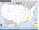
Here’s something you don’t see every day if ever. Country-wide dense fog reports. Wild 
Makeitsnow
Member
2.50 inches and counting. What a bust by the models from griffin to Athens which generally showed one or two TENTHS by now to at most 0.25. Judging by radar maybe another 0.25 to come here unless more redevelops. Of course the heaviest rainfall maybe yet to come with another few inches possible the next few days. Wouldn't be surprised to see totals over 6 inches by sat night in spots. That would push my monthly total to around 12.00 inches.
What I wouldn't give for it the models to bust this much if there is ever a winter storm here again.
What I wouldn't give for it the models to bust this much if there is ever a winter storm here again.
weatherfide
Member
- Joined
- Jan 5, 2017
- Messages
- 3,191
- Reaction score
- 4,738
About 1.37" at my house since midnight and it's 67 degrees. I'm gonna need the A/C tonight! First time I've turned it on since probably before Thanksgiving.
olhausen
Member
Driving home from work last night around midnight was scary. The ground being so cold with the warmer rain made for some serious fog. ?️Here’s something you don’t see every day if ever. Country-wide dense fog reports. Wild View attachment 143295
vsublazer
Member
Sitting right at 4.5 inches of rain since yesterday. Seriously, think I might need a boat for around here. All the local creeks that normally have a trickle of water are completely full.
weatherfide
Member
- Joined
- Jan 5, 2017
- Messages
- 3,191
- Reaction score
- 4,738
Boom! made it to 70 today! Yes!
Winning! Definitely going to switch to cooling on the A/C unit tonight!
Winning! Definitely going to switch to cooling on the A/C unit tonight!