Nashville NAMing at go timeWhat if these blues could meet up across the deep south ?

-
Hello, please take a minute to check out our awesome content, contributed by the wonderful members of our community. We hope you'll add your own thoughts and opinions by making a free account!
You are using an out of date browser. It may not display this or other websites correctly.
You should upgrade or use an alternative browser.
You should upgrade or use an alternative browser.
Pattern Jammin January 2024
- Thread starter SD
- Start date
rburrel2
Member
Some would have you think that's an ugly look to start February off with.What if these blues could meet up across the deep south ?

Seriously though, dang, you can't ask for a more titillating end of run progression.
Sorry dude only irrational posts todaySome would have you think that's an ugly look to start February off with.
Seriously though, dang, you can't ask for a more titillating end of run progression.
MichaelJ
Member
I think the period from the 10-20th February will be our best chance. east of the APPS We will likely warm up next week and turn cold again the following week unless the cold gets hung up in the APPS again, hard to tell for certain whether it does or not
That timeframe has always been a good one for storms as well as 22-27th. However start to lose interest by that timeI think the period from the 10-20th February will be our best chance. east of the APPS We will likely warm up next week and turn cold again the following week unless the cold gets hung up in the APPS again, hard to tell for certain whether it does or not
GoDuke
Member
Could make winter go from oof to woof in one day.Little split flow action ??
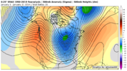
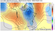
It sure does. Only difference is that there’s a noticeable STJLooks like January 2014 and January 2022. View attachment 142506View attachment 142507
The +PNA is coming. Im skeptical of blocking coming back as quickly as the weeklies show, the retrogression of the -WPO ridge to Siberia (which encourages jet extension via +EAMT is is responsible for ending the -NAO episode we’ve had, and encourages the main cold lobe/TPV around Baffin Bay. the EPO coming up on ens late jan, along with the western ridge might encourage future +NAMT events as well. I bet once the Aleutian low starts pumping in energy into the the US, it’ll encourage -NAO through wavebreaking with phasing waves off the EC
Itryatgolf
Member
Ridge over Alaska developing is interesting in time! Just a matter of when not if it gets cold again central plains east imoThe +PNA is coming. Im skeptical of blocking coming back as quickly as the weeklies show, the retrogression of the -WPO ridge to Siberia (which encourages jet extension via +EAMT is is responsible for ending the -NAO episode we’ve had, and encourages the main cold lobe/TPV around Baffin Bay. the EPO coming up on ens late jan, along with the western ridge might encourage future +NAMT events as well. I bet once the Aleutian low starts pumping in energy into the the US, it’ll encourage -NAO through wavebreaking with phasing waves off the EC
Yeah I’m not quite sure where this talk of a 3 week torch came from. Literally everything is pointing to basically around a 7 day warm up as the pattern reshuffles. Even as the warm up is happening you can see the processes unfolding that cools things back down fairly quickly. Yeah the blocking may not come back as quickly as we want, but you pointed out the main PV setting up around Baffin Bay often leads to a pseudo block like we saw in February 2014The +PNA is coming. Im skeptical of blocking coming back as quickly as the weeklies show, the retrogression of the -WPO ridge to Siberia (which encourages jet extension via +EAMT is is responsible for ending the -NAO episode we’ve had, and encourages the main cold lobe/TPV around Baffin Bay. the EPO coming up on ens late jan, along with the western ridge might encourage future +NAMT events as well. I bet once the Aleutian low starts pumping in energy into the the US, it’ll encourage -NAO through wavebreaking with phasing waves off the EC
griteater
Member
Some of these recent Euro Weekly and GEFS Ext runs pump the AK ridge, but then lose it pretty quickly via what looks like too much Pac Jet Extension, and don't bring the ridging back until mid-Feb. So, I think it's all about how much momentum is getting pumped into the Pac Jet via the +EAMT / MJO / Strong El Nino combo. Hopefully, we don't see the big extension and we'd be in pretty good shape early-mid FebThe +PNA is coming. Im skeptical of blocking coming back as quickly as the weeklies show, the retrogression of the -WPO ridge to Siberia (which encourages jet extension via +EAMT is is responsible for ending the -NAO episode we’ve had, and encourages the main cold lobe/TPV around Baffin Bay. the EPO coming up on ens late jan, along with the western ridge might encourage future +NAMT events as well. I bet once the Aleutian low starts pumping in energy into the the US, it’ll encourage -NAO through wavebreaking with phasing waves off the EC
Lol! A 2 day warm upIf it’s not gonna snow, might as well torch. This is allowable
View attachment 142493View attachment 142495
Iceagewhereartthou
Member
Legitimate question here; do we have any reason to expect the next cold outbreak to behave any differently than this one or any of the other recent ones? What will be different to drive this one east of the Apps?
No need to panic! March 1960 incoming…
Webberweather53
Meteorologist
Lol! A 2 day warm up
Never thought this late month warm-up would have much staying power at all, but it could be comparably potent (magnitude wise) to what we saw in December.
Yep. Putting all my jealousy and anger towards this winter aside, I’d say our 2nd shot this winter will probably be around 2/1-2/7, even if the western ridge is transient. My hope is getting some sort of TPV extension around Atlantic Canada and sneaking a southern wave, or digging something around the Rockies. we did it in jan 22, we can do it again. We have the tools showing up around the 31st on all ens (western ridge that’s poleward) and a TPV/cold lobe on our side, in NA. I’d say biggest concern is if we torch the heck out of late jan, will recovery be an issue ?Some of these recent Euro Weekly and GEFS Ext runs pump the AK ridge, but then lose it pretty quickly via what looks like too much Pac Jet Extension, and don't bring the ridging back until mid-Feb. So, I think it's all about how much momentum is getting pumped into the Pac Jet via the +EAMT / MJO / Strong El Nino combo. Hopefully, we don't see the big extension and we'd be in pretty good shape early-mid Feb
griteater
Member
Long range crap shoot, but the MJO and rising AAM would favor the trough not dumping and staying in the West in late Jan / early Feb. We are in the opposite mode with the MJO/AAM here in early-mid Jan.Legitimate question here; do we have any reason to expect the next cold outbreak to behave any differently than this one or any of the other recent ones? What will be different to drive this one east of the Apps?
Here is the Weekly MJO Update from NOAA:


