-
Hello, please take a minute to check out our awesome content, contributed by the wonderful members of our community. We hope you'll add your own thoughts and opinions by making a free account!
You are using an out of date browser. It may not display this or other websites correctly.
You should upgrade or use an alternative browser.
You should upgrade or use an alternative browser.
Pattern Jammin January 2024
- Thread starter SD
- Start date
If we went the 2015 route I'd die in excitement that 2 week period was epic
griteater
Member
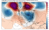
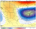
In first image here from last night's Euro, the surface high is stuck back to the west (behind the big SE Canada TPV), and the low is allowed to cut up thru WV since the heights aren't lowered off the NE coast.Thanks Grit. So let me get educated here please and make sure i have this right. We need the the TPV to be further east, so the confluence between the blocking ridge and the TPV feed south further east, over the Carolinas, rather than over the Mississippi River as shown. That allows high pressure to flow down further east, and keeps the storm track to our south.
As shown, the cold is muted because the TPV is too far west, and still allows cutters, once they gets east past the confluence over the Mississippi. Is that generally correct? Thanks.

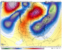
Here in this image prior to your favorite storm, the TPV is weaker, but it extends to the south out off the NE and Mid-Atl coast, with ridge behind it over MN. Sfc high in S Wisconsin. Sfc low in the gulf with wave moving east over TX. The extended, lowered heights off the NE coast don't allow the storm to cut inland - instead, it is forced to slide ENE

Many ways to get winter storms, but I'm just pointing out a key difference in the 2 setups. The Greenland Block helps to get the lowered heights off the NE coast (not the only way), but the configuration doesn't always work out each time a block / -NAO forms.
LukeBarrette
im north of 90% of people on here so yeah
Meteorology Student
Member
2024 Supporter
2017-2023 Supporter
As many have been saying El Niños are back loaded, this progression would support that
NoSnowATL
Member
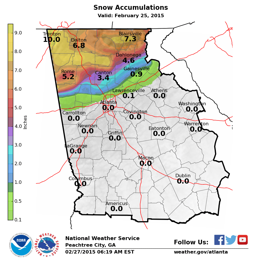
If we went the 2015 route I'd die in excitement that 2 week period was epic
NoSnowATL
Member
Iceagewhereartthou
Member
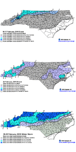
I'm almost afraid to ask but do you guys have any maps for SC for the Feb 2015 time frame? That period doesn't stand out to me at all, so that may be my answer right there.
I don't have maps but GSP got 3.7" that month. Probably not what NC got and was a below average year but I'd kill for 3.7" right now.I'm almost afraid to ask but do you guys have any maps for SC for the Feb 2015 time frame? That period doesn't stand out to me at all, so that may be my answer right there.
rburrel2
Member
I'm almost afraid to ask but do you guys have any maps for SC for the Feb 2015 time frame? That period doesn't stand out to me at all, so that may be my answer right there.
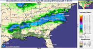
| February 16, 2015 | 1 inch of sleet 1/10th inch of ice | min temp of 27 | huge bust in our favor, models at 31/32 temp and freezing rain to rain, got 90% sleet and just a little freezing rain, wetbulbed to around 27 and temp was still 31 as final band came through |
| February 24, 2015 | 1 inch snow | ||
| February 26, 2015 | 0.7 inch snow | epic bust by forecasters... they(nws) were calling for 9-11 as the event was unfolding but boundary layer too warm |
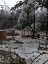
That 2/16/15 storm had very poorly modeled temps all the way to NE Georgia…I remember there were areas there that got over 1/2” of ice accrual when they were forecasted to not go below 35-36. MBY ended up with 1” of sleet and about .2” of ice with temperatures in the mid 20s the whole event. If I remember correctly a mesohigh developed over northern VA that wasn’t modeled and it kept the CAD stronger and deeper than models were showing. The NAM was almost 10 degrees too warm in some areas
February 16, 2015 1 inch of sleet 1/10th inch of ice min temp of 27 huge bust in our favor, models at 31/32 temp and freezing rain to rain, got 90% sleet and just a little freezing rain, wetbulbed to around 27 and temp was still 31 as final band came through February 24, 2015 1 inch snow February 26, 2015 0.7 inch snow epic bust by forecasters... they(nws) were calling for 9-11 as the event was unfolding but boundary layer too warm
Drizzle Snizzle
Member
nothing for the I-20 corridor
Cary_Snow95
Member
Iceagewhereartthou
Member
rburrel2
Member
Yep, and dew points were much lower than forecasted with the airmass in place ahead of the storm, (for whatever reason). All the short range models were way off with dew points even 18 hours before the event began.That 2/16/15 storm had very poorly modeled temps all the way to NE Georgia…I remember there were areas there that got over 1/2” of ice accrual when they were forecasted to not go below 35-36. MBY ended up with 1” of sleet and about .2” of ice with temperatures in the mid 20s the whole event. If I remember correctly a mesohigh developed over northern VA that wasn’t modeled and it kept the CAD stronger and deeper than models were showing. The NAM was almost 10 degrees too warm in some areas
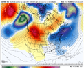
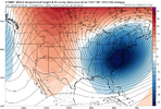
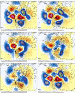
it’s eerily similar how the large scale pattern progression is to dec 2021/jan 2022. The difference this time is, we will already have an initially equatorial shifted pac jet. But it’s almost the exact same evolution to that time. Initial AK/Aleutian ridge, which destroys the -NAO via +NAMT, the cutoff ridge retrogrades to Siberia, adds a significant amount of momentum to the pacific jet, it extends, and boom a big +PNA. Love to see it 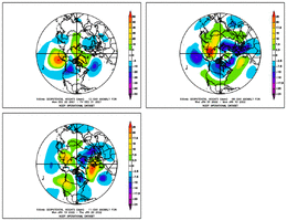


Itryatgolf
Member
Well I hope this opens up better opportunities at winter weather moving forward if this indeed happens but hopefully the cold air source is still availableit’s eerily similar how the large scale pattern progression is to dec 2021/jan 2022. The difference this time is, we will already have an initially equatorial shifted pac jet. But it’s almost the exact same evolution to that time. Initial AK/Aleutian ridge, which destroys the -NAO via +NAMT, the cutoff ridge retrogrades to Siberia, adds a significant amount of momentum to the pacific jet, it extends, and boom a big +PNA. Love to see it View attachment 141181View attachment 141182
Yeap. I remember pulling up to my house listening to the weather on radio. He was saying we dodged a bullet. I saw icicles on my birdfeeder and was thinking how weird. Boy were they wrong. It was a mess.That 2/16/15 storm had very poorly modeled temps all the way to NE Georgia…I remember there were areas there that got over 1/2” of ice accrual when they were forecasted to not go below 35-36. MBY ended up with 1” of sleet and about .2” of ice with temperatures in the mid 20s the whole event. If I remember correctly a mesohigh developed over northern VA that wasn’t modeled and it kept the CAD stronger and deeper than models were showing. The NAM was almost 10 degrees too warm in some areas

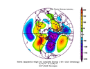
.png)
