-
Hello, please take a minute to check out our awesome content, contributed by the wonderful members of our community. We hope you'll add your own thoughts and opinions by making a free account!
You are using an out of date browser. It may not display this or other websites correctly.
You should upgrade or use an alternative browser.
You should upgrade or use an alternative browser.
Pattern Jammin January 2024
- Thread starter SD
- Start date
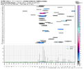
I will make the thread this evening if the 12z models hold serve.View attachment 140809
One week out.. when do we pull the new thread trigger on this one?
NWMSGuy
Member
Getting somewhat excited for us here in the Mid-South. Anyone believe we may be looking at snow ratio's higher than 10:1?
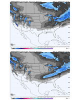
1" contour almost into the triad thereSeems like a good bet a good chunk of TN, n-AL have a great chance.
12z v/s 0z
View attachment 140823
That’s a good look for being that far out.Seems like a good bet a good chunk of TN, n-AL have a great chance.
12z v/s 0z
View attachment 140823
JLL1973
Member
absolutely. looks like temps could be in the lower 20s when the precip beginsGetting somewhat excited for us here in the Mid-South. Anyone believe we may be looking at snow ratio's higher than 10:1?
Hmm.


UNCSC
Member
This will be fun for all our TN folksHmm.


Yep. Still gets held up west of the Appellations.This will be fun for all our TN folks
But man, what a front!
UNCSC
Member
Seems like the past couple years, being east of aps is such a curse. Every front gets held up, and every storm will miss because we can’t buy a storm that will digYep. Still gets held up west of the Appellations.
But man, what a front!

JLL1973
Member
much less precip for midsouth area on 12z gfs
UNCSC
Member
GFS is a big drop in snow for everyone, but still low pressure sitting right off coast with cold air near by. The way for east of aps to score is that coastal low that has shown up the past few runs.
Showmeyourtds
Member
Cold push doesn't seem to be quite as strong either on 12z
much less precip for midsouth area on 12z gfs
You’re going to get several different looks. No need to focus on one run. You look at the overall picture.GFS is a big drop in snow for everyone, but still low pressure sitting right off coast with cold air near by. The way for east of aps to score is that coastal low that has shown up the past few runs.
UNCSC
Member
7 days out stuff starts getting weird every single timeYou’re going to get several different looks. No need to focus on one run. You look at the overall picture.
JLL1973
Member
no doubt. just like the cmc increased amountsYou’re going to get several different looks. No need to focus on one run. You look at the overall picture.
That low popping on the front and bringing snow to the tidewater is how those of us east of north of 64 and east of I-74 can score next week

