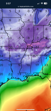
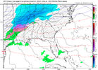
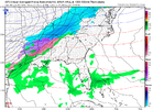
Signal seems to be the strongest in the border counties in the north central and northeastern piedmont. Even Halifax airport in Northampton had 21/30
-
Hello, please take a minute to check out our awesome content, contributed by the wonderful members of our community. We hope you'll add your own thoughts and opinions by making a free account!
You are using an out of date browser. It may not display this or other websites correctly.
You should upgrade or use an alternative browser.
You should upgrade or use an alternative browser.
Pattern Jammin January 2024
- Thread starter SD
- Start date
CNCsnwfan1210
Member
@BullCityWx do you have both ensemble (EPS GEFS) temp graphs for KJNX?
Sent from my SM-A136U1 using Tapatalk
Sent from my SM-A136U1 using Tapatalk
10/30 at JNX but that was up from 2/30 at 12z ?
CNCsnwfan1210
Member
Need to keep that up for sure10/30 at JNX but that was up from 2/30 at 12z
Sent from my SM-A136U1 using Tapatalk
JLL1973
Member
My man! ? LolSignal seems to be the strongest in the border counties in the north central and northeastern piedmont. Even Halifax airport in Northampton had 21/30
Well yall are leading the pack for onceMy man! ? Lol
ghost1
Member
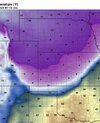
Just once I want to experience a blue northerView attachment 140687
Check out this insane temp gradient
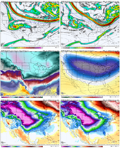
Probably even better for the western area too? Correct?Fwiw the 18z EPS/control looks better. In fact the height field suppression on the control is just as good, if not slightly better then last nights 00z run, which lead to a colder SE Vs last nights run, which would probably bode well for the storm. View attachment 140685
Probably the closest thing to it we’ve ever had in the NC Piedmont in my lifetime was when the backdoor cold front pushed through as the February 1994 ice storm approached. It was pretty amazing to go home from school one day and play basketball outside with temperatures in the upper 70s and then the next day be driving home from school in a raging sleet storm with temperatures in the mid 20s.Just once I want to experience a blue norther
BHS1975
Member
Just once I want to experience a blue norther
We get red southers all the time lol.
Sent from my iPhone using Tapatalk
Brent
Member
Just once I want to experience a blue norther
It's gonna be hard to top the one in December 2022 here. We went from 40s to a flash freeze in 15 minutes. I had never seen a front like that and I've been in the Plains for 8 years now
griteater
Member
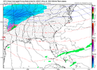
12z UKMet had a weaker, more suppressed look with snow breaking out from Shreveport to Tupelo at the end. 1st image loop is comparison of the Euro vs. UKMet at the end at hr168


I don't hate this look at the end of the 00Z ICON.
Arctic air pressing down with west to wsw flow aloft with a little bagginess in the SW US.


Arctic air pressing down with west to wsw flow aloft with a little bagginess in the SW US.
UNCSC
Member
Seems like the 16th is a no go for upstate and piedmont. Going to cut through alps or TN and cold air chasing moisture. We all know that never works anywhere in Carolina’s outside of the mountains. But the pattern coming up seems almost almost guaranteed to score. But we also are very good at screwing up great patterns.I don't hate this look at the end of the 00Z ICON.
Arctic air pressing down with west to wsw flow aloft with a little bagginess in the SW US.


GFS looks slightly faster/colder with the intrusion but not a huge change from last run so far


