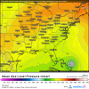
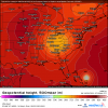
Imo the full latitude more progressive trough on the latest euro is much less threatening than the runs run the cutoff
-
Hello, please take a minute to check out our awesome content, contributed by the wonderful members of our community. We hope you'll add your own thoughts and opinions by making a free account!
You are using an out of date browser. It may not display this or other websites correctly.
You should upgrade or use an alternative browser.
You should upgrade or use an alternative browser.
Tropical Hurricane Sam
- Thread starter SD
- Start date
Yikes GFS is a hurricane landfall where Hurricane Larry just took out their seawall. Newfoundland.Clear break in the modeling as it approaches the islands. The gfs hooks it out for the recurve but the euro keeps is steadily WNW.
Shaggy
Member
pretty well defined center now nd it should be named today i think. We will see what the models do with this now clear LLC position.
pretty well defined center now nd it should be named today i think. We will see what the models do with this now clear LLC position.
The stronger it gets, the better the chance for a safe recurve per models.
The first test ^ looking at the new version of the euro from yesterday there is spread over Heberts box #1. To qualify a hurricane must pass inside it with winds of 110…this is probably why many are watching closely as 98L could have those winds by then. Hopefully it misses the box as seen in some spread. I know that’s largely tied to south Florida but given the intensity it could qualify. Should 98L miss all those ensemble intensity forecasts you could still get a weak storm passing just outside the box and end up with something like Hurricane Floyd. TLDR; we wait and see on what the intensity is and if it goes through the box or not. Too much uncertainty at this range.

Last edited:
Shaggy
Member
Euro coming in a touch NE so far and really different with the upstream system in New England
Brent
Member
TD 18 probably coming at 5
Downeastnc
Member
ForsythSnow
Moderator
TD 18 now, up to a 3 at day 5
Brent
Member
Henry2326
Member
Henry2326
Member
so we have the NHC going for the CAT 3 intensity to qualify for the Hebert box ? but it’s honestly 50-50 does it track into it or not? The ensembles that do look very bad for the Bahamas ??
Henry2326
Member
Downeastnc
Member
Yeah the SE Bahamas and just east of there is the danger zone for NC, this map highlights that very well......NC's Herbert Box is 65W 25N south of that point and moving WNW or NW is trouble.
Henry2326
Member
Downeastnc
Member
Downeastnc
Member
Hard to trust the GFS and its big hundreds of miles shifts run to run........still at this point it looks like a turn and track east of Bermuda seems to be supported much more than a threat to the SE
Last edited:
Downeastnc
Member
Sam is recurving here but would it still hit further up the east coast? We'll never know because this run is over!

Was not recurving much still moving NW on the last 3 plots, extrap it out and it would be SC/NC border, the real key is the ULL over the lower Ohio valley, that makes me very nervous.....

If that ULL drifts SW at all we got problems...assuming this is what the map actually looks like in 10 days....

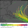
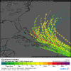
0Z EPS is at this point more threatening than the prior run but we'll see what % recurve before the CONUS. Looks like an arrow pointed for the CONUS here but I still expect a good % to recurve pretty sharply later in the run. We'll know soon:

Edit: Most did recurve sharply and only a couple of members hit the CONUS (NC).


Edit: Most did recurve sharply and only a couple of members hit the CONUS (NC).

Last edited:
Downeastnc
Member
accu35
Member
I'm more interested in the gulf storm that the gfs has been showing past few runs now
Almost giving me Hugo VibesWas not recurving much still moving NW on the last 3 plots, extrap it out and it would be SC/NC border, the real key is the ULL over the lower Ohio valley, that makes me very nervous.....
View attachment 91338
If that ULL drifts SW at all we got problems...assuming this is what the map actually looks like in 10 days....
View attachment 91339
Downeastnc
Member
Almost giving me Hugo Vibes
If that ULL was 200 miles further SW and not moving much we would have problems......06Z GFS crushes Bermuda, another 300 mile shift for the GFS.
Right still got time to trend that way the ULL was in northeast on earlier runs.If that ULL was 200 miles further SW and not moving much we would have problems......06Z GFS crushes Bermuda
Henry2326
Member
Henry2326
Member
Yeah just about out of time for a completely clean recurve here and numerous less that desirable scenarios are possible. It's good to see many of the eps on the map posted above with an earlier safer turn and just looking through the eps data we have a few around here that produce high rain totals but the wind gusts aren't anything crazy so I'm assuming they are more related to the ull/fronts than Sam. Playing with fire here though any model adjustments toward the euro are not good but if the Euro goes toward other models then it's not a big deal for most posters on this boardWas not recurving much still moving NW on the last 3 plots, extrap it out and it would be SC/NC border, the real key is the ULL over the lower Ohio valley, that makes me very nervous.....
View attachment 91338
If that ULL drifts SW at all we got problems...assuming this is what the map actually looks like in 10 days....
View attachment 91339
Downeastnc
Member
At least the general trend of the eps has been south/stronger with the trough and the axis stays off shore. If the mean starts backing the trough axis west and getting more of a cut off look it might be time to get nervous View attachment 91344
Need to dig up some maps of what the setup was for Fran, seems she had a fairly similar path to what the 00Z Euro showed and had a ULL over the mid deep south if I recall correctly that let her come more NW and deep inland....
Interesting should this storm miss the s/e a lot of areas look to go 384+ hours without any rain per model consensus. A weakened state would be nice like a CAT1 otherwise the weather is set to be fairly dry. Feast or famine take your pick.
Yeah I believe that's right. In this case, there's a awful lot of work that needs to be done for a big SE hit. A track avoiding the SE is highly favored right now.Need to dig up some maps of what the setup was for Fran, seems she had a fairly similar path to what the 00Z Euro showed and had a ULL over the mid deep south if I recall correctly that let her come more NW and deep inland....
Just looking at the upper air analogs from the GFS and finding systems active at the time you have:
Josephine 1984
Daisy 1962
Ginny 1963
Sutrop Depression 22 2005
Jeanne 2004
Josephine 1984
Daisy 1962
Ginny 1963
Sutrop Depression 22 2005
Jeanne 2004
Henry2326
Member


