• Hello, please take a minute to check out our awesome content, contributed by the wonderful members of our community. We hope you'll add your own thoughts and opinions by making a free account!

Tropical Hurricane Milton

12Z UKMET is out: I use mainly for track not intensity though it continues to trend stronger as it catches up like usual. It initialized its position well and landfalls further N than the 0Z’s Naples with it near or possibly slightly N of Ft. Myers per my estimate based on the text (see below). I’ll have to see the 6 hour maps later when they’re released to better pinpoint its landfall point but it’s clearly further N though still S of the ICON/GFS:

MET OFFICE TROPICAL CYCLONE GUIDANCE FOR NORTH-EAST PACIFIC AND ATLANTIC

GLOBAL MODEL DATA TIME 1200UTC 06.10.2024

TROPICAL STORM MILTON ANALYSED POSITION : 22.5N 95.0W

ATCF IDENTIFIER : AL142024

LEAD CENTRAL MAXIMUM WIND
VERIFYING TIME TIME POSITION PRESSURE (MB) SPEED (KNOTS)
-------------- ---- -------- ------------- -------------
1200UTC 06.10.2024 0 22.5N 95.0W 1003 30
0000UTC 07.10.2024 12 22.0N 93.2W 1000 32
1200UTC 07.10.2024 24 21.6N 91.6W 997 37
0000UTC 08.10.2024 36 22.1N 89.3W 993 40
1200UTC 08.10.2024 48 23.0N 87.2W 989 41
0000UTC 09.10.2024 60 24.2N 85.1W 987 42
1200UTC 09.10.2024 72 26.2N 82.7W 987 48
0000UTC 10.10.2024 84 28.2N 80.1W 990 49
1200UTC 10.10.2024 96 29.4N 76.9W 987 71
0000UTC 11.10.2024 108 30.9N 70.9W 992 53
1200UTC 11.10.2024 120 30.6N 65.4W 1000 54
0000UTC 12.10.2024 132 30.6N 59.8W 1007 36
1200UTC 12.10.2024 144 CEASED TRACKING
 
I have numerous family members in Bradenton and Tampa.....most of them will not leave during hurricanes.....they are "set" in their ways

Oh, the family that has been there for a bit has evacuated for one hurricane, but honestly, idk if they would here as they have a generator now.

In all honesty, as I think about it, the aunt that has been there for a year or two probably has no choice but to leave her condo (and she was saying that she'd probably leave under similar circumstances occurring again). She's near water (not the beach though I don't think) and based off the flood warnings, the water has not receded.
 
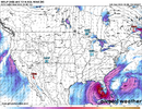
12Z GEFS tells me these things:

- Mean further N than last few runs with it near Tampa

- Only 4 of its 30 members (13%) are as far N as the operational

- GEFS means continue for whatever reason to be S of the operational run. Anyone know why?
Edit: The answer may be that members are run at lower resolution and thus are mainly weaker than the GFS op. With them weaker, they’re track on further S in the progged atmospheric env.
 
12Z GEFS tells me these things:

- Mean further N than last few runs with it near Tampa

- Only 4 of its 30 members (13%) are as far N as the operational

- GEFS means continue for whatever reason to be S of the operational run. Anyone know why?
I would think intensity. Are the four northern members intense solutions as well?
 
I would think intensity. Are the four northern members intense solutions as well?

It is weird as it depends on the source. Whereas Pivotal and WxBell don’t show these N members notably stronger vs others, TT does. For whatever reason, TT tends to have lower SLPs for GEFS and perhaps other ensemble members in general. I wonder why. I wouldn’t think that TT, itself, can run them at higher resolution.
 
12Z UKMET is out: I use mainly for track not intensity though it continues to trend stronger as it catches up like usual. It initialized its position well and landfalls further N than the 0Z’s Naples with it near or possibly slightly N of Ft. Myers per my estimate based on the text (see below). I’ll have to see the 6 hour maps later when they’re released to better pinpoint its landfall point but it’s clearly further N though still S of the ICON/GFS:

MET OFFICE TROPICAL CYCLONE GUIDANCE FOR NORTH-EAST PACIFIC AND ATLANTIC

GLOBAL MODEL DATA TIME 1200UTC 06.10.2024

TROPICAL STORM MILTON ANALYSED POSITION : 22.5N 95.0W

ATCF IDENTIFIER : AL142024

LEAD CENTRAL MAXIMUM WIND
VERIFYING TIME TIME POSITION PRESSURE (MB) SPEED (KNOTS)
-------------- ---- -------- ------------- -------------
1200UTC 06.10.2024 0 22.5N 95.0W 1003 30
0000UTC 07.10.2024 12 22.0N 93.2W 1000 32
1200UTC 07.10.2024 24 21.6N 91.6W 997 37
0000UTC 08.10.2024 36 22.1N 89.3W 993 40
1200UTC 08.10.2024 48 23.0N 87.2W 989 41
0000UTC 09.10.2024 60 24.2N 85.1W 987 42
1200UTC 09.10.2024 72 26.2N 82.7W 987 48
0000UTC 10.10.2024 84 28.2N 80.1W 990 49
1200UTC 10.10.2024 96 29.4N 76.9W 987 71
0000UTC 11.10.2024 108 30.9N 70.9W 992 53
1200UTC 11.10.2024 120 30.6N 65.4W 1000 54
0000UTC 12.10.2024 132 30.6N 59.8W 1007 36
1200UTC 12.10.2024 144 CEASED TRACKING
1728235658109.png
 
It is weird as it depends on the source. Whereas Pivotal and WxBell don’t show these N members notably stronger vs others, TT does. For whatever reason, TT tends to have lower SLPs for GEFS and perhaps other ensemble members in general. I wonder why. I wouldn’t think that TT, itself, can run them at higher resolution.
I'm not sure. I pretty much use RAL and TT for all tropical weather.

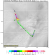
Regarding intensity, both HAFS A and B along with the HWRF bring Milton to CAT 5 intensity by 48 hours! That 200 Mb steering is of great interest to me regarding a further north path into Florida.
 
Back
Top