• Hello, please take a minute to check out our awesome content, contributed by the wonderful members of our community. We hope you'll add your own thoughts and opinions by making a free account!

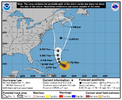
Tropical Hurricane Lee

20232500910-20232501440-GOES16-ABI-AL132023-GEOCOLOR-1000x1000.gif
 
I had not paid much attention to path of the hurricane models until I read them mentioned in the latest NHC discussion, they are all south of most guidance (not that I expect much beyond that to change). Thought it interesting that the 06 runs of the hurricane models had Lee moving almost due west at end of their run (which is only out to 126) so still would curve beyond that
 
11 am discussion
Good grief....


Many of the models are calling for remarkable rates of intensification, beyond rates normally seen with model forecasts.
Both HAFS models forecast Lee to exceed 150 kt within the next 2 days, and even HCCA brings the hurricane above the category 5 threshold.

The NHC intensity forecast has been shifted significantly higher, but is actually within the guidance envelope. It should be stressed that internal dynamics (eyewall replacement cycles) will become a factor with the maximum strength of Lee as it becomes a major hurricane.

This is almost certain to lead to fluctuations in intensity that are
beyond our ability to forecast at these lead times.

Hurricane Hunteraircraft are scheduled to investigate Lee beginning this evening and overnight, which should provide extremely useful information about Lee's intensity during the coming days.
 
Just like 1995. We may get something yet though from the gulf like we did with Opal that year. The season may very well last longer than usual due to warm water temperatures.
Caribbean October. 1954 I believe Ms. Hazel. That's the jack in the box imo. Caribbean is at a broil. Need a fancy digging, neg trough to pull it up seaboard.

ohc_naQG3_ddc.gif


at195409.gif
 
Probably correct that at the 5 PM advisory.

Yeah. I'm thinking there will be a massive correction by 5PM. Dvorak Data-T estimates of 5.5 at 11:00am. Now up to 6.2 Raw T. This will be a category 4 by the time HH flies into the storm with pressures near 950Mb.


Hurricane Lee Discussion Number 9
NWS National Hurricane Center Miami FL AL132023
1100 AM AST Thu Sep 07 2023

Lee is rapidly intensifying. Early this morning, a well-defined
low-to mid-level eye was observed in microwave imagery, a signal
that is often a precursor rapid intensification (RI). Since then,
Lee has developed an eye in visible and infrared imagery, with
subjective Dvorak Data-T estimates quickly increasing to as high as
5.5 during the past hour or so. Satellite classifications supported
an intensity of around 80 kt at 1200 UTC, but given the significant
improvement in Lee's appearance since then, the advisory intensity
is set at 90 kt.
 
With the size the Wind field is projected to be its great that its looking like a miss
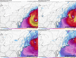
Just looking at the GFS, it’s still showing a 953mb as it’s moving over the southern tip of New Foundland close to St John’s. It would likely have a massive wind field by then.
 
Last edited:
Back
Top