• Hello, please take a minute to check out our awesome content, contributed by the wonderful members of our community. We hope you'll add your own thoughts and opinions by making a free account!

Tropical Hurricane Jose

Yeah looks like ridge is building to me.... is it plausible that mother nature has decided every state from Tx all the way around the gulf and up the EC needs to get a storm this year. Holy crap
ecmwf_z500aNorm_watl_8.png
 
There are so many different elements at play here. H5 will be critical in determining the path as the remnants of Irma may sweep it out to sea. It would be devastating and absolutely chaotic if somehow the remnants of Irma captured Jose and slammed it into the East coast. Not sure if that could happen, or Jose gets shoved south more.
 
Yeah there's a lot of elements to Jose's future track, but it's been trending further south & west in the longer term in general & given how NWP (even the EPS) handled the strength of the AB high w/ Irma, it definitely makes one a little bit uncomfortable to see guidance already hinting at a storm backing WSW yet again underneath a burgeoning subtropical high in the Atlantic....
 
It's way farther north than Irma with a trough approaching so it would be OTS


Sent from my iPhone using Tapatalk
 
It's way farther north than Irma with a trough approaching so it would be OTS


Sent from my iPhone using Tapatalk

I wouldn't necessarily say that... Jose actually misses the trough on the European and gets shunted back W-WSW as a ridge builds near the east coast and over top of the storm by day 6-7.
Jose's journey OTS is liable to be quite muddled and may become increasingly difficult if he misses the first trough on day 4-5 (which is becoming more likely).
ecmwf_z500a_atl_11.png
 
Yeah but I've never seen and there has never been that I know of a storm come in from the east. The ne US is a different story.


Sent from my iPhone using Tapatalk
 
Yeah but I've never seen and there has never been that I know of a storm come in from the east. The ne is a different story.


Sent from my iPhone using Tapatalk

But you're also assuming that the storm will be due east of NC when (if) it gets stuck underneath the ridge, it may end up further to the NE or even further SW (as we've seen of late). In any case, it has happened before as recently as 2002.
at200211.gif

at196704.gif

1933 Chesapeake-Potomac hurricane went over Bermuda and still hit NC/VA.
at193308.gif

There's also a storm in 1901 that formed halfway between Bermuda & the Azores and still ended up in the Gulf of Mexico
Screen Shot 2017-09-08 at 3.18.22 PM.png

These are just a few examples...
 
Last edited:
Whoa that's crazy. With global warming I bet tracks will get even wackier with the expansion of subtropical ridging.


Sent from my iPhone using Tapatalk
 
Whoa that's crazy. With global warming I bet tracks will get even wackier with the expansion of subtropical ridging.


Sent from my iPhone using Tapatalk
We don't knot to my knowledge whether or not it has anything to do with GW. I honestly don't believe this season has anything to do with it. Extremes happen, and unless we get a season like this for the next 50 years, I don't thing the "GW = more storms, more dangerous storms" argument stands well. Cherry picking isn't going to go well either by saying this year is a sign of GW's impacts. There have been whacky tracks in the past, as Webber posted above. They just happen in the right conditions.
 
Jose misses the initial trough on the 18z GFS and does a cyclonic loop w/ Jose and is turning back westward by 144 HR, similar to the ECMWF/UKMET solutions...
gfs_mslp_wind_watl_25.png
 
Looks like it hit some cooler water cause the clouds warmed up quickly.


Sent from my iPhone using Tapatalk
 
18z GEFS trying to catch onto the idea of Jose doing a cyclonic loop in the SW Atlantic and getting steered back westward towards the Bahamas thereafter. Obviously a lot to sort out between now & then...
gfs-ememb_lowlocs_watl_36.png
 
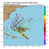
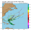
Model run down as of 6z 9/9...

GEFS
12L_gefs_latest.png

EPS
AL12_2017090900_ECENS_large.png

GEPS
12L_geps_latest.png
MOGREPS (UKMET ensemble)


Screen Shot 2017-09-09 at 8.33.13 AM.png


Generally speaking most NWP except Jose to slow down after day 3 once steering currents break down to his north and he will likely miss the initial trough passing to his NE on day 4-5. Thereafter, a ridge builds to his north and he is likely going to lose some latitude and undergo a cyclonic loop. Thereafter, it's very unclear where Jose will be, but this storm is liable to end up much closer to the US as a result of getting trapped underneath the subtropical high, especially in comparison to what was anticipated even a few days ago.... All interests in the Greater Antilles, Bahamas, and eastern US should continue to vigilantly monitor Jose in addition to Irma.
 
Yep NWP can't handle tropical cyclones losing latitude in the face of strengthening subtropical highs, probably going to keep trending southwestward w/ time unfortunately... Definitely bares watching in the southeastern US.
Incredible just freaking incredible.... this may be a hurricane season for the books no doubt!
 
Yep NWP can't handle tropical cyclones losing latitude in the face of strengthening subtropical highs, probably going to keep trending southwestward w/ time unfortunately... Definitely bares watching in the southeastern US.
Totally agree and there are multiple strong CV storms in the past as proof. Lack of sampling of the atmosphere over the ocean especially ridge dynamics through the vertical. And, I believe, lack of understanding of the interaction between large strong storms and the ridge itself.
Jose is in a different environment as opposed to Irma currently with a TUTT directly to it's NW in front of the main ridging instead of when Irma was in this position the TUTT was to the NE ahead of the main ridge. It will be interesting if this TUTT lifts out or moves NNW and as the ridging fill's in that space, to see how strong and how far west the main ridge will build. Imo that's what will decide Jose's fate and any conus affects. It really irks me that forecasters refuse to acknowledge model weaknesses/biases time and again and input their own skills into forecasts. Unless we are solidly in a generation of silicon reliant met's who just don't have the skills to forecast on their own anymore.
Just my :weenie: opinion
and brave the storm to come, for it surely looks like rain ...
wind and rain
 
12z eps suggests it stays offshore . But that's a long way out will change

Sent from my SM-J320VPP using Tapatalk
 
Yea the EPS was near Bermuda a few days ago and while they're offshore now the suite has been progressively creeping southwestward after Jose completes his cyclonic loop south of Bermuda.
 
And yet another crazy track, it's actually bending back NW in this frame.... I swear I believe Irma was in this spot on model runs at one point and we were thinking it was gonna hit Delmarva peninsula, then Va, then OBX, then SC....
gfs_mslp_pcpn_frzn_seus_36.png
 
Jose makes a run for the East Coast on the GFS, misses the OBX by about 200 miles

Looks like it may curve into the east coast north of the Carolinas at 222
 
Hooks into the Mid-Atlantic around MD/DE/NJ between 252 and 264 hours

I remember when Irma was doing this too
 
Overnight models still suggest Jose stays offshore. Still a long way to go
72d7bfe388b9bc2dbfbac209f51f6c73.jpg


Sent from my SM-J320VPP using Tapatalk
 
Lol GFS seems to be up to its usual tricks of decaying subtropical highs too quickly and plowing TCs into them. 12z looks stronger with the ridge north of Jose by day 5 and it may continue to trend stronger...
gfs_z500trend_atl_10.png
Unknown.gif
 
Back
Top