• Hello, please take a minute to check out our awesome content, contributed by the wonderful members of our community. We hope you'll add your own thoughts and opinions by making a free account!

Tropical Hurricane Dorian

215101_5day_cone_no_line_and_wind.png

SUMMARY OF 1100 PM EDT...0300 UTC...INFORMATION
-----------------------------------------------
LOCATION...26.9N 78.5W
ABOUT 30 MI...55 KM NNE OF FREEPORT GRAND BAHAMA ISLAND
ABOUT 100 MI...160 KM E OF WEST PALM BEACH FLORIDA
MAXIMUM SUSTAINED WINDS...130 MPH...215 KM/H
PRESENT MOVEMENT...STATIONARY
MINIMUM CENTRAL PRESSURE...946 MB...27.94 INCHES
 
I wish it were a credible tropical model, but maybe it is an indicator of favorable (more offshore) trends continuing. We can only hope. Meanwhile, Dorian is still not budging. Fascinating that these storms can remain stationary for so long!

Yeah i really didn't believe the stall would be so long honestly
 
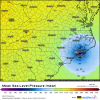
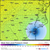
ICON is west of prior run after about hour 54. East Earlier. So the recurve is less sharp and maybe how close to FL early has no real influence on OBX impacts later?
 
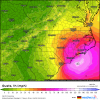
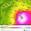
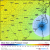
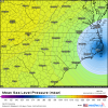
ICON still right over Emerald Isle into the Pamlico Sound...it has hurricane force gust coming onshore between SAV and Charleston and all the way up the SC coastal areas as well....

us_model-en-087-0_moddeu_2019090300_77_480_149.pngus_model-en-087-0_moddeu_2019090300_77_480_211.png

SC coast....not really familiar with how those places do in this setup though but I would think at least the immediate coast would see some big gust

us_model-en-087-0_moddeu_2019090300_61_487_211.png
 
Notice in the bottom image and most current that the WAR is building west, should get some movement later tonight or in the morning, finally

1567481856709.png

1567481880128.png
 
Trough weaker, more ridging over top, results touch slower and little closer to SC coast.... not moving NE yet either.

Might slam Wilmington this run
df9592ee9f229f24d9fd9e9a9229ebca.gif


Sent from my SM-G950U using Tapatalk
 
Current steering. Had to change levels since recon says we have a 950mb hurricane

wg8dlm4.gif
 
If ridge continues to build could this thing be push west.

like I was noting earlier, it seems like the weaker solutions are more west so it makes you wonder especially given the significant weakening that has happened today

the only thing I'm pretty sure if is it won't make the Gulf lol, anything else is still fair game
 
ICON still right over Emerald Isle into the Pamlico Sound...it has hurricane force gust coming onshore between SAV and Charleston and all the way up the SC coastal areas as well....

View attachment 22926View attachment 22927

SC coast....not really familiar with how those places do in this setup though but I would think at least the immediate coast would see some big gust

View attachment 22930

Winds along the coast would be absolutely brutal. Winds back into Berkeley and Dorchester Counties would have some reduction but not a whole hell of a lot. That's a very grim output from the Icon
 
Back
Top