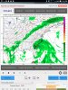
• Hello, please take a minute to check out our awesome content, contributed by the wonderful members of our community. We hope you'll add your own thoughts and opinions by making a free account!

Tropical Global Model Runs Discussion 2018

The 12Z FV3 illustrates quite well the forecasting nightmare that may be ahead and may last a long time. The run once again leaves behind a residual Leslie related 500 mb weakness long enough to attract Caribbean energy up E of FL on 10/9 instead of into the Gulf. Afterward, the very strong MidAtlantic states ridge gets established and traps it just off the SE US coast 3 days before finally moving NE OTS 10/13-14.
Larry,
Please. Keep broadcasting off shore ... :rolleyes:
Best!
Phil

PS ... Bastardi doesn't even have anything exciting, so we must be in a rut ... o_O
 
The 12Z FV3 illustrates quite well the forecasting nightmare that may be ahead and may last a long time. The run once again leaves behind a residual Leslie related 500 mb weakness long enough to attract Caribbean energy up E of FL on 10/9 instead of into the Gulf. Afterward, the very strong MidAtlantic states ridge gets established and traps it just off the SE US coast 3 days before finally moving NE OTS 10/13-14.
I see the Euro is showing some development as well but does not have that 500 mb weakness left behind by Leslie as the FV3 shows, either way this is certainly the hotbed to watch over the coming week or so.
 
Gotta watch the Caribbean over the next few days to see if anything can get going. A track toward the US would seem somewhat possible if development occurred

Sent from my SM-G955U using Tapatalk
You called it and all models are hinting at something now.... certainly something to watch.
 
Last edited:
The 12Z FV3 illustrates quite well the forecasting nightmare that may be ahead and may last a long time. The run once again leaves behind a residual Leslie related 500 mb weakness long enough to attract Caribbean energy up E of FL on 10/9 instead of into the Gulf. Afterward, the very strong MidAtlantic states ridge gets established and traps it just off the SE US coast 3 days before finally moving NE OTS 10/13-14.

I've been watching and hoping that every "next" run swings it out to sea, quickly.. The 12z FV3 scenario is a horrible possibility. It will paralyze the coast of south and north Carolina, maybe Georgia and North Florida too, with evacuations and waiting to see "where she stops, and nobody knows". Better than getting slammed!
Any scenario with positioning for any model version, predicts a possible ugly picture in the next 2 weeks for somebody. (Except Euro OP...can you see if any members are running with the other models?)
 
12Z Euro 228 just off SE FL in NW Bahamas. Weak. Then moves NNE (stays off FL) as ridging to north starts to weaken. I’d bet that later maps would have recurved it offshore the US as ridging would very likely keep pulling out/weaken. Different scenario of many possibilities.
 
12Z Euro 228 just off SE FL in NW Bahamas. Weak. Then moves NNE (stays off FL) as ridging to north starts to weaken. I’d bet that later maps would have recurved it offshore the US as ridging would very likely keep pulling out/weaken. Different scenario of many possibilities.
Move to banter if appropriate ... but sounds much like a US Senate committee hearing ... LOL
~~~~~~~~
Actually, Larry, watching tropics here with interest ... not up to prognosticating, but am up to say ... "Oh, possible "poop" " ... :eek:
 
Move to banter if appropriate ... but sounds much like a US Senate committee hearing ... LOL
~~~~~~~~
Actually, Larry, watching tropics here with interest ... not up to prognosticating, but am up to say ... "Oh, possible "poop" " ... :eek:
Hahaha....hopefully in the end we find both with unnecessary drama. :)
 
The 12Z EPS is more active than the prior run and is a huge mess with numerous members with TCs, many of which are Hs, hitting the CONUS TX-NC 10/9-13+.
 
12Z EPS: I count close to 30 TCs from the 51 members with ~17 Hs, 7 of which slam into FL 10/10-15 along with one near miss and several TSs. All of the 7 Hs that hit FL come off the Gulf with the highest concentration Big Bend to Ft. Myers. Parts of every state TX-NC get hit by at least one member within the 10/10-15 timeframe though in some cases from overland.
 
12Z EPS: I count close to 30 TCs from the 51 members with ~17 Hs, 7 of which slam into FL 10/10-15 along with one near miss and several TSs. All of the 7 Hs that hit FL come off the Gulf with the highest concentration Big Bend to Ft. Myers. Parts of every state TX-NC get hit by at least one member within the 10/10-15 timeframe though in some cases from overland.
'Tis the season ... :mad:
~~~~~~~~
Larry,
Can you toss up a couple maps ... just in time for Sunday dinner? ... o_O
 
Going in to Wiki right this moment!
Thanks!!!!
BTW ...
View attachment 6612
Not to add to the fire as it is, but... toss this run it's the 18Z.
gfs_mslp_pcpn_frzn_seus_40.png
 
I would give a 95% chance of landfall in the US if a TC ends up right east of FL. If it goes OTS we will all be rejoicing due to the beat down of the ridge. Ive about given up hope of that.
 
18z FV3.....same general direction, Georgia/Carolinas, but doesn't spin it up. Sits for a couple of days.
 

Attachments

  • Screenshot_20180930-211654.jpg
    Screenshot_20180930-211654.jpg
    1.9 MB · Views: 31
Looks like the feature disappears or is much weaker and further south on the 0z gfs/fv3. Thoughts ?
 
Looks like the feature disappears or is much weaker and further south on the 0z gfs/fv3. Thoughts ?
At 06Z it's back... all models still show something coming out of the Caribbean but they will be all over the place until something actually develops, then and only then will we have some idea (although as we've seen only a vague idea) of what may or may not happen. One thing appears certain pressure will be falling that region and it certainly looks primed for something to develop but beyond that is anybody's guess.
 
Last edited:
Back
Top