• Hello, please take a minute to check out our awesome content, contributed by the wonderful members of our community. We hope you'll add your own thoughts and opinions by making a free account!

Misc General Banter Thread

The GFS doesn't love ATL at all...GFS, you owe us from that bull you pulled last week. Flurries at best for ATL area. The GFS and Euro are worlds apart. Even GFS doesn't match the AIGFS.

Yep!

For my intents and purposes, I continue to be fine with literally EVERY model run except for the GFS.

GFS 👎👎👎 , though I might could head to the northern part of the CSRA with that depiction. I'm 50/50 on it...I've never driven on icy roads.
 
I'm not sharing. Thanks
tiny lister friday movie GIF
 
I feel like a walk-on player on the football team. We get to watch all these winter events from the sidelines. Always close to the action, but only get on the field if it's 63-3. Looks like we're only up 35-7 in the 4th here, but I am praying for 3 quick TDs and just a little action.
 
I dont think at this point it is hyperbole to say we may not only be looking at a generational event but what we may consider THE event of our lifetimes.
If I am going to get screwed out of my trip to Charlotte this weekend, it better be a big dog! A 2-4" won't cut it! Give me 6-12"+!!!!! ⛄ ⛄ ⛄

I'm worried my hopes are getting too high now! :D

With 2-4", I may still go there and see how it goes, but with some of these snow totals, I am not sure I'd be able to make it back to my house, LOL!
 
I mean what do you even put out there as a tv met for your first call. 1-3 and leave room to go up tomorrow evening .
 
That rule where you take the lowest QPF model (which for 12z is UKMET) and divide by two would blank the entire state of NC.
Not true for the southern areas, but yeah I would rather have every model onboard to some degree. Still not particularly concerned about it.
 
This is a butt pucker situation for the central Piedmont. Being in the bullseye of the CMC/GFS combo has an uneasy feel to it. But we got the WeatherNxt trending better, so maybe so.

Would love to have the Euro/UK combo honking too for the large doggie.

Looking good though. I'm sitting pretty in the Morganton Minimum.
 
And on that note--imagine how much RDU would have gotten if Jan 2000 was all snow??? 💧☔

View attachment 190670
I know the Triangle started as rain with that one, but how much rain did they get before changing over? I think we in GSO started as snow from the beginning (assuming my eight-year old self remembers it right), although we had a lot less liquid equivalent to work with, anyways.
 
I know the Triangle started as rain with that one, but how much rain did they get before changing over? I think we in GSO started as snow from the beginning (assuming my eight-year old self remembers it right), although we had a lot less liquid equivalent to work with, anyways.
I think your memory is correct. I was in Thomasville for that one. Took awhile for the column to saturate but it was all snow once it did.

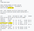
I was looking through archives on Jan 2000 awhile back and randomly found the RDU rain obs at onset and legit LOLed.
 
Jeez if we lose this storm to a south trend after losing snow last week to a north trend that would be quite a disappointment


Sent from my iPhone using Tapatalk
 
For you guys from NC who best understand the Lee side of the Apps and how these scenarios play out.....do you anticipate those areas to benefit from the ULL? If so, are there any certain areas that tend to produce best? Im familiar with Maggie Valley, but nowhere else on the Lee side.
 
Back
Top