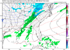
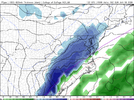
Like to hear it brother. hopefully we can get more than 0.9 this time.i think we are sitting okay; i'd be worried if i was sc coast right now. im thinking i20 north, as usual this time around
-
Hello, please take a minute to check out our awesome content, contributed by the wonderful members of our community. We hope you'll add your own thoughts and opinions by making a free account!
You are using an out of date browser. It may not display this or other websites correctly.
You should upgrade or use an alternative browser.
You should upgrade or use an alternative browser.
Misc General Banter Thread
- Thread starter Rain Cold
- Start date
LukeBarrette
im north of 90% of people on here so yeah
Meteorology Student
Member
2024 Supporter
2017-2023 Supporter
I think the sky is the limit on how far NW this really can come. There’s really no overly bearing sagging airmass it necessarily must carve around. And I still expect it to moderate a bit even still. Hoping is the fun partThe coastal storm last year was a different scenario due to the insanely negative AO which isn't as negative this go around. Hoping for more widespread snow further north this time.
- Joined
- Jan 23, 2021
- Messages
- 4,602
- Reaction score
- 15,197
- Location
- Lebanon Township, Durham County NC
how many accounts can one have over time here?You should stay in the banter thread.
packfan98
Moderator
Supposed to be one.how many accounts can one have over time here?
Drizzle Snizzle
Member
I think on Friday we’ll have a good idea of what may happen this weekend.
I mean..everybody’s a little too comfortable in here. And that makes me uncomfortableYou should stay in the banter thread.
May not be a sleet zone or at least a very narrow transition zone with this set up.Hard to hate the trends if you’re along the I-85 corridor in NC. Hoping we can stay west of the inevitable sleet zone, but at this point I wouldn’t even care if we got sleet. I am desperate for any type of winter weather or storm.
i want sound reasoning why it would turn to an apps runnerI mean..everybody’s a little too comfortable in here. And that makes me uncomfortable
No way. I’m not saying anything. Don’t put that hex on me.i want sound reasoning why it would turn to an apps runner
If it snows in Myrtle Beach this will be the 4th time in a year something frozen has fallen from the sky. Crazy!
If it snows in Myrtle Beach again that ain’t the only thing you should be looking for in the sky.If it snows in Myrtle Beach this will be the 4th time in a year something frozen has fallen from the sky. Crazy!
You can cut the tension with a knife right now. Reminds me of how we used to do the damn thing in here. Bring it don’t sing it 
Round Oak Weather
Member
We’re all fighting over every inchYou can cut the tension with a knife right now. Reminds me of how we used to do the damn thing in here. Bring it don’t sing it
You never know around here, lol. Always something going on.If it snows in Myrtle Beach again that ain’t the only thing you should be looking for in the sky.
im new here, you dont want to be in the bullseye in coastal regions right now, thats all i know
SnowNiner
Member
Once we get the synoptic details pinned down this thing is probably going to shift north and west, and possibly a good bit at that, even down to the 0 hour.
Overrunning events are basically driven by a large-scale warm front aloft “overrunning” a cold low level Arctic air mass. Models just plain suck with warm advection
Ok, we're talking about overrunning now? Great, this will be a good test to see if we can still get a good overrunning event for CLT area. Is it the January 1988 kind? Or 2014, that gave a car topper to most of the piedmont? Back in 22 we got a few car toppers from it. Sounds like the NW trend is car topper stuff, not 1988 stuff.
I'll take what I get at this point but I'm trying manage my expectations here.
That's the truth. If I need to head back to Sumter I just may do that. Long weekend. Last year was such a blessing.im new here, you dont want to be in the bullseye in coastal regions right now, thats all i know
broken025
Member
Bigedd09
Member
I wonder if the icon has a clue of. What it’s doing
Sent from my iPhone using Tapatalk
Sent from my iPhone using Tapatalk
WolfpackHomer91
Member
What do we need to make this a Bowling ball out over Baja ?
Bigedd09
Member
Yeah this gfs run is about to be wild
Sent from my iPhone using Tapatalk
Sent from my iPhone using Tapatalk
Webberweather53
Meteorologist
Ok, we're talking about overrunning now? Great, this will be a good test to see if we can still get a good overrunning event for CLT area. Is it the January 1988 kind? Or 2014, that gave a car topper to most of the piedmont? Back in 22 we got a few car toppers from it. Sounds like the NW trend is car topper stuff, not 1988 stuff.
I'll take what I get at this point but I'm trying manage my expectations here.
Overrunning around MLK Day is what I’ve been thinking for a while now. The overall pattern has a very 2014 feel to it.
Our best bet is to let the first system go by & then score a southern slider/overrunning type event around MLK Day after the big vortex drops in.
mydoortotheworld
Member
What’s the old tried and true saying??
Fear the NW trend!!!
Fear the NW trend!!!
broken025
Member
hate to say it; but one more tick like this is going to be bad for a lot of people i20 south. maybe the runner isn't impossible if this keeps up
Chill bumps
LukeBarrette
im north of 90% of people on here so yeah
Meteorology Student
Member
2024 Supporter
2017-2023 Supporter
Wow maybe Atlanta is in this thing. Not sold on this but wowzers
Hope you like snow or rain! To be determined! BOOM!
Webberweather53
Meteorologist
Ok, we're talking about overrunning now? Great, this will be a good test to see if we can still get a good overrunning event for CLT area. Is it the January 1988 kind? Or 2014, that gave a car topper to most of the piedmont? Back in 22 we got a few car toppers from it. Sounds like the NW trend is car topper stuff, not 1988 stuff.
I'll take what I get at this point but I'm trying manage my expectations here.
Compared to how Jan 2014 evolved, this event is ahead of schedule/more NW in the model world at this range. Though the models are better now than they were then, they still suck at forecasting warm advection & isentropic upglide.
Brent
Member
If it's already trending NW it's gonna trend out here haha *runs*
- Joined
- Jan 5, 2017
- Messages
- 3,770
- Reaction score
- 5,969
Gets should be telling in a bit.
Round Oak Weather
Member
Well I’m in the bullseye now that’s a wrap
GeorgiaGirl
Member
Okay we're seriously getting to the point where we're playing with fire for my intents and purposes.
This works on this run, but I'd love if it stopped now lol.
Would be a heck of a trend as is. From looking like not much to 2-3 inches of snow.
This works on this run, but I'd love if it stopped now lol.
Would be a heck of a trend as is. From looking like not much to 2-3 inches of snow.
broken025
Member
ok now I’m scared of west trend
technically, it ruined it for our sc coastal friends; inland areas of my area are next. too soon, congrats 85 NW. itll be tracking over sumter in the next few runs
GeorgiaGirl
Member
Well I’m in the bullseye now that’s a wrap
Yeah we're getting to a territory where we're seriously playing with fire.
Round Oak Weather
Member
I guess the expansive amount of snow in Georgia is a benefit but this is quickly heading northYeah we're getting to a territory where we're seriously playing with fire.


