He could let us know but I might delete my account if shetley scoredWe would all have to block @Jimmy Hypocracy if that happened we’d never hear the end
-
Hello, please take a minute to check out our awesome content, contributed by the wonderful members of our community. We hope you'll add your own thoughts and opinions by making a free account!
You are using an out of date browser. It may not display this or other websites correctly.
You should upgrade or use an alternative browser.
You should upgrade or use an alternative browser.
Pattern FEB 3-6 2024 System
- Thread starter SD
- Start date
- Status
- Not open for further replies.
NCSNOW
Member
They deserve it. Downslope capital of the eastern conus. 19 peaks to their nw back toward smoky mtn park at 6,000 feet. They Literally live in no mans land . About a half mile to far west for any coastalWe would all have to block @Jimmy Hypocracy if that happened we’d never hear the end
J1C1111
Member
Yes. I would agree. It sure seemed that way in winters of the past. In my opinion it just seems like everything has been all down hill after December of 2018 in the frozen department.Used to be way easier amirite?
Sent from my iPhone using Tapatalk
Carolina crusher hit Union county SC pretty big.They deserve it. Downslope capital of the eastern conus. 19 peaks to their nw back toward smoky mtn park at 6,000 feet. They Literally live in no mans land . About a half mile to far west for any coastal
A place called Buffalo SC got 24 inches out of that storm in Union county.
GVL county was the cut off and normally is of those coastal Storms.
Plus being in the shadow of mountains does often dry slot us here from down slopping.
NCSNOW
Member
NCSNOW
Member
NCSNOW
Member
dsaur
Member
Rosie gets snow with this one, good on her! Too bad it's probably fantasy.
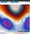
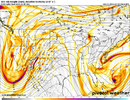
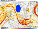
Yep. Probably just needed that trough down the WC off shore to pull the pattern west and allow for a little more poleward extension of the omega ridge. PAINIf this bleepin omega ridge is back west just a hair we are measuring snow in ft.
I hate snow and everything about it.
View attachment 144836
Yep...why I am not bullish for rest of winter. We haven't even sniffed anything remotely close to snow and what could go wrong has gone wrong. Some winters it wants to snow and some it works hard not to.Yep. Probably just needed that trough down the WC off shore to pull the pattern west and allow for a little more poleward extension of the omega ridge. PAIN
Something, something. Oh I give up....If this bleepin omega ridge is back west just a hair we are measuring snow in ft.
I hate snow and everything about it.
View attachment 144836

There’s still time. Remember the Carolina crusher no one knew til 30min before it started snowingIf this bleepin omega ridge is back west just a hair we are measuring snow in ft.
I hate snow and everything about it.
View attachment 144836
lexxnchloe
Member
Just wait till you see the 12Z gfs
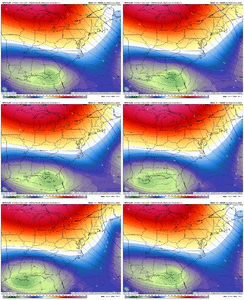
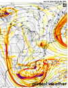
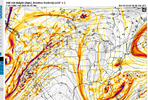
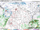
Nothing says we are almost there and 1 NW trend away like the 700mb low over lake Okeechobee
big win for apostles of the church of "we should worry about suppression". come join, plenty of room in this welcoming congregationNothing says we are almost there and 1 NW trend away like the 700mb low over lake Okeechobee
I am not quite ready to give up on this event at the coast. We are a 50-100 mile shift from seeing some precip and at ~100 hr forecast time, that is well within the range of modeling error. I am more concerned about the lack of real cold air at the coast.
I am not quite ready to give up on this event at the coast. We are a 50-100 mile shift from seeing some precip and at ~100 hr forecast time, that is well within the range of modeling error. I am more concerned about the lack of real cold air at the coast.

- Status
- Not open for further replies.

