• Hello, please take a minute to check out our awesome content, contributed by the wonderful members of our community. We hope you'll add your own thoughts and opinions by making a free account!

Wintry Feb. 19-20

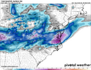
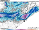
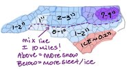
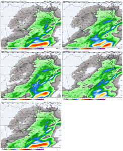
12km, 3km and GFS all on top of each other....clearly the jackpot area is going to be Elizabeth City to Norfolk and to Richmond. Raleigh is probably like 1-2" snow/sleet and GSO will crank out a 3-4" event like it usually does.

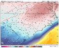
NAM's are great at sniffing out warm noses and it's a battle into southern Wake. But..atleast it's a battle.
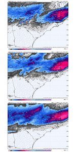
NAMGFS.gif
 
i honestly dont hate this nam run at alllllll. sure i might mix with some sleet in NE Durham but if this verified, id also be playing right up against the heaviest bands stemming from the snow side of the mixing line and im down for that game lol
 
For north ga..it might be noteworthy that dewpoints are running well below model projections right now...models generally have had dewpoints surging throughout the day and yet as of 3pm dps range are still in the teens in many areas (even single digits around atl) vs the nam/3km showing them at near 30 by 4pm. Gfs is about 10 to 15. degrees too warm. That's a pretty big difference if it holds. Although again precip will be light i suspect there will be more mixing and out right snow south of where the models have it...assuming there is enough precip. (Rome, Gainesville, Hartwell) . Just seeing flakes fall would be a win in my book..since this one has never been seen as anything here.
 
It's actually not so hard. Just draw a big circle around where Cold Rain lives and go for zero.

I live in lenoir not far from you and I promise climo will eventually win out over course of time. You’re in much better location now this winter has just been terrible for northern foothills


Sent from my iPhone using Tapatalk
 
At what point do globals become meaningless? 18hrs in?

In other words the 0zs tonight?
 
When convection is shaped like a funnel in Gulf, it helps, doesn't hurt. Wish Web or 1300m could explain this better than me. But its not a kiss of death, so long as it has that V ( funnel) shape. Its a good thing
That AND /OR following Orientation of The low it will create the firehose effect from Gulf. If the mods are only drying up bc of some make believe convection.... id say everyone chill for now. If these things cant even verify that Brent guys temp in the next 30 min really think its 100% pinned down these ungodly severe storms in the gulf? ummm no
 
18z RGEM is pretty similar to 12z, maybe a little worse. GSO gets a dusting, which would be quite a disaster for all the official forecasts. Raleigh 2-3". The GFS will save us.

EDIT: Ninja'd by @packfan98, oops!
 
For north ga..it might be noteworthy that dewpoints are running well below model projections right now...models generally have had dewpoints surging throughout the day and yet as of 3pm dps range are still in the teens in many areas (even single digits around atl) vs the nam/3km showing them at near 30 by 4pm. Gfs is about 10 to 15. degrees too warm. That's a pretty big difference if it holds. Although again precip will be light i suspect there will be more mixing and out right snow south of where the models have it...assuming there is enough precip. (Rome, Gainesville, Hartwell) . Just seeing flakes fall would be a win in my book..since this one has never been seen as anything here.
That's a valid point and should be monitored. Our biggest problem is qpf and we will have enough to cool the column. Only a few models show that and it's at best gonna be some token flakes I'm afraid. I'm still hanging on to that thread that @rburrel has been dangling out the window that we get an over performer in nw sc and ne ga. The radar trends and ground truth will be fun to watch tonight.
 
That's a valid point and should be monitored. Our biggest problem is qpf and we will have enough to cool the column. Only a few models show that and it's at best gonna be some token flakes I'm afraid. I'm still hanging on to that thread that @rburrel has been dangling out the window that we get an over performer in nw sc and ne ga. The radar trends and ground truth will be fun to watch tonight.
It's probably a rate driven thing here we will only see snow in the heavier bands of Precip. Lighter bands is gonna be rain and possibly some Sleet
 
Thoughts on timing of onset in siler city/pittsboro/ chapel hill? I work on the road in healthcare and wanting to make sure I’m home safe before the roads get the slightest bit dicey.. sorry if this is not appropriate place to post this inquiry..
 
Tomorrow reminds me of a slightly west version of Dec 2000...still the most painful bust I've ever experienced. Even if tomorrow is all rain wouldn't come close to Dec 2000.
I concur, that was the most painful bust. All models were advertising big amounts and ended up with flurries. Without a doubt the most disappointing bust in my life for sure.
 
Back
Top