Northfurther north or further south?
-
Hello, please take a minute to check out our awesome content, contributed by the wonderful members of our community. We hope you'll add your own thoughts and opinions by making a free account!
You are using an out of date browser. It may not display this or other websites correctly.
You should upgrade or use an alternative browser.
You should upgrade or use an alternative browser.
Louisiana steals my snow last month. Now their thunderstorms block my snow. That place is dead to me. I hope it breaks off and falls into the gulf
Nomanslandva
Member
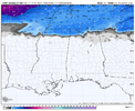
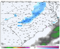
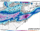
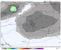
This is very odd. I know many models/runs have shown it but it will be interesting to see if it happens.Nam has it flurrying/light sn for most of night into the morning as well View attachment 170227
Stormlover
Member
That lee side skip is probably going to be there. That’s just the reality of the topography. It’s not that it doesn’t want to snow here. It just literally can’t
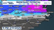
Snow map by bird bare with me 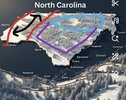 Red) mountains 2-4”+ Boone/Sparta, Black)relative min, light coating western Wilkes to 1.0” Mount airy, hickory, Red) 2”+ Salisbury, Winston-Salem, Concord, Purple)mixing issues 1-3” snow/sleet and ZR Raleigh to Charlotte, Blue) Greensboro 3-6” snow some sleet. Small zone of 6” along the Virginia state line maybe up to 10” crossing into Virginia.
 Red) mountains 2-4”+ Boone/Sparta, Black)relative min, light coating western Wilkes to 1.0” Mount airy, hickory, Red) 2”+ Salisbury, Winston-Salem, Concord, Purple)mixing issues 1-3” snow/sleet and ZR Raleigh to Charlotte, Blue) Greensboro 3-6” snow some sleet. Small zone of 6” along the Virginia state line maybe up to 10” crossing into Virginia.
Banter thread please, thanks
Pops
Member
Really don't know what to expect here in northwest bame..geez
And with that I'm out for the night before Ukie and Euro douse my dreams. Everyone try to behave please and keep banter in banter so @packfan98 and myself don't have to spend half our morning cleaning up, thanks!
mx3gsr92
Member
Will there be any high winds associated with this storm along the coast?
Chattownsnow
Member
Expect nothing and you will never be disappointed. Learned that the hard way lol. The only no doubter I’ve ever been through was the Jan 10, 2011Really don't know what to expect here in northwest bame..geez
interestedclimatist
Member
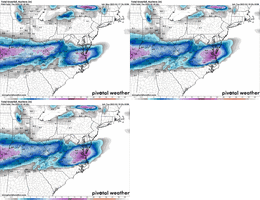
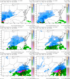
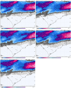
Interesting, looks like the GFSView attachment 170239
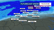
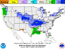
WRAL uses Baron as their in house model, and this is what it is showing as of 9pm for the viewing area forecast through Thursday AM.
BackThePack
Member
Fishel mentioned it in his videoThis is very odd. I know many models/runs have shown it but it will be interesting to see if it happens.
So far at 0z northern Randolph southern Guilford. Trend has been our friend.
4 inches
Sref
3kNam
Fv3
Icon
Wral Baron
Graphcast
GFS ( hitting 5)
2
Rdps
4 inches
Sref
3kNam
Fv3
Icon
Wral Baron
Graphcast
GFS ( hitting 5)
2
Rdps
Last edited:
yep, quite similar! but i guess it is this product: https://baronweather.com/weather-modelingInteresting, looks like the GFS
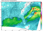
interesting windfield. each cam will bounce around with llc position some- will be arbitrarily tied too where it fires convection. may be a thing we don't nail down until the start of the event. early jan 2018 was like this too- cyclogenesis was tied to convection, and i think in that storm a reason more snow made it inland than forecast is that models were too trigger happy to fire convection away to the coast and drift the llc further offshore
NBAcentel
Member
Blue_Ridge_Escarpment
Member
Can you run this out through Thursday morning? GFS seems more excited on that backend band this run
Happened in the afternoon here seems like 2 or 3.MBY went from 43 to 32 in about 5 minutes. Had 2” in 45 minutes and it got to me right as it was getting dark so even the roads got quickly covered
It snowed so hard that the roads here had almost the same amounts as the grass.
Rates that heavy win in almost any scenario!
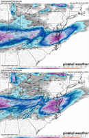
Gfs Best run of the night. Dont expect euro suite to be as giddy, canadian will follow rdps. But man what a pos trend back this way. Still can gain another.15.-.2 qpf in my opinion.
WolfpackHomer91
Member
.
This seems excited about Thursday too
Sent from my iPhone using Tapatalk
GFS very very close to my map. Just remember global model has hard time with lee side shadow it could extend further north and east. Also be wary around Raleigh Ice will hamper snow amounts in short distance, 1-3” sleet preserved snow vs 4-8” snow just to the north
Xlhunter3
Member
NBAcentel
Member
we had a squall like this come through in february 15, it was a lot of fun
I could also see the clipper skipping over Mount Airy, Wilkesboro and Lenoir. Let’s get through the first part then we can see where the “clipper jump line” will form. My guess is Mooresville-Salisbury gonna get smoked and maybe points north-east
NBAcentel
Member
That was the area that got the most with the December clipper as well. Got 0.8” with that oneI could also see the clipper skipping over Mount Airy, Wilkesboro and Lenoir. Let’s get through the first part then we can see where the “clipper jump line” will form. My guess is Mooresville-Salisbury gonna get smoked and maybe points north-east
NBAcentel
Member
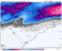
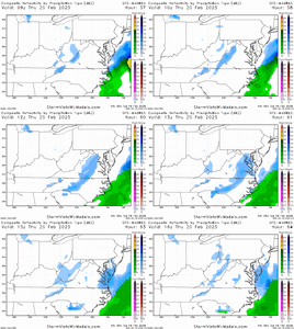
CMC is absolutely dreadful.
interestedclimatist
Member
its about the same tbhCMC is absolutely dreadful.
Sone area sw Randolph bumped 2 inches off Dec Clipper

