NBAcentel
Member
I could also see the clipper skipping over Mount Airy, Wilkesboro and Lenoir. Let’s get through the first part then we can see where the “clipper jump line” will form. My guess is Mooresville-Salisbury gonna get smoked and maybe points north-east

Honestly, we probably should toss it at this point in time. It’s a little too close to the event for the cmc rn. The cmc also hasn’t been reliable this season so I wouldn’t think too much of it. Focus on NAM, HRRR, and NBM for nowCMC backed precip off for most everybody that run
For RDU, UKMET 12z was 0.8” and 18z was 0.2” so the 2.4” with 00z was actually an improvement. Raleigh northeast toward the coast actually moistened up.UKMET .... has officially 90% Lost the entire event for anyone even Wake County, Def GSO
UKMET improved…it’s also not really in range atmUKMET .... has officially 90% Lost the entire event for anyone even Wake County, Def GSO
No, the 00z UKMET was actually a huge improvement. RDU went from literally being shut out to some snow. It’s still bad but seems like it may be folding towards the other modeling after being way further east for a day’s worth of models.UKMET .... has officially 90% Lost the entire event for anyone even Wake County, Def GSO
So many people have been concerned about supression and losing the storm but why would we not want more supression and have that legitimate snow in AR, TN, and KY move down our way? I mean it's not going to happen at this lead time but bigger confluence could have slid that right down to us. Would have been much colder and a higher ratio snow.Euro trend . Maybe we’ve stopped the bleeding
View attachment 170261
soYou do get the feeling this is going to have some Uzbek foggy preciseness even at 12hrs-18hrs out.


6z RGEM
Sent from my iPhone using Tapatalk

It’s probably doing better with the related warm air advection and QPF generation from it quite honestly.
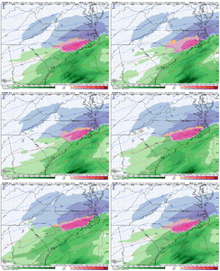
I was getting ready to post that trend. Looks like the Euro and GFS are getting in relative agreement. It’s such a sharp cutoff that each little tick will result in gaining or losing an inch. Throw in the metro areas this is effecting and it really becomes a difficult forecast.So close to the .5” line hitting Raleigh. Couple of ticks nw on the Euro past couple of runs.
View attachment 170274
View attachment 170275
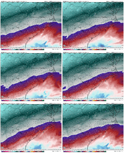
Warm nose out east trending stronger on the euro… I don’t buy how far SE it is with the heavier snow, that trend at 850mb makes me more confident. Gonna likely see QPF increase as the warm nose/warm air advection starts to be sniffed out further on the euroFirst call…. Gonna go the route of WAA more in line with the American models… been torched to hard by it… extremely difficult forecast View attachment 170271


Maybe the heavy thunderstorms in the gulf? I've heard that can rob moisture back this wayView attachment 170255Newest RGEM looks dryer back west.
Edit: don’t know why energy was more robust and better tilt. Maybe someone else can elaborate on where it went wrong.
