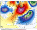
Thats exactly right. NW trends still do exist though the majority of the time. Just like this storm tonight. But when it would benefit us it's guaranteed not to happen.Yeah we used to love this look. But now not so much.
-
Hello, please take a minute to check out our awesome content, contributed by the wonderful members of our community. We hope you'll add your own thoughts and opinions by making a free account!
You are using an out of date browser. It may not display this or other websites correctly.
You should upgrade or use an alternative browser.
You should upgrade or use an alternative browser.
Pattern Fab Feb
- Thread starter SD
- Start date
Yes our Carolina friends is going to love it.GEFS looks good on the mean thru 180! Can’t post pics right now
GeorgiaGirl
Member
wow
Member
WolfpackHomer91
Member
I really really hope this pushes back toward Sunday Afternoon so I can see it lol. Going to Savannah Friday
Sent from my iPhone using Tapatalk
wowzers!
Y’all go look at the end of the Euro 18z
Who says you won’t in Savannah?!I really really hope this pushes back toward Sunday Afternoon so I can see it lol. Going to Savannah Friday
Sent from my iPhone using Tapatalk
TheBetterDoge
Member
wow
Member
BKWRN29
Member
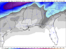
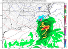
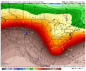
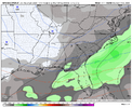
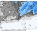
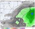
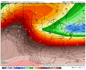
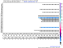
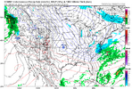
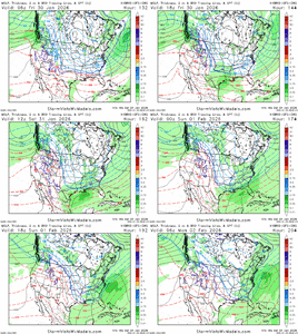
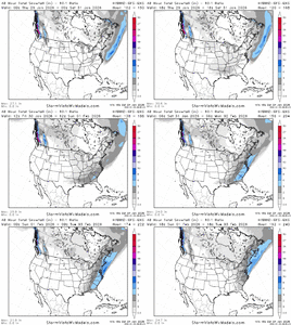
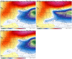
This is almost identical to last weeks storm…View attachment 188692View attachment 188693View attachment 188694GEFS 6hr precip, GEFS mean snowfall, and GEFS AI 6hr precip. Very nice signal!
I see 1052MB highs into N. Dakota is this year's Groundhog Day.
Just in time for Groundhog Day. I guess the groundhog won't be seeing his shadow. He might not want to come out of his hole.View attachment 188692View attachment 188693View attachment 188694GEFS 6hr precip, GEFS mean snowfall, and GEFS AI 6hr precip. Very nice signal!
lexxnchloe
Member
Lol just another 1052 High that's going to screw us.Y’all go look at the end of the Euro 18z
It's good seeing the pattern so suppressed and also the block showing up in E/C Canada. That's much better than north Greenland, especially at this range.
accu35
Member
So a few models have time differences. Some have this starting Friday night into Saturday and some Sunday into Monday?
That high won’t be that strong as it approaches time.Lol just another 1052 High that's going to screw us.
It's good seeing the pattern so suppressed and also the block showing up in E/C Canada. That's much better than north Greenland, especially at this range.
Congrats IndianapolisLol just another 1052 High that's going to screw us.
It's good seeing the pattern so suppressed and also the block showing up in E/C Canada. That's much better than north Greenland, especially at this range.
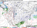
Here's the 18z WeatherNext Ensemble run. About like the last run. It does show some late blooming snow in E GA into the Carolinas (it only has a total snow product on SV...doesn't have a 48hr one)
I'm kind of mixed on this setup. Pattern is there. Suppressed storm track is there. High potential is there. Like wow has mentioned I believe, I'd like to see the southern stream wave be stronger as it works thru the western ridging and the Rockies. That helps with its ability to dig into the SE and turn the corner. If the wave is weak, it gets bullied as it's trying to dig and isn't able to assert itself into a storm. Ideally, the wave is either quite strong and goes about digging and tilting itself....or it's moderately strong and the western appendage of the TPV drops in and phases with it (or a combo of those scenarios!). The GFS AI products seem to have the strongest southern wave in the various model runs as it works SE. CMC was pretty good with it too. On to the 00z's
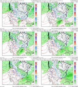
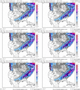
I'm kind of mixed on this setup. Pattern is there. Suppressed storm track is there. High potential is there. Like wow has mentioned I believe, I'd like to see the southern stream wave be stronger as it works thru the western ridging and the Rockies. That helps with its ability to dig into the SE and turn the corner. If the wave is weak, it gets bullied as it's trying to dig and isn't able to assert itself into a storm. Ideally, the wave is either quite strong and goes about digging and tilting itself....or it's moderately strong and the western appendage of the TPV drops in and phases with it (or a combo of those scenarios!). The GFS AI products seem to have the strongest southern wave in the various model runs as it works SE. CMC was pretty good with it too. On to the 00z's


Appreciate you sharing these runs. Super encouraged to see this, can’t think of any better look at this point. If we miss to the south then so be it, just cannot handle losing another one to the mid atlHere's the 18z WeatherNext Ensemble run. About like the last run. It does show some late blooming snow in E GA into the Carolinas (it only has a total snow product on SV...doesn't have a 48hr one)
I'm kind of mixed on this setup. Pattern is there. Suppressed storm track is there. High potential is there. Like wow has mentioned I believe, I'd like to see the southern stream wave be stronger as it works thru the western ridging and the Rockies. That helps with its ability to dig into the SE and turn the corner. If the wave is weak, it gets bullied as it's trying to dig and isn't able to assert itself into a storm. Ideally, the wave is either quite strong and goes about digging and tilting itself....or it's moderately strong and the western appendage of the TPV drops in and phases with it (or a combo of those scenarios!). The GFS AI products seem to have the strongest southern wave in the various model runs as it works SE. CMC was pretty good with it too. On to the 00z's
View attachment 188755
View attachment 188756
SegTindo
Member
Here's the 18z WeatherNext Ensemble run. About like the last run. It does show some late blooming snow in E GA into the Carolinas (it only has a total snow product on SV...doesn't have a 48hr one)
I'm kind of mixed on this setup. Pattern is there. Suppressed storm track is there. High potential is there. Like wow has mentioned I believe, I'd like to see the southern stream wave be stronger as it works thru the western ridging and the Rockies. That helps with its ability to dig into the SE and turn the corner. If the wave is weak, it gets bullied as it's trying to dig and isn't able to assert itself into a storm. Ideally, the wave is either quite strong and goes about digging and tilting itself....or it's moderately strong and the western appendage of the TPV drops in and phases with it (or a combo of those scenarios!). The GFS AI products seem to have the strongest southern wave in the various model runs as it works SE. CMC was pretty good with it too. On to the 00z's
View attachment 188755
View attachment 188756

Who’s ready to suffer tracking this storm!
Sent from my iPhone using Tapatalk
Are those things you would like to be seeing this far out though?Here's the 18z WeatherNext Ensemble run. About like the last run. It does show some late blooming snow in E GA into the Carolinas (it only has a total snow product on SV...doesn't have a 48hr one)
I'm kind of mixed on this setup. Pattern is there. Suppressed storm track is there. High potential is there. Like wow has mentioned I believe, I'd like to see the southern stream wave be stronger as it works thru the western ridging and the Rockies. That helps with its ability to dig into the SE and turn the corner. If the wave is weak, it gets bullied as it's trying to dig and isn't able to assert itself into a storm. Ideally, the wave is either quite strong and goes about digging and tilting itself....or it's moderately strong and the western appendage of the TPV drops in and phases with it (or a combo of those scenarios!). The GFS AI products seem to have the strongest southern wave in the various model runs as it works SE. CMC was pretty good with it too. On to the 00z's
View attachment 188755
View attachment 188756
MichaelJ
Member
Virginia and north storm unless it gets a lot stronger
WolfpackHomer91
Member
That high won’t be that strong as it approaches time.
Maybe, this one Verified 1050 in Mt yesterday
Sent from my iPhone using Tapatalk
I hear ya. I definitely have always liked that suppressed look in the long range.....however, the "mechanics" for how the storm comes together still has to be there. If the ensemble is spitting out weak moisture along the gulf coast, that is fine if said mechanics are there....if not, it's not necessarily the best look. Again, I think it's 50/50 here, but certainly potential is thereAppreciate you sharing these runs. Super encouraged to see this, can’t think of any better look at this point. If we miss to the south then so be it, just cannot handle losing another one to the mid atl
WolfpackHomer91
Member
Congrats Indianapolis

This man Licking His Chops knowing that NW trend coming again ….. “He wins Google Him”
Sent from my iPhone using Tapatalk
Pops
Member
bet we get some eye candy at least a few runs next couple days!!
I hear ya. I definitely have always liked that suppressed look in the long range.....however, the "mechanics" for how the storm comes together still has to be there. If the ensemble is spitting out weak moisture along the gulf coast, that is fine if said mechanics are there....if not, it's not necessarily the best look. Again, I think it's 50/50 here, but certainly potential is there
Agreed. Suppression is nice when you have a legit storm, but many forget that suppression and sheered to oblivion are two different things.
And the Icon makes the first wet fart of the evening. Congrats!
Ummm, it hasn’t even made it to this time period for this on the run.And the Icon makes the first wet fart of the evening. Congrats!
SegTindo
Member
So when are we going to start tracking this upcoming one? Monday Tuesday?
Sent from my iPhone using Tapatalk
Sent from my iPhone using Tapatalk
wow
Member
GeorgiaGirl
Member
Ummm, it hasn’t even made it to this time period for this on the run.
Yeah it has.
There's been a wave that's been somewhat interesting showing up for 1/31-2/01, but there's been some OP runs bullying it out of existence with the northern stream lately.
Teach Lesley
Member
If my lights are still on.So when are we going to start tracking this upcoming one? Monday Tuesday?
Sent from my iPhone using Tapatalk
Ummm, it hasn’t even made it to this time period for this on the run.
Pivotal weather has it faster.
RecklessApple
Member
If you are able to check, what did the Hybrid GEFS look like a week out for this current storm?

