Webberweather53
Meteorologist
I thought this would be pretty applicable here. A majority of this sounds all too familiar lol...View attachment 485
We should definitely consider making one for the SE US lol
I thought this would be pretty applicable here. A majority of this sounds all too familiar lol...View attachment 485
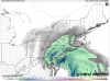
Nope but we are right on the line for a mix with or change to sleet snow tomorrow morningThe clown maps on TT for the NAM are just stupid, don't believe them..... showing accumulations into NC what a joke. Sure there may be some mixing in the NW piedmont, maybe some ip or zr but nothing like those maps are showing. Can't wait for someone t post in on social media and boom lmao
Obviously the maps on Pivotal Weather (Kuchera ratio) that show nothing are far more accurate

We should definitely consider making one for the SE US lol
A box each for "sun angle", "ground temps", and "PSP- premature sled purchase"
Sent from my iPhone using Tapatalk

At least you saw some flakes in january !I am going to move up to NYC for one winter. That would be a lot of fun. I am tired of waiting on my flakes here.
I am going to move up to NYC for one winter. That would be a lot of fun. I am tired of waiting on my flakes here.
There's some beautiful land in upstate NY. Plenty of snow all winter....... Not as much in the city and too crowded there for me.I am going to move up to NYC for one winter. That would be a lot of fun. I am tired of waiting on my flakes here.
Would you trade catfish, grits, cole slaw, hush puppies, fried okra, blackberry cobbler and cold beer for snow? .... LOLThere's some beautiful land in upstate NY. Plenty of snow all winter....... Not as much in the city and too crowded there for me.

Right. I haven't seen a 6 - 8 inch snowfall in years.must be nice to be freaking out about totals being downgraded from 8" to 14" to 6" to 8" in certain places...
Delta's ready ....I would love to be in NYC for this snowstorm.


Yep, some of those web cams will be epic.The mid Atlantic crowd is in panic mode !!!! I love it . Best part about having a kidney stone is I get to watch live coverage all day tomorrow !!
Sent from my iPhone using Tapatalk
my brother in VA way west and north of DC is going to video for me - and rub salt in the wounds ... he's figuring 15" ...Yep, some of those web cams will be epic.

Of course we care!For those who care it's snowing above 3000 feet over Alabama ......
Sent from my iPhone using Tapatalk
For those who care it's snowing above 3000 feet over Alabama ......
Sent from my iPhone using Tapatalk
I bet DC don't see 6-8 inches. Good chance they'll have to much mix............


Already changed over to sleet in Washington DC. That didn't take long

Per web cams and ground truth, it has switched to snow in many NC mountain areas.Just going off of radar, seems like it's snowing in the southern Apps.
ETA: Although looking at the intensity of the of the precip, I bet the radar is wrong outside of higher elevations in the Georgia mountains, JMO.