-
Hello, please take a minute to check out our awesome content, contributed by the wonderful members of our community. We hope you'll add your own thoughts and opinions by making a free account!
You are using an out of date browser. It may not display this or other websites correctly.
You should upgrade or use an alternative browser.
You should upgrade or use an alternative browser.
Pattern December to Remember
- Thread starter SD
- Start date
If there is anything we are learning right now, it’s that anything beyond 5 days or so has to be taken with a huge grain of salt and details are not going to be nailed down until inside 3 days. For whatever reason right now, models are struggling with even latching on to overall patterns.
pcbjr
Member
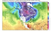
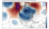
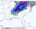
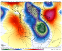
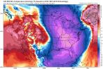
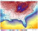
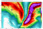
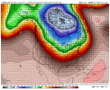
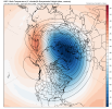
That's 384 hours out ... let's get it here 1st, then and if ... we can start talking about keeping it ... but 1st things 1st ...Look how much cold air is on our side of the court astounding View attachment 95546View attachment 95547
We should have learned this many years ago.If there is anything we are learning right now, it’s that anything beyond 5 days or so has to be taken with a huge grain of salt and details are not going to be nailed down until inside 3 days. For whatever reason right now, models are struggling with even latching on to overall patterns.
Webberweather53
Meteorologist
This is why we love -EPOLook how much cold air is on our side of the court astounding View attachment 95546View attachment 95547
B
Brick Tamland
Guest
If there is anything we are learning right now, it’s that anything beyond 5 days or so has to be taken with a huge grain of salt and details are not going to be nailed down until inside 3 days. For whatever reason right now, models are struggling with even latching on to overall patterns.
It's been that way for at least a decade.
LickWx
Member
It's been that way for literally ever. You telling me weather models 10 years ago had better long-range accuracy than one's today? lol. There's so much that weather models cant see, I mean they are literally attempting to predict the interactions between a million frickin variables when there are at least 10 million more they just can't account for. Think of all the small details they don't see that add up into big changes, small topographical changes compounded over long distances, maybe even the interaction between built environments and the atmosphere, or even something like chaos theories butterfly affect.It's been that way for at least a decade.
I mean check this out, this is what goes into weather models. literal chaos theory and disorder. Look at this lorentz attractor. funny I learned about this from an article about dimensions of consciousness. This is weather turbulence modeled, a set of chaotic solutions. I also wonder how small temp changes work. I mean, our weather sensor might read something that rounds too 70.4 degrees, when in reality if we could break up a 1 cubic meter area of air and break that even further into smaller areas and be able to measure the temps in each of those smaller areas we would find so many variations! from 70.4, to 70.3893 to 70.2 to 70.7 etc etc. I mean weather models are just not able to see that stuff.

Dimensions of consciousness - PMC
LickWx
Member
We need to break the chains of Binary code and elevate ourselves into the realm of cubits to create exponentially more powerful weather models!It's been that way for literally ever. You telling me weather models 10 years ago had better long-range accuracy than one's today? lol. There's so much that weather models cant see, I mean they are literally attempting to predict the interactions between a million frickin variables when there are at least 10 million more they just can't account for. Think of all the small details they don't see that add up into big changes, small topographical changes compounded over long distances, maybe even the interaction between built environments and the atmosphere, or even something like chaos theories butterfly affect.
I mean check this out, this is what goes into weather models. literal chaos theory and disorder. Look at this lorentz attractor. funny I learned about this from an article about dimensions of consciousness. This is weather turbulence modeled, a set of chaotic solutions. I also wonder how small temp changes work. I mean, our weather sensor might read something that rounds too 70.4 degrees, when in reality if we could break up a 1 cubic meter area of air and break that even further into smaller areas and be able to measure the temps in each of those smaller areas we would find so many variations! from 70.4, to 70.3893 to 70.2 to 70.7 etc etc. I mean weather models are just not able to see that stuff.

Dimensions of consciousness - PMC
www.ncbi.nlm.nih.gov
You guys can discuss model verification in whamby or start a thread about it. Thanks
Agreed, but the run is an interesting outlier in that every day of it is BN in the SE. Happy Hour!That's 384 hours out ... let's get it here 1st, then and if ... we can start talking about keeping it ... but 1st things 1st ...
Mr. Golf
Member
Disturbing December
D
Deleted member 609
Guest
LovingGulfLows
Member
- Joined
- Jan 5, 2017
- Messages
- 1,499
- Reaction score
- 4,100
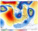
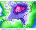
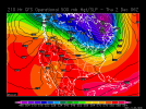
First sign of true arctic air on the GFS....ofc it's past 300 hours so can't take too seriously, but places in GA/AL are getting sub -15C 850s. You know there would be flurries with being that cold aloft.
LovingGulfLows
Member
- Joined
- Jan 5, 2017
- Messages
- 1,499
- Reaction score
- 4,100
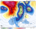
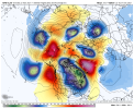
I absolutely love the high north of Alaska. If I could only have one teleconnection, that’s the one I’d pick. It was what made February 2014 so cold despite the +NAO, and occasional -EPO.
View attachment 95571
Yeah it would help funnel the siberian airmass around it and towards North America. Add in a +PNA ridge and it's no wonder we just saw this mammoth of a trough. Nice ridging around towards Greenland as well.
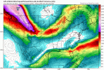
tappable. Literally the only way to get it done around here especially early in the season.Does this get @Rain Cold’s approval?
View attachment 95573
Getting a really good soaking rain this morning. Definitely looks on radar to be more than what was expected
Looks like a solid half an inch maybe a bit more if we’re lucky but we’ll neededGetting a really good soaking rain this morning. Definitely looks on radar to be more than what was expected
Oh yeah. That's headed in the right direction there. Now let's move it right along the timeline toward 0. ?Does this get @Rain Cold’s approval?
View attachment 95573
LickWx
Member
It's all still so far out but I think models have been relatively consistent in showing early December warmth. Now the cold behind it is even further out but it's a possibility that fits with previous nina type years. December 1 is barely under 240 hours right now! 9 days out.Most of the good eps trends got erased last night. Blah
I mean with the general trend of the cool season so far for the epo ridge to show then disappear as we get closer it's hard to not go with the models that show the +epo looks. We have a timeframe coming up (week 2 of Dec) where we can buck the trend but like you said a warm period is pretty likely on the back of the cold that should dominate through the next 7 days.It's all still so far out but I think models have been relatively consistent in showing early December warmth. Now the cold behind it is even further out but it's a possibility that fits with previous nina type years. December 1 is barely under 240 hours right now! 9 days out.
Webberweather53
Meteorologist
It was the biggest reason why 2013-14 sort of bucked the trend for warmer February during -ENSO. Iirc, Florida was baking while we got those 2 storms on Feb 11 and Feb 12-13I absolutely love the high north of Alaska. If I could only have one teleconnection, that’s the one I’d pick. It was what made February 2014 so cold despite the +NAO, and occasional -EPO.
View attachment 95571
Hey we had our happy hour fun it’s time for Webb or Brent to get theirsMost of the good eps trends got erased last night. Blah
View attachment 95586
Prestige Worldwide
Member
DT is getting excited fwiw
NoSnowATL
Member
DT is getting excited fwiw
Aussi MJO? I remember that thing. It doesn’t t have a great track record in the past few years but it’s sure fun to look at.
DT is getting excited fwiw
You and others can tag me as a weenie for saying this, but this Euro forecasted MJO by itself is downright yummy to me at the end!
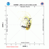
Even if right, the challenge though will be the NAO/AO/PNA, which the GEFS is currently forecasting to all be unfavorable for SE cold at day 14 (Dec 6th). My hope is that they're off for Dec 6th and/or they will quickly reverse soon after to hopefully make for a cold mid to late Dec.
pcbjr
Member
?You and others can tag me as a weenie for saying this, but this Euro forecasted MJO by itself is downright yummy to me at the end!
View attachment 95624
Even if right, the challenge though will be the NAO/AO/PNA, which the GEFS is currently forecasting to all be unfavorable for SE cold at day 14 (Dec 6th). My hope is that they're off for Dec 6th and/or they will quickly reverse soon after to hopefully make for a cold mid to late Dec.
Paula Abdul belongs in the man cave section, thanks!?Most of the good eps trends got erased last night. Blah
View attachment 95586
cd2play
Member
Please keep this thread on topic. Thanks.
Poll is up, went with the first 10, if I missed one let me know
EastAtlwx
Meteorologist
It obviously has to be December to Remember, lol might as well just close the poll and rename it.Poll is up, went with the first 10, if I missed one let me know

