Yep but that’s just the way it goes. A lot of power in those mountains.Does anybody besides me, get sick and tired of seeing these snow maps that curve so beautifully around the SC border?
-
Hello, please take a minute to check out our awesome content, contributed by the wonderful members of our community. We hope you'll add your own thoughts and opinions by making a free account!
You are using an out of date browser. It may not display this or other websites correctly.
You should upgrade or use an alternative browser.
You should upgrade or use an alternative browser.
Pattern December Doldrums 2025 🎄 ❄️
- Thread starter SD
- Start date
Yes, I scream internally instead of externally now.Does anybody besides me, get sick and tired of seeing these snow maps that curve so beautifully around the SC border?
256wx
Member
There is this, if you advance the loop a few hours and live in coastal SC.

tonysc
Member
LoL I know you do Mitch. I watch your YT channel all the time.Yes, I scream internally instead of externally now.
packfan98
Moderator
Great video to see the ingredients for the pattern through January. Don’t let @Mitch West see it though. He will be raging!
Had surprise frost this morning. Looking like a run tonight decently below freezing but too much wind for more. ILM still discussing 4-5 days AN this at or below normal around Sunday timeframe. I still don't think this stretch will be enough to get us AN for the month at KFLO.
NBAcentel
Member
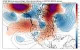
Icon opening up the 00z suite with a ridge completely shifted out west 
A major man! wow!Icon opening up the 00z suite with a ridge completely shifted out west View attachment 179498
NBAcentel
Member
that NATL blocking trend on the GFSAI is impressive
NBAcentel
Member

NBAcentel
Member
By tomorrow afternoon RDU/GSO is wedged 
NBAcentel
Member
Cold shot looking stout on the AI. No moisture or trailing wave to go around with it though. But probably gonna spoil averages for Dec to not be AN across of portion of the SE 

Heat weenies hate this one trick 
Heat weenies hate this one trick View attachment 179505
Oh my, Jamming Jimmy is going way below freezing with that look. Also, you can bet the ranch on being dry.
Sent from my iPhone using Tapatalk


NBAcentel
Member
It’s AI counterpart othThe EPS is still getting colder late month:
View attachment 179506
But not so much with the GEFS, which is not nearly as cold:View attachment 179507


Related to my post just above this….
From elsewhere, look at how much the EPS has evolved for late month over one week of runs: note that this major evolution has occurred with the Aleutian ridge not budging but at same time the -NAO gets stronger and forces the rise of the PNA/big colder E US change from the NE!

@Webberweather53
From elsewhere, look at how much the EPS has evolved for late month over one week of runs: note that this major evolution has occurred with the Aleutian ridge not budging but at same time the -NAO gets stronger and forces the rise of the PNA/big colder E US change from the NE!
@Webberweather53
Last edited:
That ridge on the west coast hooking up with the -NAO, is good for cold in the East? Correct??Related to my post just above this….
From elsewhere, look at how much the EPS has evolved for late month over one week of runs: note that this major evolution has occurred with the Aleutian ridge not budging but at same time the -NAO gets stronger and forces the rise of the PNA/big colder E US change from the NE!
View attachment 179529
@Webberweather53
The record breaking Torchmas and highs in the 60s talk by local Mets the last week or so, gonna bust! Thanks to clouds and fog all day! Suck on that 

iGRXY
Member
The -NAO is getting stronger and stronger and more west based. It’s pushing the North Atlantic trough further and further south and west.Related to my post just above this….
From elsewhere, look at how much the EPS has evolved for late month over one week of runs: note that this major evolution has occurred with the Aleutian ridge not budging but at same time the -NAO gets stronger and forces the rise of the PNA/big colder E US change from the NE!
View attachment 179529
@Webberweather53
rburrel2
Member
FWIW, the 06z euro is back to showing a similar solution that spit out the snowstorm on the 00z run from yesterday…


Good catch! Wouldn't it be something if we see our little slider make a comeback over the next few cycles? Perusing through the various parameters confirms a near-perfect match with the execption of the stronger LP over the Canadian Maritimes.FWIW, the 06z euro is back to showing a similar solution that spit out the snowstorm on the 00z run from yesterday…
View attachment 179531View attachment 179533


Attachments
LOL at the ensemble spread. Might as well flip a coin.


But no +PNA in sight.

But no +PNA in sight.
 look at how fat that box/whisker is for friday PM lmaooo
Look how much the EPS has cooled for the lows of Dec 30th in just 6 runs thanks to the pushback from the strengthening -NAO despite the Aleutian ridge not budging!
It has cooled this much from the Friday 12Z run, an amazing amount for an ensemble mean over such a short period:
- Roxboro 12F from 38 to 26
- Charlotte 14F from 40 to 26
- CAE 14F from 43 to 29
- SAV 15F from 48 to 33
- ATL 18F from 45 to 27
- Chattanooga 19F from 41 to 22
- Nashville 19F from 42 to 23
- Birmingham 20F from 47 to 27
- Tupelo 19F from 48 to 29
- Chicago 13F from 30 to 17
- Tulsa 11F from 43 to 32
Last edited:
Look at how much the US population weighted HDD rose on the EPS mean from the 12/17 12Z run to the 12/22 0Z run for 12/28-31: 25 HDD (from a way BN 74 to a NN 99)! Normal is 100 HDD.
12/17 12Z HDD run in purple on left

12/22 0Z HDD run in purple on left

12/17 12Z HDD run in purple on left
12/22 0Z HDD run in purple on left
Last edited:
LukeBarrette
im north of 90% of people on here so yeah
Meteorology Student
Member
2024 Supporter
2017-2023 Supporter
Pattern looks elite for Northeast sliders/clippers
If yall are into that
If yall are into that

CNCsnwfan1210
Member
Would like to see that cutoff low off CA throw something at us or eject east.
Sent from my iPhone using Tapatalk

We've locked in this trough for the final days of December
.png")
NBAcentel
Member
Nice wedge to kill twisters hopes and dreams 
Now just need to pull off a storm? Somehow?We've locked in this trough for the final days of December
View attachment 179558
HeartwarmingNice wedge to kill twisters hopes and dreams View attachment 179561
Look how much the EPS has cooled for the lows of Dec 30th in just 6 runs thanks to the pushback from the strengthening -NAO despite the Aleutian ridge not budging!
It has cooled this much from the Friday 12Z run, an amazing amount for an ensemble mean over such a short period:
- Roxboro 12F from 38 to 26
- Charlotte 14F from 40 to 26
- CAE 14F from 43 to 29
- SAV 15F from 48 to 33
- ATL 18F from 45 to 27
- Chattanooga 19F from 41 to 22
- Nashville 19F from 42 to 23
- Birmingham 20F from 47 to 27
- Tupelo 19F from 48 to 29
- Chicago 13F from 30 to 17
- Tulsa 11F from 43 to 32
View attachment 179548
Followup: the 12Z EPS is 1-2 degrees colder than the 0Z for the lows of 12/30. So, the multiday colder trend on the EPS has continued through the 12Z run!

packfan98
Moderator
Nice trend. Do you have the details for the weeklies? Always appreciate your analysis.Followup: the 12Z EPS is 1-2 degrees colder than the 0Z for the lows of 12/30. So, the multiday colder trend on the EPS has continued through the 12Z run!
View attachment 179566
Nice trend. Do you have the details for the weeklies? Always appreciate your analysis.
Thank you!
1. Sig. colder 12/29-1/4 vs yesterday but we already knew that. Two days ago, they had solidly AN in the SE. Todays has NN to a little BN for that week! Tomorrow’s may be even colder.
2. The rest of the weeks are still mainly AN but not really torchy. However, with them recently struggling with 12/29-1/4, I suspect that colder changes will occur as we get closer to each week. That’s especially the case if the Jan 2022 analog and other analogs with a +PNA Jan following a -PNA Dec during -ENSO end up being a good guide and a switch to a +PNA ends up occuring. That’s also considering the likelihood of a -WPO in Jan due to the strong Dec -WPO.
Last edited:
Ahahaha BUST

