Drizzle Snizzle
Member
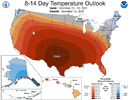
It’s amazing the power of the sun. Even with a low sun angle and temps below freezing.Don’t worry, winter 26/27 gonna be yalls winter! Currently 27 here, full sun, melting everywhere
It’s amazing the power of the sun. Even with a low sun angle and temps below freezing.Don’t worry, winter 26/27 gonna be yalls winter! Currently 27 here, full sun, melting everywhere
Single digit dewpoints sure beats 70 degree dewpointsI just took a walk in very refreshing and invigorating 40 degree single digit dewpoint air along with beautiful blue skies and light winds. I love this wx!
Unprecedented. Have we seen worse?This isn’t pleasing
Time for the beach, guess winter is only a December thing nowThis isn’t pleasing
Even then, you can see how you snow with that look - nice western ridge. I think the only reason the PNA registered as negative is because of the trough in the NW US. However, I think that's just a second low that resulted from an active pattern.Most negative PNA for 6”+ RDU storms since 1950 (based on research I did previously):
-0.8: 3/2-3/1960
-0.5: 3/9/1960
-0.3: 12/26/2010
These had -0.1 PNA, which I consider neutral PNA:
-0.1: 2/18-19/1979
-0.1: 2/26-27/2004
-0.1: 1/17/2018


Considering it's AI, should be far better then the GFS.Question: is the AIGFS gonna be as bad as the GFS?(not possible i wouldn't think) What's everyone's opinion?
It's showing some lame wedding as @webhas eluded to. But still mostly above average temps through NYE...sad
While the Euro AI is really close temp wise as well..they are alot closer to each other than their operational for sure
What’s interesting with those is that the ridge is centered over the Rockies and Southern Plains which looks to be the case the next couple weeks.Even then, you can see how you snow with that look - nice western ridge. I think the only reason the PNA registered as negative is because of the trough in the NW US. However, I think that's just a second low that resulted from an active pattern.
View attachment 179045
Then adding on the next three:
View attachment 179046
Very Nino-esque looks with undercutting, something we aren’t seeing showing up anytime soonEven then, you can see how you snow with that look - nice western ridge. I think the only reason the PNA registered as negative is because of the trough in the NW US. However, I think that's just a second low that resulted from an active pattern.
View attachment 179045
Then adding on the next three:
View attachment 179046


Dern. Your algorithm is giving you Saks ads? People at your house are getting GOOD Christmas!Time to hit the beach! That torch is legit! My normal high is 39 or so! Freezing fog tonight!
the rich gets richer lolDern. Your algorithm is giving you Saks ads? People at your house are getting GOOD Christmas!
Wrong algorithm! It was supposed to just be Sacks!Dern. Your algorithm is giving you Saks ads? People at your house are getting GOOD Christmas!

 currently 23 degrees!
Also notice to most of these storms were late season events, when wavelengths are shorter and it’s easier to have a amplified pattern/undercutting and cutoff lows, we are working against typical early-mid season long wavelengths. Best bet is what @KyloG mentioned going poleward with the Aleutian ridge and bridging it to a -NAO block, and trying our luck with that, because there’s nothing really there right now to change up the pacific, later on it might be easier to change it up if we get the pacific warm pool to migrate eastwardEven then, you can see how you snow with that look - nice western ridge. I think the only reason the PNA registered as negative is because of the trough in the NW US. However, I think that's just a second low that resulted from an active pattern.
View attachment 179045
Then adding on the next three:
View attachment 179046
Good find. Looks like much of the 2nd half of that dec had an Aleutian ridge/-PNA/-WPO/+SCAND with a +NAO. Looks like a pacific jet extension resulted in the flip, along with a +SCAND —> -NAO retrogression, both occurring at the same time. End result was a +PNA/-NAO ridge bridge. Looks like in NC no storms occured with the pattern but that’s a good look. The -NAO in this instance could good be a good analog but not sure if we get another pacific jet extension with mountain torque in east asia not cooperative. But if we can see a +EAMT event finally show up with all the +AAM in the background as well, then something like this isn’t to far fetched. At the moment though, we are looking at the Atlantic side for help.Aleutian Ridges, on average, last 32.6 days. They almost always cause the PV to get disturbed, especially early events. I would think this one would be considered early. The "season" for them in the study I read was November 1st until March 10th. 33 of 35 of the early events between the 70s and 2010s saw the PV split or get highly perturbed around 26 days on average, after the AH formed.
We roasted from December 8th or so, 1984, until January 3rd or so, 1984 with the Aleutian high in place. That verification was basically what we see on models now. 15 to 20f AN, with 70s here a week after early December 20s and single digits with light snow as the AH was establishing itself, it was also in the 70s here after New Years (my normal for late December is around 46) .
The PV was split on December 30th, 1984, 27 days into the Aleutian ridge pattern. A week later it broke down, and cold returned to the East. It's total duration was


Yea, this is how I remembered it as well. The last five days of Dec-1984, Memphis recorded highs in the 70's and lows in the 50's, then flipped cold on Jan-3, 1985 and we received 8.1" of snow. This was one of my favorite snow events that month as we received a total of 21" for the season. Many southeast cities had record lows later that month.Aleutian Ridges, on average, last 32.6 days. They almost always cause the PV to get disturbed, especially early events. I would think this one would be considered early. The "season" for them in the study I read was November 1st until March 10th. 33 of 35 of the early events between the 70s and 2010s saw the PV split or get highly perturbed around 26 days on average, after the AH formed.
We roasted from December 8th or so, 1984, until January 3rd or so, 1984 with the Aleutian high in place. That verification was basically what we see on models now. 15 to 20f AN, with 70s here a week after early December 20s and single digits with light snow as the AH was establishing itself, it was also in the 70s here after New Years (my normal for late December is around 46) .
The PV was split on December 30th, 1984, 27 days into the Aleutian ridge pattern. A week later it broke down, and cold returned to the East. It's total duration was
Yea, this is how I remembered it as well. The last five days of Dec-1984, Memphis recorded highs in the 70's and lows in the 50's, then flipped cold on Jan-3, 1985 and we received 8.1" of snow. This was one of my favorite snow events that month as we received a total of 21" for the season. Many southeast cities had record lows later that month.
Chasing that instability along and E of 95 of coursegood morning @SD i hope you have your sprinklers in order because we are back to seeing where 1"+ rain will go to miss your yard
View attachment 179059
Our all time coldest temperature at the Tri-Cities Airpirf here in Northeast Tennessee was January 21st, 1985. We hit -21. All time record low.Yea, this is how I remembered it as well. The last five days of Dec-1984, Memphis recorded highs in the 70's and lows in the 50's, then flipped cold on Jan-3, 1985 and we received 8.1" of snow. This was one of my favorite snow events that month as we received a total of 21" for the season. Many southeast cities had record lows later that month.


We open the clubhouse and cart shed long enough for our group to get started and close the gate behind us..lolIf the Models where supreme court Justices. It's a unanimous decision this morning our Chestnuts want be roasting by the fire Christmas Eve & Day. They will be on Fire.
My advice is don't look and maybe at 12z it will look different. Warm 70 degree temps don't do me any favors Christmas eve/day as most Golf courses are closed. Dec 26, we'll you just take what the wx offers and go tee em up, if it want send us any cold and snow. Ole can't beat em, so go join them mantra.

Until we see a breakdown of the Aleutian ridge, CAD is the best we can hope for which normally means ice around here and that is even no guaranteed outcome. If we stay warm through March (which is very possible), you can bet your house we will have a cold and dry April and May
Are we going to lose this impressive snow pack?