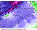
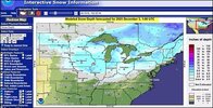
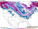
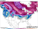
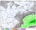
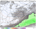
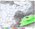
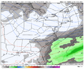
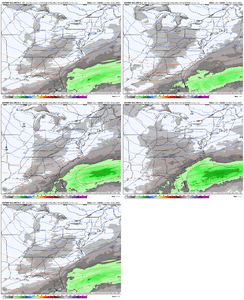
Plus, the GFS verbatim shows a rain-to-snow transition, which raises some red flags.Man only if the western ridge was taller. Not gonna be easy with how the flow is, -NAO is trying to slow things down but the trough over AK trough Canada is pancaking the western ridge, and making the flow faster, not a huge believer in this one tbh, but I could be wrong and I hope I am, the surface pattern is mint honestly with the trailing high following the low in SE Canada but if there’s issues it’s the wave itself View attachment 177790View attachment 177791
-
Hello, please take a minute to check out our awesome content, contributed by the wonderful members of our community. We hope you'll add your own thoughts and opinions by making a free account!
You are using an out of date browser. It may not display this or other websites correctly.
You should upgrade or use an alternative browser.
You should upgrade or use an alternative browser.
Pattern December Doldrums 2025 🎄 ❄️
- Thread starter SD
- Start date
Euro appears to have ticked a little south with the dusting for the system on the 8th.
trackersacker
Member
We made December 2018 with scraps. EPO, NAO, and AO was positive I’m pretty sure. All we had in our hand was a +PNA and 50/50 low and it got the job done, shockingly. Not an ideal probability next week, but certainly something to watch IMOPlus, the GFS verbatim shows a rain-to-snow transition, which raises some red flags.
Torch when???Holy Euro Barney!
View attachment 177792
But in December 2018, we had a monster wave from the Pacific that models had spotted 10 days out, which crashed into Southern California. That one was oddly predictable and consistent. Most of our storms, which are wishy-washy and hard to predict because they come down the Idaho stovepipe, require precise timing and amplification.We made December 2018 with scraps. EPO, NAO, and AO was positive I’m pretty sure. All we had in our hand was a +PNA and 50/50 low and it got the job done, shockingly. Not an ideal probability next week, but certainly something to watch IMO
If I had a nickel for every time the GFS overamplified and dropped a paste bomb, I would have a lot of nickels. If I had a nickel for the amount of time that those solutions verified, I would be a broke man. I am a weenie, so I'm going to stalk out the Euro and GDPS runs, but I sadly think December 2018 is a false comparison.
Although anything is possible with a 50/50 low and a +PNA. So who knows.
Bigedd09
Member
Sucks we’re gonna miss out on this one Friday for being too warm. Then cold enough next week but no precipitation. Classic southeast winters. Oh well
Sent from my iPhone using Tapatalk
Sent from my iPhone using Tapatalk
trackersacker
Member
Those are fair points. And I’m not analoging it much at this point. It’s only been a couple of runs with something, so it remains low probability.But in December 2018, we had a monster wave from the Pacific that models had spotted 10 days out, which crashed into Southern California. That one was oddly predictable and consistent. Most of our storms, which are wishy-washy and hard to predict because they come down the Idaho stovepipe, require precise timing and amplification.
If I had a nickel for every time the GFS overamplified and dropped a paste bomb, I would have a lot of nickels. If I had a nickel for the amount of time that those solutions verified, I would be a broke man. I am a weenie, so I'm going to stalk out the Euro and GDPS runs, but I sadly think December 2018 is a false comparison.
Although anything is possible with a 50/50 low and a +PNA. So who knows.
CNCsnwfan1210
Member

Euro was further offshore with the Monday system. The GFS is doing GFS things with a rain to snow changeover. Still would like to see more agreement from other models.
Sent from my iPhone using Tapatalk
CNCsnwfan1210
Member
Both models do generally agree on a decent shot of cold air though around the 12th/13th. 00z ECMWF /6z GFS


Sent from my iPhone using Tapatalk


Sent from my iPhone using Tapatalk
CNCsnwfan1210
Member


Ensembles keep correcting colder in the long range, imagine that… 12 hour model cycle difference
Sent from my iPhone using Tapatalk
Webberweather53
Meteorologist
Bigedd09
Member
Would surface temps be cold enough to support snow?
Sent from my iPhone using Tapatalk
Webberweather53
Meteorologist
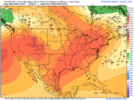
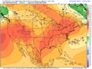
In general, there’s nothing wrong pattern wise with this day 5-6 system. The western ridges usually aren’t super tall with coastal low type events anyway.
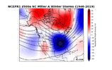
You really just need a nice trough axis centered over the TN Valley, a good cold source, & a -NAO and we have those things available here, it doesn’t have to be perfect or look exactly like the composite to work. I’ve almost seen more instances of the pattern looking almost exactly like the composite and it not working than the other way around. There’s a lot of internal or storm to storm variability that’s not captured by this
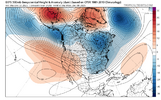
You really need the wave to be a little slower like the GEFS shows (so we can get a bit more moisture and amp the wave a bit) and this can work just fine
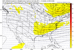
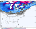
If the southern mid Atlantic sees some decent snowfall from the preceding system on Fri and Sat, we wouldn’t have to work that hard to get legitimate cold air transported in place at the right time

You really just need a nice trough axis centered over the TN Valley, a good cold source, & a -NAO and we have those things available here, it doesn’t have to be perfect or look exactly like the composite to work. I’ve almost seen more instances of the pattern looking almost exactly like the composite and it not working than the other way around. There’s a lot of internal or storm to storm variability that’s not captured by this

You really need the wave to be a little slower like the GEFS shows (so we can get a bit more moisture and amp the wave a bit) and this can work just fine

If the southern mid Atlantic sees some decent snowfall from the preceding system on Fri and Sat, we wouldn’t have to work that hard to get legitimate cold air transported in place at the right time

28 degrees
Mega frost
Mega frost
Webberweather53
Meteorologist
Bigedd09
Member
Could this be a rare GFS W??
Xlhunter3
Member
Tsappfrog20
Member
31 in Youngsville this morning heavy frost and freeze went outside and my steps were frozen. It is officially winter!
Sent from my iPhone using Tapatalk
Sent from my iPhone using Tapatalk
It's a progression. Minor event yesterday, minor event Friday, moderate event Tuesday, bigger event mid-month, major big dog at Christmas.
28 first mega frost of the szn
- Joined
- Jan 23, 2021
- Messages
- 4,602
- Reaction score
- 15,197
- Location
- Lebanon Township, Durham County NC
Not only that but some black ice on my way in28 degrees
Mega frost
CNCsnwfan1210
Member
29.3 with some ice on grass from yesterday’s leftover rainfall
Sent from my iPhone using Tapatalk
Sent from my iPhone using Tapatalk
Same, 27 and deck sheet of ice. Even some icy limbs on my dogwood trees with mega frost. Looks festive out 
Webberweather53
Meteorologist
It’s the first week of December and we have one potential minor event on Fri for NW NC and VA followed by another possible system trying to sneak into the fold on Monday or so.
Not to mention, things are trended colder in the long-term
Can’t ask for much more at this point.
Not to mention, things are trended colder in the long-term
Can’t ask for much more at this point.
Brent
Member
It’s the first week of December and we have one potential minor event on Fri for NW NC and VA followed by another possible system trying to sneak into the fold on Monday or so.
Not to mention, things are trended colder in the long-term
Can’t ask for much more at this point.
Right? We're probably gonna have our second flizzard of the week tomorrow I mean there's been at least one or maybe two years since I've been here it hasnt even snowed yet at all
Even if we warm up well we warm up every winter
Webberweather53
Meteorologist
Could this be a rare GFS W??
The GFS actually sniffed out the Friday system before the Euro did. Granted it was probably way too aggressive with snow but it caught onto the idea first. Wouldn’t be shocked if that happens here as well
Amen x1000. Well statedIt’s the first week of December and we have one potential minor event on Fri for NW NC and VA followed by another possible system trying to sneak into the fold on Monday or so.
Not to mention, things are trended colder in the long-term
Can’t ask for much more at this point.
It's a healthy start to Winter & aligned with what we always thought on December a couple months ago.It’s the first week of December and we have one potential minor event on Fri for NW NC and VA followed by another possible system trying to sneak into the fold on Monday or so.
Not to mention, things are trended colder in the long-term
Can’t ask for much more at this point.
Brent
Member
Models will 100% under estimate moisture.we've been trending the wrong way here for 3 days so this is interesting View attachment 177820
Brent
Member
Models will 100% under estimate moisture.
Yeah Mondays freezing drizzle was a big surprise to some people. Apparently the state didn't think it was worth it to treat the roads and several people died in accidents
The snow was literally 10 minutes of flakes hours later
Bigedd09
Member
Didn't the GFS sniff out that early December event last year as well? I guess it's possible lolThe GFS actually sniffed out the Friday system before the Euro did. Granted it was probably way too aggressive with snow but it caught onto the idea first. Wouldn’t be shocked if that happens here as well
Haha yeh brother something about your area & moisture being undermodeled lolYeah Mondays freezing drizzle was a big surprise to some people. Apparently the state didn't think it was worth it to treat the roads and several people died in accidents
The snow was literally 10 minutes of flakes hours later
SnowNiner
Member


Ensembles keep correcting colder in the long range, imagine that… 12 hour model cycle difference
Sent from my iPhone using Tapatalk
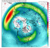
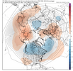
Maybe because it looks like it's extending the jet substantially and getting a nicer -EPO perhaps? Split vortex and conus wide trough. I think we work with that right? Verbatim this is warm south, but it doesn't look far from unleashing cold cross polar flow. If we can get the epo ridge to connect to the Scandinavian ridge, watch out.
I can't figure out how to post a trend, but the jet is definitely extending now going out in time on the EPS.
BrickTamland
Member
GFS is not backing down on next Monday. Would love to see the Euro on board. However, this Friday's deal the GFS was pretty consistent with something wintry here while the Euro went from wintry to rain and back more wintry like the GFS. Maybe the GFS will get the upset win.
If memory serves, we were dumping on the GFS for being too amped and unlike the flat EURO. This is a similar situation.The GFS actually sniffed out the Friday system before the Euro did. Granted it was probably way too aggressive with snow but it caught onto the idea first. Wouldn’t be shocked if that happens here as well
Tsappfrog20
Member
Allan just said that he is skeptical of any big warmup through mid January!
Sent from my iPhone using Tapatalk
Sent from my iPhone using Tapatalk

